348 entries match your criteria. Entries 301 through 348 are listed.⊲ Previous 100
Lost at Sea Historical Markers
Markers honoring merchant mariners, fishermen/women, crew and passengers who have been lost at sea during warfare and peacetime. Excluded: military personnel (in war or peace); aircraft; vessels lost with no people lost.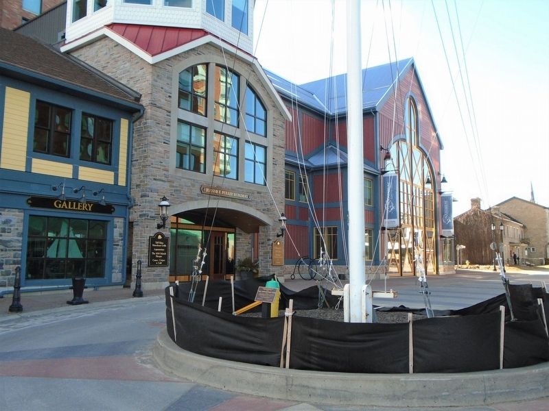
By William Fischer, Jr., March 14, 2020
Tall Ships 1812 Tour Marker
301 ► Ontario, Leeds and Grenville United Counties, Brockville — Tall Ships 1812 Tour —  |
| On Broad Street just south of Flint Street, on the left when traveling south. | |||
| 302 ► Québec, La Côte-de-Gaspé, Cap-des-Rosiers — Carricks of Whitehaven Shipwreck Memorial — |
| Near Québec Route 132, on the left when traveling south. | |||
| 303 ► Québec, La Côte-de-Gaspé, Cap-des-Rosiers — Cloche du "Carrick's" voilier Irlandais / Bell of the "Carrick's" Irish Sailboat — |
| Near Boulevard de Cap des Rosiers. | |||
| 304 ► Estonia, Harju maakond, Tallinn, Kesklinna, Vanalinn — Mälestusmärk “Katkenud Liin” / “Broken Line” — M/S Estonia Memorial — |
| On Rannamäe tee just east of Pikk Street, on the left when traveling south. | |||
| 305 ► France, Normandie, Calvados, Arromanches-les-Bains — Merchant Navy Seamen Memorial — |
| Near Place du Six Juin 1944 0.1 kilometers west of Rue F.Jourdan de la Passardière, on the left when traveling east. | |||
| 306 ► France, Normandie, Calvados, Saint-Laurent-sur-Mer — Omaha la Sanglante - Bloody Omaha — |
| On Rue Bernard Anquetil, on the left when traveling east. | |||
| 307 ► Germany, Bremen, Findorff, Bremen, Bremen-West — 8 — Kurt von Goessel — |
| On Goesselstraße at Findorffstrasse, on the left when traveling east on Goesselstraße. | |||
| 308 ► Iceland, Western Region, Snæfellsbær, Dritvík — Epine - Grimsby — |
| Near Dritvíkurvegur (Route 572) 2.1 kilometers west of Útnesvegur. | |||
| 309 ► Ireland, Connacht, County Galway, Galway, Latin Quarter — In Memory of Mariners Lost at Sea / Captain William J. Woolley — |
| On Father Griffin Road (Connacht Route 336) at the east approach to the Wolfe Tone Bridge, on the left when traveling west on Father Griffin Road. | |||
| 310 ► Ireland, Connacht, County Galway, Galway, Latin Quarter — Thompson • Kinkaid • Roberts Memorial — |
| On Churchyard Street just west of High Street, on the right when traveling west. | |||
| 311 ► Ireland, Connacht, County Mayo, Murrisk — Murrisk Fisherman's Monument — |
| Near The Carrigeens. | |||
| 312 ► Ireland, Leinster, County Dublin, Dublin, Dublin's Docklands — Irish Seaman's National Memorial — |
| On City Quay (Leinster Route 813) at Lombard Street East ( Route 814), on the right when traveling east on City Quay. | |||
| 313 ► Ireland, Leinster, County Dublin, Dublin, Dublin's Docklands — S.S. Adela — |
| On Sir John Rogerson’s Quay just east of Creighton Street, on the left when traveling east. | |||
| 314 ► Ireland, Leinster, County Fingal, Howth — Lost At Sea — |
| On Harbour Road. | |||
| 315 ► Ireland, Leinster, County Westmeath, Athlone, Athlone and Bigmeadow — Titanic Memorial — |
| On Castle Street just south of Barrack Street, on the right when traveling south. | |||
| 316 ► Ireland, Leinster, County Wicklow, Glencree — The German Military Cemetery, Glencree — Der Deutsche Soldatenfriedhof Glencree — Reilig Mhíleata Gearmánach i nGleann Criothaigh — |
| On Local Route L1011 0.6 kilometers east of Route R115, on the left when traveling east. | |||
| 317 ► Ireland, Munster, County Cork, Cobh — S.S. Lusitania — |
| On Strand Road. | |||
| 318 ► Ireland, Munster, County Cork, Kinsale — Lost Seafarers Memorial — |
| On Pier Road (Munster Route R600) 0.3 kilometers south of Emmet Place, on the left when traveling south. | |||
| 319 ► Ireland, Munster, County Cork, Kinsale — Nautical Artefacts at Kinsale Museum — |
| On Market Lane, on the left when traveling east. | |||
| 320 ► Ireland, Munster, County Cork, Kinsale — Seafarers Memorial — |
| On Pier Road (Munster Route R600) 0.3 kilometers south of Emmet Place, on the left when traveling south. | |||
| 321 ► Ireland, Munster, County Cork, Old Head — Lusitania Memorial Garden — |
| On Old Head Ring Route, on the right when traveling south. | |||
| 322 ► Ireland, Munster, County Cork, Old Head — Nineteenth Century Ship's Bollard — |
| On Old Head Ring Route, on the right when traveling south. | |||
| 323 ► Ireland, Munster, County Cork, Old Head — RMS Lusitania Lifeboat Davit — gifted to The Lusitania Museum at the Old Head — by Gerry Doyle, his wife Josie and their family — |
| On Old Head Ring Route, on the right when traveling south. | |||
| 324 ► Ireland, Munster, County Cork, Old Head — Victims of the RMS Lusitania Sinking — |
| On Old Head Ring Route, on the right when traveling south. | |||
| 325 ► Norway, Møre og Romsdal, Ålesund — Mot Havet — Seaward (English) — |
| On Ålesundsvegen (Route E136) close to Rådstugata. | |||
| 326 ► Portugal, Porto, Matosinhos, Leça da Palmeira — Naufrágio de Veronese / Shipwreck of Veronese — Matosinhos Mar — |
| Near Avenida Liberdade. | |||
| 327 ► Solomon Islands, Guadalcanal, Capital Territory, Honiara — Guadalcanal American Memorial — |
| On Skyline Drive south of Mbokonavera Road, on the left when traveling west. | |||
| 328 ► United Kingdom, England, Greater London, City of London — Malta G.C. / The Siege — The Siege of 1940-43 / — |
| On Byward Street (Route A100) at Great Tower Street, on the left when traveling west on Byward Street. | |||
| 329 ► United Kingdom, England, Greater London, Tower Hamlets — The Tower Hill Memorial — First World War — |
| On Tower Hill (England Route A100) at Trinity Square, on the right when traveling west on Tower Hill. | |||
| 330 ► United Kingdom, England, Greater London, Tower Hamlets — The Tower Hill Memorial — Second World War extension — |
| On Tower Hill (England Route A100) at Trinity Square, on the right when traveling west on Tower Hill. | |||
| 331 ► United Kingdom, England, Hartlepool — Seaton Tower Lighthouse — |
| Near Marina Way at The Highlight, on the left when traveling south. | |||
| 332 ► United Kingdom, England, Lancashire, Fleetwood — S T Goth Memorial — |
| On Station Road at Dock Street, on the left when traveling south on Station Road. | |||
| 333 ► United Kingdom, England, Medway, Chatham — The Destroyer Memorial — |
| Near Western Avenue at Main Gate Road, on the left when traveling north. | |||
| 334 ► United Kingdom, England, Plymouth — The Plymouth Naval Memorial — |
| On Osborne Place at Citadel Road, on the left when traveling south on Osborne Place. | |||
| 335 ► United Kingdom, England, Plymouth — The Plymouth Naval Memorial — |
| Near Osborne Place at Citadel Road, on the left when traveling south. | |||
| 336 ► United Kingdom, England, Portsmouth — Portsmouth Naval Memorial — |
| On Clarence Esplanade at Serpentine Road, on the right when traveling north on Clarence Esplanade. | |||
| 337 ► United Kingdom, England, Portsmouth — Portsmouth Naval Memorial — |
| On Clarence Esplanade at Serpentine Road, on the right when traveling north on Clarence Esplanade. | |||
| 338 ► United Kingdom, England, Portsmouth — Portsmouth Naval Memorial Extension — |
| On Clarence Esplanade at Serpentine Road, on the right when traveling north on Clarence Esplanade. | |||
| 339 ► United Kingdom, England, Redcar and Cleveland, Redcar — The Birger — |
| On Esplanade at Clarendon Street, on the left when traveling east on Esplanade. | |||
| 340 ► United Kingdom, England, Southampton, Cultural Quarter — Engineer Officers of the RMS Titanic — |
| On Above Bar Street. | |||
| 341 ► United Kingdom, Northern Ireland, Belfast — "Titanic" Memorial — |
| On Donegall Square East just south of Donegall Square North (Northern Ireland Route A1), on the right when traveling south. | |||
| 342 ► United Kingdom, Northern Ireland, Belfast — Titanic and Olympic Slipways — |
| Near no nearby street. | |||
| 343 ► United Kingdom, Northern Ireland, Belfast — Titanic Memorial Garden — |
| On Donegall Square East just south of Donegall Square North (Northern Ireland Route A1), on the right when traveling south. | |||
| 344 ► United Kingdom, Northern Ireland, Belfast — Titanic Slipway — Titanic Quarter — Launched 31st May 1911 • Sank 15th April 1912 — |
| Near no nearby street. | |||
| 345 ► United Kingdom, Scotland, Fife, Anstruther — The "Battle" of May Island — |
| On East Shore just east of Haddfoot Wynd, on the right when traveling east. | |||
| 346 ► United Kingdom, Scotland, Highland, Cromarty — HMS Natal — |
| On Marine Terrace at Bank Street, on the right when traveling north on Marine Terrace. | |||
| 347 ► United Kingdom, Scotland, Highland, Thurso — George William Mackay — |
| Near Aird Road 4 kilometers north of Route A836, on the right when traveling north. | |||
| 348 ► United Kingdom, Scotland, Orkney, Stromness — Stromness Lifeboat Station — |
| On Ferry Road at Victoria Street, on the right when traveling south on Ferry Road. | |||
348 entries matched your criteria. Entries 301 through 348 are listed above. ⊲ Previous 100