Marker Logo HMdb.org THE HISTORICAL
MARKER DATABASE
“Bite-Size Bits of Local, National, and Global History”


19 entries match your criteria.  


Historical Markers and War Memorials in Kings County, Prince Edward Island

 
East Point Marker • <i>wide view<br>(Elmira Railway Museum in left background)</i> image, Touch for more information
By Cosmos Mariner, July 16, 2019
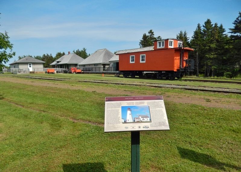
East Point Marker • wide view
(Elmira Railway Museum in left background)
1 Prince Edward Island, Kings County, Elmira — East Point
Near Elmira Road, 1.6 kilometers south of Northside Road (Prince Edward Island Route 16), on the right when traveling south.
2 Prince Edward Island, Kings County, Elmira — ElmiraThe End of the Line / La Fin de la Ligne Ferroviaire
Near Elmira Road, 1.6 kilometers south of Northside Road (Prince Edward Island Route 16), on the right when traveling south.
3 Prince Edward Island, Kings County, Elmira — Elmira Railway Museum / Musée ferroviaire d’Elmira
Near Elmira Road, 1.6 kilometers south of Northside Road (Prince Edward Island Route 16), on the right when traveling south.
4 Prince Edward Island, Kings County, Elmira — The Original Fog Alarm BuildingLe « Fog Alarm Building »
Near Lighthouse Road, 2 kilometers east of East Point Road (Prince Edward Island Route 16), on the right when traveling east.
5 Prince Edward Island, Kings County, Georgetown — Georgetown War Memorial
Near Georgetown Road near Grafton Street, on the left.
6 Prince Edward Island, Kings County, Georgetown — Georgetown’s New Railway StationNouvelle gare ferroviaire de Georgetown
On Richmond Street close to West Street, on the left when traveling west.
7 Prince Edward Island, Kings County, Georgetown — The Honorable Andrew Archibald (A.A.) Macdonald
Near Georgetown Road close to Grafton Street, on the left when traveling south.
8 Prince Edward Island, Kings County, Georgetown — Three RiversLes trois rivières — Samkook —
On Richmond Street close to West Street, on the right when traveling west.
9 Prince Edward Island, Kings County, Greenwich — Havre Saint Pierre
Near Prince Edward Island Route 313.
10 Prince Edward Island, Kings County, Greenwich — Mussel Power/Les moules plus d'une utilité
Near Prince Edward Island Route 313.
11 Prince Edward Island, Kings County, Greenwich — St. Peters
Near Prince Edward Island Route 313.
12 Prince Edward Island, Kings County, Greenwich — The Sanderson Farm/La ferme Sanderson
Near Prince Edward Island Route 313.
13 Prince Edward Island, Kings County, Murray Harbour — Cape Bear
Near Black Brook Road, 0.3 kilometers north of Cape Bear Road (Prince Edward Island Route 18), on the right when traveling north.
14 Prince Edward Island, Kings County, Murray Harbour — Cape Bear Lighthouse / Phare de Cape Bear
On Station Lane just south of Cape Bear Road (Main Street) (Prince Edward Island Route 18), on the right when traveling south.
15 Prince Edward Island, Kings County, Murray Harbour — Getting the Train to the Track / L’Arrivée du Train sur la Voie Ferrée
On Station Lane just south of Cape Bear Road (Main Street) (Provincial Route 18), on the right when traveling south.
Paid Advertisement
16 Prince Edward Island, Kings County, Murray Harbour — Murray Harbour War Memorial
On Main Street (Prince Edward Island Route 18) just north of Cape Bear Road (Prince Edward Island Route 18A), on the right when traveling south.
17 Prince Edward Island, Kings County, Murray Harbour — The “Harbour” / Le « Harbour »
On Main Street (Prince Edward Island Route 18) just north of Westview Drive, on the right when traveling west.
18 Prince Edward Island, Kings County, Murray Harbour — The Fishery at Murray Harbour / La Pêche À Murray Harbour
On Station Lane just south of Cape Bear Road (Main Street) (Prince Edward Island Route 18), on the right when traveling south.
19 Prince Edward Island, Kings County, Murray River — The Murray Harbour Branch / L’Embranchement Menant À Murray Harbour
On School Street just west of Main Street (Prince Edward Island Route 4), on the left when traveling west.
 
 
CeraNet Cloud Computing sponsors the Historical Marker Database.
This website earns income from purchases you make after using our links to Amazon.com. We appreciate your support.
Paid Advertisement
May. 3, 2024