14 entries match your criteria.
Related Historical Markers
Pratt Army Air Field Historical Walk
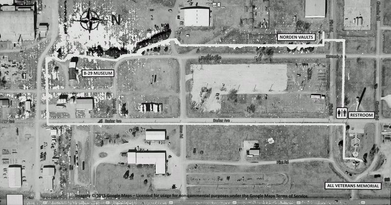
Courtesy Google Maps
Marker detail: Pratt Army Air Field Historical Walk Map
SHOWN IN SOURCE-SPECIFIED ORDER
| On Barker Avenue just north of Flint Road, on the left when traveling north. |
| Near U.S. 281 at Northeast 40th Street (Flint Road), on the left when traveling north. |
| On Barker Avenue at Flint Road, on the left when traveling north on Barker Avenue. |
| On Barker Avenue at Chandler Road, on the right when traveling north on Barker Avenue. |
| On Kennedy Avenue just north of Flint Road, on the right when traveling south. |
| On Kennedy Avenue just north of Flint Road, on the right when traveling north. |
| On Flint Road just west of Kennedy Avenue, on the right when traveling west. |
| On Flint Road just west of Kennedy Avenue, on the left when traveling west. |
| On Flint Road just west of Kennedy Avenue, on the left when traveling west. |
| On Flint Road just west of Kennedy Avenue, on the left when traveling west. |
| On Morris Avenue just north of Curran Road, on the left when traveling north. |
| Near Curran Road just west of Morris Avenue, on the right when traveling west. |
| On Kennedy Avenue just west of Barker Avenue, on the left when traveling west. |
| On Curran Road just west of Morris Avenue, on the right when traveling west. |
May. 19, 2024