Near Dunker Church Road / Old Hagerstown Pike, on the right when traveling south.
Maryland Baltimore Battery Jackson's Division C.S.A. The battery, under the command of Capt. J.B. Brockenbrough, occupied a position near this marker at daybreak, and opened the battle on the Confederate side. The monument to the Maryland troops . . . — — Map (db m6270) HM
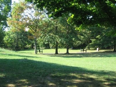
On Smoketown Road at Mummas Lane, on the left when traveling south on Smoketown Road.
Maryland Battery A 1st MD Light Artillery 1st Slocum's Division 6th Franklin's Corps The battery under the command of Capt. John W. Wolcott occupied a line 100 feet in rear of this marker and facing Dunkard Church. Loss 1 killed, 11 wounded. The . . . — — Map (db m6035) HM
On Cornfield Avenue, on the right when traveling west.
Maryland Battery B. 1st Md. Light Artillery 2nd (Smiths) Division 6th (Franklins) Corps The battery under the command of Lieut. Theodore J. Vanneman. Occupied a position on the edge of the East Woods, 240 yards north from this marker the . . . — — Map (db m5720) HM
On Smoketown Road at Mummas Lane, on the left when traveling west on Smoketown Road.
September 17, 1862 —————— From a position about 60 yards south of this point the battery, between 2 and 3 p.m., engaged and silenced the Confederate artillery around the Dunkard Church. — — Map (db m6036) HM
On Richardson Avenue, on the left when traveling east.
September 17, 1862 ——————From 3.30 p.m. until near sunset this battery from a point about 80 yards north of this, engaged the enemy around the Piper buildings. — — Map (db m5629) HM
On Burnside Bridge Road, on the right when traveling north.
(Front Face): OHIO 1st Battery
Light Artillery Commanded by Capt. James R. McMullin Hugh Ewings (1st) Brig. Kanawha Division Ninth Army Corps Army of the Potomac (Rear Face): This battery occupied position about 250 yards due . . . — — Map (db m6799) HM
On Boonsboro / Shepherdstown Pike (State Highway 34), on the right when traveling west.
U.S.A. Horse Batteries and Reserve Artillery, Army of the Potomac. (September 17, 1862) Horse Batteries A, B and L (Consolidated) and M, 2nd U.S. Artillery, C and G (Consolidated) of the 3d U.S. Artillery, were established on the crown of the . . . — — Map (db m7060) HM
On Cornfield Avenue, on the right when traveling east.
U.S.A. September 17-18, 1862. During and after Sedgwick's assault on the Confederates in the West Woods, a line of batteries was established, running from Mumma's Cemetery on the south, crossing the road at this point and extending northwardly . . . — — Map (db m5771) HM
On Boonsboro / Shepherdstown Pike (State Highway 34), on the right when traveling west.
U.S.A. Battery A, 2d U.S. Artillery. Captain John C. Tidball, U.S.A. Commanding. (September 17, 1862.) Horse Battery A, 2d U.S. Artillery, moved from its bivouac near Keedysville on the morning of the 17th, crossed the Antietam by the Middle . . . — — Map (db m7025) HM
On Boonsboro / Shepherdstown Pike (State Highway 34), on the right when traveling west.
U.S.A. Battery M, 2d U.S. Artillery. Lieut. Peter C. Hains, U.S.A. Commanding. (September 17, 1862.) Horse Battery M, 2d U.S. Artillery, crossed the Antietam by the Middle Bridge, in the forenoon of the 17th and, preceded by the 4th Pennsylvania . . . — — Map (db m7057) HM
On Boonsboro / Shepherdstown Pike (State Highway 34), on the right when traveling west.
U.S.A. Batteries B and L, 2d U.S. Artillery. Captain Jas. M. Robertson, U.S.A., Commanding (September 17, 1862.) Horse Batteries B and L (Consolidated), 2nd U.S. Artillery, crossed the Antietam by the Middle Bridge, in the forenoon of September . . . — — Map (db m7055) HM
On Boonsboro / Shepherdstown Pike (State Highway 34), on the right when traveling west.
U.S.A. Batteries C and G, 3d U.S. Artillery. Captain Horatio G. Gibson, U.S.A. Commanding. (September 17, 1862.) Horse Batteries C and G (Consolidated), 3d U.S. Artillery, crossed the Antietam in the forenoon of September 17, and went into . . . — — Map (db m7027) HM
On Boonsboro / Shepherdstown Pike (State Highway 34), on the right when traveling west.
U.S.A. Battery E, 1st U.S. Artillery. Lieut. Alanson M. Randol, U.S.A., Commanding. (September 17, 1862.) Early in the afternoon of the 17th, Battery E, 1st U.S. Artillery, crossed the Antietam by the Middle Bridge and relieved Robertson's . . . — — Map (db m7026) HM
On Boonsboro / Shepherdstown Pike (State Highway 34), on the right when traveling west.
U.S.A. Battery K, 5th U.S. Artillery, Lieut. William E. Van Reed, U.S.A., Commanding. (September 17, 1862.) Battery K, 5th U.S. Artillery, crossed the Antietam, by the Middle Bridge and about 2 p.m., September 17, relieved Battery M, 2d U.S. . . . — — Map (db m7059) HM
On Smoketown Road, on the right when traveling west.
U.S.A. Batteries A and C 4th U.S. Artillery. Lieut. Evan Thomas, U.S.A., Commanding. (September 17, 1862.) Batteries A and C (consolidated), 4th U.S. Artillery (6 guns), relieved Battery I, 1st U.S. Artillery just north of this point and went . . . — — Map (db m6032) HM
On Dunker Church Road / Old Hagerstown Pike, on the right when traveling south.
U.S.A. Battery B, 4th U.S. Artillery Capt. Joseph B. Campbell, U.S.A. Commanding. (September 17, 1862.) Early in the morning this battery advanced from its bivouac north of Jos. Poffenberger's, passing through the North Woods to the ploughed . . . — — Map (db m6105) HM
On Smoketown Road, on the left when traveling west.
U.S.A. Battery D, 2nd U.S. Artillery. Lieut. Edward B. Williston, U.S.A., Commanding. (September 17, 1862.) Battery D, 2nd U.S. Artillery, moved from its bivouac near Crampton's Pass on the morning of the 17th and went into position south of the . . . — — Map (db m6034) HM
On Dunker Church Road / Old Hagerstown Pike, on the right when traveling north.
U.S.A. Battery C, 5th U.S. Artillery Captain Dunbar R. Ransom, U.S.A. Commanding, (September 16-17, 1862.) On the evening of September 16th, Battery C, 5th U.S. Artillery came into battery 370 yards east of the Hagerstown Pike, on the south edge . . . — — Map (db m6087) HM
On Branch Avenue, on the left when traveling south.
U.S.A. Battery E, 2nd U.S. Artillery. Lieut. Samuel E. Benjamin, U.S.A. Commanding. (September 16-17, 1862.) On the morning of September 16, Benjamin's Battery took position on the ridge bordering the Antietam, above the Burnside Bridge, engaged . . . — — Map (db m6722) HM
On Branch Avenue, on the left when traveling south.
U.S.A. Battery E, 4th U.S. Artillery. Capt. Joseph C. Clark Jr., U.S.A. Commanding. (September 17, 1862.) At daybreak Battery E, 4th U.S. Artillery, was in bivouac in rear of the high ground east of the Burnside Bridge. Soon after daybreak it . . . — — Map (db m6718) HM
On Smoketown Road at Mummas Lane, on the left when traveling west on Smoketown Road.
U.S.A. Battery F, 5th U.S. Artillery. Lieut. Leonard Martin, U.S.A., Commanding. (September 17, 1862.) Early in the morning of the 17th, Battery F, 5th U.S. Artillery, generally known as Ayers' Battery, moved with Smith's Division, Sixth Army . . . — — Map (db m6030) HM
On Smoketown Road, on the right when traveling west.
U.S.A. Battery I, 1st U.S. Artillery, Lieut. Geo. A. Woodruff, U.S.A. Commanding. (September 17, 1862.) Between 9 and 10 a.m., Battery I, 1st Artillery, advancing by the Smoketown Road, passed through the East Woods to the assistance of the . . . — — Map (db m185587) HM
On Branch Avenue, on the left when traveling south.
U.S.A. Battery G, 4th U.S. Artillery Lieut. Marcus P. Miller, U.S.A. Commanding (September 17, 1862.) Battery G, 4th U.S. Artillery, belonged to the Artillery Reserve, which was attached to the Fifth Army Corps. On the morning of the 17th, the . . . — — Map (db m6757) HM
On Branch Avenue, on the left when traveling south.
U.S.A. Battery A, 5th U.S. Artillery. Lieut. Chas. P. Muhlenburg, U.S.A. Commanding. (September 17, 1862.) On the morning of the 17th, Battery A was in position on the crest of the hill east of the Rohrbach Lane, east of and overlooking the . . . — — Map (db m6758) HM
On Boonsboro Pike (State Highway 34), on the right when traveling east.
C.S.A. Washington Artillery, Longstreet's Command, Col J. B. Walton, Commanding. Organization. 1st Company, Washington Artillery, La. 2nd Company, Washington Artillery, La. 3rd Company, Washington Artillery, La. 4th Company, Washington . . . — — Map (db m7232) HM
On Boonsboro Pike (State Highway 34), on the right when traveling east.
C.S.A. Washington Artillery, Longstreet's Command, Col. J. B. Walton Commanding. (September 17, 1862.) During the forenoon the Washington Artillery was engaged with the enemy's heavy batteries on the opposite side of Antietam Creek. At 9:15, the . . . — — Map (db m7233) HM
On Boonsboro Pike (State Highway 34), on the right when traveling east.
C.S.A. Reserve Artillery, Army of Northern Virginia, Brig. Gen. William N. Pendleton, Commanding. September 16-18, 1862. A portion of the Reserve Artillery took part in the battle of September 16-17; The rest was posted at the fords, in the . . . — — Map (db m7231) HM
On Branch Avenue, on the right when traveling south.
C.S.A. Wise (Virginia) Artillery. Capt. J.S. Brown, Commanding. The Wise Artillery was the only one of the four batteries attached to D.R. Jones' Division which was present on the field. During the greater part of the engagement it occupied the . . . — — Map (db m6606) HM
On Dunker Church Road / Old Hagerstown Pike, on the right when traveling north.
Confederate Colonel Stephen D. Lee positioned his batteries to repel Union attacks toward the Dunker Church. The attacks came and the guns fired solid shot and explosive shells and canister - tin cans filled with small lead or iron balls that . . . — — Map (db m6368) HM
On Dunker Church Road / Old Hagerstown Pike, on the right when traveling north.
Confederate Col. Stephen D. Lee placed his battalion of nineteen cannons here. Throughout the morning, Union infantry and artillery aimed their attacks towards this high ground and the Dunker Church. Twenty-five percent of his men were killed or . . . — — Map (db m20575) HM
On Dunker Church Road / Old Hagerstown Pike, on the right when traveling north.
Civil War canoneers of both armies learned from the Artillery Drill manual: "To the Field Artillery belongs the service of the batteries which manoeuver with the troops on the field of battle. It is divided into two parts. Horse Artillery, which . . . — — Map (db m6350) HM
On Dunker Church Road / Old Hagerstown Pike, on the right when traveling north.
At Antietam, the open and rolling terrain benefited the artillerymen of both armies. By placing their cannon on high ground, Blue and Gray alike were able to effectively strike enemy troop positions at great distances. Over 500 cannon thundered . . . — — Map (db m20591) HM
Near Dunker Church Road / Old Hagerstown Pike, on the right when traveling south.
The Baltimore Battery (Confederate) fired from this spot into the Union forces in the Cornfield. It included a 12-pounder iron howitzer (like the small gun before you), the only one of its kind among the 500 cannon at Antietam. — — Map (db m6269) HM