On Craven Street, on the right when traveling east.
Erected in 1798 and rebuilt in 1852, the Beaufort Arsenal was the home of the Beaufort Volunteer Artillery, commissioned in 1802, which had its roots in an earlier company organized in 1776 and served valiantly in the Revolutionary War. The BVA was . . . — — Map (db m5664) HM
On Carteret Street (U.S. 21), on the right when traveling west.
Beaufort College, a college preparatory academy founded in 1795, occupied this Greek Revival building from 1852 to 1861. The school opened in 1804 at Bay and Church Sts. but closed in 1817 after a yellow fever epidemic, reopening in 1820 at . . . — — Map (db m218213) HM
On Scott Street, on the left when traveling north.
The Society, founded in 1814 to educate and provide relief for destitute children, built this
house in 1895 and leased it for many years, using the income to help the needy. Tenants included the Clover Club, which operated a circulating library . . . — — Map (db m5681) HM
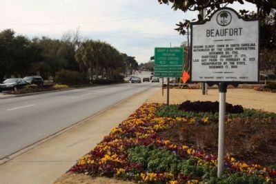
On Bay Street near Scott Street, on the right when traveling east. Reported missing.
On or near this site in the settlement known as Stuart Town stood the "Tight Watch House" erected in 1683-4. After the destruction of the town by the Spanish in 1686 it was replaced by a fort, approximately 100 feet square defended by "9 Great Guns" . . . — — Map (db m5939) HM
On Church Street south of King Street when traveling south.
(Marker Front):
This Episcopal Parish was established by Act of the Assembly June 7, 1712. The first known rector, William Guy, conducted early worship services in homes of settlers. The parish suffered greatly during the 1715 Yemassee . . . — — Map (db m5827) HM
John Mark Verdier
1759-1826
Builder Of This House
1795-1800
General Lafayette Spoke To The People
Of Beaufort From This Portico
March 18, 1825 — — Map (db m19644) HM
On Craven Street at Carteret Street (Business U.S. 21), on the left when traveling east on Craven Street.
Built in 1917-18, this was one of fourteen libraries constructed in S.C. with funding from the Carnegie Corporation. It was built at the urging of the Clover Club, a local women's literary group who in 1902 began a small subscription library. The . . . — — Map (db m223614) HM
On May River Road (State Highway 46) at Verdier Cove Road, on the right when traveling east on May River Road. Reported missing.
Settled in 1825, as a summer resort of rice and cotton planters, this town was incorporated in 1852. Here in 1844 was launched the protest against the Federal tariff known as the "Bluffton Movement". — — Map (db m219148) HM
On Dr. Martin Luther King Drive (State Highway S-7-45), on the right when traveling south.
( Front text )
On the night of August 27, 1893, a
huge "tropical cyclone," the largest
and most powerful storm to hit S.C.
until Hurricane Hugo in 1989, made
landfall just E of Savannah, Ga.
With gusts as high as 120 mph and a
storm . . . — — Map (db m8782) HM
On Trask Parkway (U.S. 21) near Parker Drive, on the right when traveling south.
Near the old halfway house, in the
vicinity of Grays Hill, on February
3, 1779, a force of South Carolina
Militia, Continentals, and
volunteers, including men from
Beaufort, under General William
Moultrie, defeated the British in
their . . . — — Map (db m14738) HM
Less than three decades after Columbus had discovered America, on Aug. 18, 1521 ( St. Helena's Day ), Spanish seafarers from Santo Domingo sighted this magnificent harbor, named its Eastern headland the Punta de Santa Elena, from which the area . . . — — Map (db m21253) HM
On Pinckney Wildlife Refuge near William Wilton Parkway (U.S. 278), on the right.
[Front]:
Born in South Carolina, Pinckney was educated in England and served in the First and Second Provincial Congresses. A commander in the Revolution, he later served in the SC General Assembly, signed the US Constitution, and was . . . — — Map (db m30536) HM
On Pinckney Wildlife Refuge north of William Wilton Parkway (Route 352), on the right when traveling north.
[Front]:
Inhabited for some 10,000 years, Pinckney Island was known as Espalanga, Look–out, and Mackey's prior to about 1775. Alexander Mackey received two Proprietary grants for land on the island in 1710. Charles Pinckney later . . . — — Map (db m6611) HM
On Lands End Road (State Highway 45), on the left when traveling south.
To St. Helena's Church, Beaufort, S.C. Built about 1740. Made a separate church after the revolution. Burned by forest fire Feb. 22, 1886. — — Map (db m19647) HM
On Old Sheldon Church Road north of Bailey Road, on the right when traveling north. Reported permanently removed.
Ruins of Old Sheldon Prince William's Parish Church Built 1745-55. Burned 1779 by British. Rebuilt 1826. Burned 1865 by Federal Army. Named for ancestral home of the Bull family in Warwickshire, England. ——— Annual Services . . . — — Map (db m26366) HM
On State Highway 462, 0.1 miles south of State Highway 27-336, on the left when traveling south.
Member of South Carolina Provincial Congress and Council of Safety and of Continental Congress. Signer of Declaration of Independence and Articles of Confederation and captain of militia at Battle of Port Royal and Siege of Charleston. Prisoner of . . . — — Map (db m6415) HM