On Buster Pike, 0.5 miles north of Bellows Mill Road, on the right when traveling north.
Built in 1848 by Robert Mosby Davis and Sarah Harris, his wife, this beautifully situated Greek Revival house features a façade laid in Flemish bond, a central two story portico with four Ionic columns, and a widow's walk accessible by an attic . . . — — Map (db m218280) HM
On Buster Pike, 0.7 miles north of Faulkner Lane (Kentucky Route 1896), on the left when traveling north.
One of the early settlers in Kentucky, this station was erected by John Bunton around 1781 on a 400-acre settlement. The land was later assigned to William McBride, and Bunton removed to a 400-acre tract near the Kentucky River on present-day McAfee . . . — — Map (db m218284) HM
On Lexington Road (U.S. 68), on the right when traveling north.
Abraham Chapline at 19 was the youngest of the original settlers to accompany James Harrod to Kentucky. This is the site of his 1400 acre settlement and preemption. He married Elizabeth Higgins in 1793, and their restored pioneer cemetery is located . . . — — Map (db m153039) HM
On Aspen Hall Drive at Aspen Hall Court, on the right when traveling south on Aspen Hall Drive.
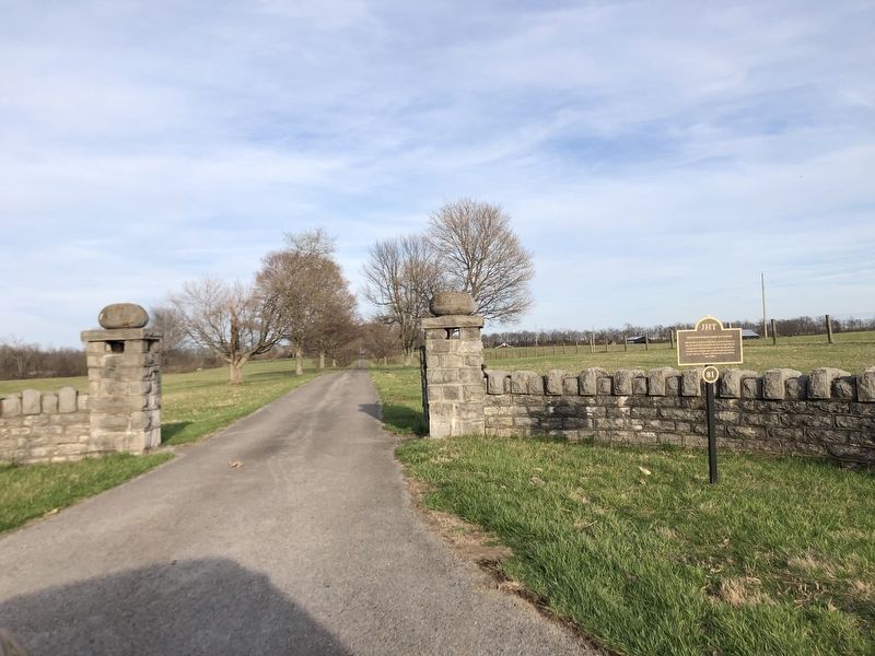
Built on land originally part of Greenville Springs, this imposing Greek Revival house was built in 1840 by Dr. James Shannon, President of Bacon College. Later the residence of John Bryan Bowman, Mercer County farmer and crusader for higher . . . — — Map (db m152934) HM
On West Broadway, on the right when traveling west.
The hotel was built circa 1843 and the house built circa 1853 by Benjamin Passmore, Harrodsburg blacksmith and entrepreneur. The house is a hall and parlor plan. During the era of stage coach travel, the hotel provided popular accommodations. It . . . — — Map (db m153030) HM
On East Poplar Street at South Main Street, on the left when traveling west on East Poplar Street.
This Queen Anne building with Romanesque details was built circa 1890 by John and Etta Litsey and sold to C.B. Sullivan in 1893. Long occupied by the Isenberg Brothers as a department store, it is notable for a beautifully decorated second floor . . . — — Map (db m152928) HM
On East Broadway at North Main Street, on the left when traveling east on East Broadway.
Located on in-lot 86, this house of timberframe construction with brick nogging has a log nucleus which may be as early as 1786. Home to the Chenoweth, Slavens and Cardwell families, it was purchased circa 1863 by John and Sophia Taylor Cardwell and . . . — — Map (db m153031) HM
On North East Street just north of East Factory Street, on the right when traveling north.
Built circa 1830 by Charles Ficklin and sold in 1833 to Alexander Buchanan, this five bay, story and a half house with a façade laid in Flemish bond, features Matthew P. Lowery interior woodwork. Lowery woodwork also framed the exterior front . . . — — Map (db m153072) HM
On Beaumont Avenue, 0.1 miles south of Mooreland Avenue, on the right when traveling north.
Built circa 1814 by Beriah Magoffin, Sr. and his wife, Jane McAfee, on out-lot 40. It was the birthplace of Kentucky’s Civil War Governor Beriah Magoffin, Jr. and his equally successful siblings. In the Georgian style, the portico was added in 1845. . . . — — Map (db m152955) HM
On South Main Street just south of Short Street, on the left when traveling north.
A 1786 plat of Harrodsburg designates a public square on which four courthouses have been located. A stone courthouse was built in 1788 followed by a brick structure in 1818. This was incorporated into a larger brick building in 1912 which was . . . — — Map (db m153166) HM
On North Main Street just south of Pearson Street, on the right when traveling north.
Occupying out-lot 5, Courtview is so named for its view of the courthouse when this Federal brick residence was built in 1823 by Col. Richard M. Sutfield and his first wife, Elizabeth Thomas. Contains Matthew P . Lowery woodwork with unique mantel . . . — — Map (db m153078) HM
On Beaumont Avenue just north of Dedman Street, on the left when traveling north.
Built in 1884 by Charles M. and Mary (Mollie) Curry Dedman, this Queen Anne style Victorian house is notable for the pargeting gable decoration. Mrs. Dedman chose the lot, plans and oversaw construction. Long time residence of the Ruby family. — — Map (db m152938) HM
On North College Street at Price Avenue, on the right when traveling north on North College Street.
Diamond Point is one of Kentucky’s finest examples of Greek Revival architecture with its textbook Minard Lafever doorway. An unusual portico features two round columns flanked by two square piers and a narrow balcony accessed by three upstairs . . . — — Map (db m153003) HM
On West Poplar Street just west of South Main Street, on the right when traveling west.
Brick Italianate residence built in 1884 by Dr. Anselm Daniel and Caroline S. Henry Price. Dr. Price practiced medicine in Harrodsburg for 40 years. This house served as his medical office and operating room. Notable for its Victorian gingerbread . . . — — Map (db m152880) HM
On North College Street at College Manor, on the right when traveling north on North College Street.
This hall and parlor home was built circa 1848 as a town house by Dr. James Harrison and Mary Messinger Moore. Important in the early economic development of this community, Dr. Moore and his wife had extensive landholdings and banking interests in . . . — — Map (db m153008) HM
On Lexington Road (U.S. 68), on the right when traveling east.
Located on the land of Gabriel Slaughter, Governor of Kentucky 1816 – 1820, the present Carpenter’s Gothic house was the home of Robert E. Coleman who, along with Crit Davis, were among the first to develop Mercer’s reputation for prizewinning . . . — — Map (db m153038) HM
On West Broadway, on the right when traveling west.
First Baptist Church. This rectangular brick structure has its principal three-bay façade in the gable end. Front facade consists of two equally~spaced doorways separated by a window. The doors and a stained glass transom are enclosed in a . . . — — Map (db m153028) HM
On North College Street just south of College View Street, on the left when traveling north.
Enlarged by Madison and Mary Worthington using timberframe construction, portions of this house were built as early as 1820 by Mary May. The house’s name is derived from the solid poplar tree trunks forming the four Doric columns. — — Map (db m153006) HM
On South College Street (U.S. 127) at West Lexington Street, on the right when traveling south on South College Street.
Begun in 1774 by James Harrod and Company, the Fort was crucial to the settlement of Harrodsburg and Kentucky. The present replica was erected in 1927 on Old Fort Hill also known as Seminary Hill. President Franklin D. Roosevelt visited the Fort in . . . — — Map (db m46261) HM
On Beaumont Avenue at Aspen Hall Drive, on the left when traveling north on Beaumont Avenue.
Built in 1896 by G. A. and Zeletta Graveson Curry, this Queen Anne style house stayed in the Curry Family for two decades. It retains its original wrap around porch and beautiful leaded and stained glass windows. — — Map (db m152937) HM
On Beaumont Inn Drive just west of Beaumont Avenue, on the right when traveling south.
Greystone was built in 1931 by Mrs. A. G. Kyle, a niece of Eli Lilly of pharmaceutical fame. Hugh Meriweather, noted for his commercial and residential designs, was the architect. Built of Kentucky limestone, it is now associated with neighboring . . . — — Map (db m152935) HM
On South Main Street just south of West Office Street, on the left when traveling north.
This historic congregation was organized in 1839 by Dr. William Vaughn and worshipped in the Old Republican Meeting House located behind this structure and facing the Courthouse. The present building was completed in 1961. — — Map (db m152866) HM
On South Main Street just south of East Office Street, on the right when traveling north.
Located on in-lot 152, this was the site of Rev. Jesse Head's cabinetry shop and later the offices of the Bohon Buggy Factory. The 1928 church houses an historic Disciples of Christ congregation chartered in 1803. — — Map (db m152867) HM
On Dry Branch Road (County Route 1915), on the right when traveling north.
Henry Wilson was one of the fortunate members of the militia to survive the Battle of Blue Licks. He and his wife, Elizabeth Mahan, built their circa 1779 station large enough to accommodate the first Kentucky land court and George May’s surveying . . . — — Map (db m153041) HM
On East Factory Street at North East Street, on the right when traveling east on East Factory Street.
Wattle, daub and hewn log house built in the early 1800s by Samuel Hogue containing much of its original woodwork and cabinetry. Purchased as a residence in 1856 by John Augustus Williams, President of Daughters’ College. — — Map (db m153073) HM
On Beaumont Avenue just south of Runyon Road, on the left when traveling north.
Designed and built by Dr. Guilford Runyon in the early 1840s for his fiancé Kitty Ferrel who died of cholera. Runyon was an orphan reared by the Shakers at Pleasant Hill until he was expelled after announcing his intention to marry. Noted for its . . . — — Map (db m152936) HM
On South East Street, 0.1 miles south of East Lexington Street (U.S. 68), on the right when traveling north.
This house was owned by Hugh and Katie Yocum McGary in 1795 but construction methods indicate an earlier building date. The house is of timberframe construction with brick nogging. Much original woodwork remains. McGary was a pioneer in Mercer . . . — — Map (db m153001) HM
On East Lexington Street (U.S. 68) just west of Miarimon Avenue, on the right when traveling east.
Built by Isaac Hipple circa 1845, the façade is divided into five bays by brick pilasters topped with Doric capitals. The windows have slightly pedimented wooden lintels that have an acanthus leaf motif. Later owned by the Garnett and Thompson . . . — — Map (db m152998) HM
On North Greenville Street at Ewing Avenue, on the left when traveling north on North Greenville Street.
This circa 1817 house was built for John L. Bridges and his wife, Anna Adair Bridges, the daughter of Governor John Adair. Bridges was a Mercer County Representative to the State Legislature and a circuit judge. Contains Matthew P . Lowery woodwork. — — Map (db m153094) HM
On Lexington Road (Kentucky Route 33), on the right when traveling north.
John and Elizabeth McCoun McMurtry established this station around 1780, and the log house presumed to be part of the station still exists within this structure.
Captain McMurtry survived the Battle of Blue Licks but was captured, required to . . . — — Map (db m216692) HM
On Short Street just west of South Main Street, on the right when traveling west.
In 1810 the Trustees of Harrodsburg sold certain lots from the Public Square for the sites of workshops and offices and Lawyer’s Row was born. This street was traditionally home to lawyers’ offices due to its proximity to the Courthouse. — — Map (db m152931) HM
On East Lexington Street (U.S. 68) just west of Marimon Avenue, on the right when traveling east.
Built circa 1878 as the home of Jesse and Lucy Newton Cogar. This house is a fine example of Golden Age architecture with cherry and oak inlaid floors, intricate moldings, stained glass windows and pargeting. — — Map (db m152957) HM
On Beaumont Avenue, 0.1 miles north of Dixie Manor, on the left when traveling north.
Built by Beriah Magoffin, Sr., Beriah Magoffin, Jr. and his wife Anne Shelby, granddaughter of Isaac Shelby, first governor of Kentucky, resided here after 1839. Later owned by Benjamin Mills noted gunsmith and commander of Harper’s Ferry at the . . . — — Map (db m152954) HM
On East Poplar Street at South Greenville Street, on the left when traveling west on East Poplar Street.
This house has been the residence of two Mercer County literary figures. It was built in the mid 1800s by Maria Thompson Daviess the author of “The History of Mercer and Boyle Counties”. Elizabeth Pendleton Hardin, who penned “The . . . — — Map (db m152930) HM
On Linden Avenue at Fairgrounds Road, on the left when traveling north on Linden Avenue.
Recognized as the oldest continuous Fair and Horse Show in the United States, dating from 1828, the present location was purchased in 1904 having been the site of an African American Fair. The property was once a part of the Harrodsburg Springs. — — Map (db m153036) HM
On South Chiles Street just north of West Office Street, on the left when traveling north.
"Built by Squire Joseph Morgan and extended by John G. Chiles for whom the street was named, who had stage contracts extending largely over Kentucky that kept Harrodsburg wide awake with the rattle of the wheels and the echoes of the merry stage . . . — — Map (db m152871) HM
On East Lexington Street (U.S. 68) 0.1 miles east of Woodland Avenue, on the right when traveling east.
Built by Harrodsburg tailor Muscoe F. Garnett and wife, Margaret E. Hunt Garnett, in 1852. This substantial brick home was subsequently owned by long time Mercer Circuit Court Clerk Ben C. Allin, and later by T. C. Bell, prominent Mercer County . . . — — Map (db m153000) HM
On South Chiles Street north of Mooreland Avenue, on the left when traveling north.
Built in 1827, the large building served as a home for the jailer and his family and as jail cells for the prisoners. Most famous inmate was Lizzie Hardin, a Confederate sympathizer, jailed for waving her handkerchief at John Hunt Morgan and his men . . . — — Map (db m152870) HM
On Dry Branch Road (County Route 1915), on the right when traveling south.
The history of this Church goes back well over 400 years from Holland to New York to New Jersey to Pennsylvania and finally to Kentucky. Members of this Dutch Reformed congregation immigrated to Kentucky as early as 1781, and many of those pioneers . . . — — Map (db m153044) HM
On Beaumont Avenue just south of Dixie Manor, on the left when traveling north.
Located on out-lot 81, this Queen Anne style house was built by Benjamin Franklin Poteet in 1883. The home was designed by nationally recognized architect George Barber and is listed as design # 29 in “The Cottage Souvenir No. 2” design . . . — — Map (db m152940) HM
On North Main Street at Price Avenue, on the left when traveling north on North Main Street.
This circa 1857 house was built by Monroe Pulliam and completed by Kentucky legislator Daniel Curry and his wife, Martha Jane Forsythe. The Gothic Revival style is shown by the board and batten siding and lacy bargeboards. — — Map (db m153081) HM
On North College Street (U.S. 127) just south of College Manor, on the left when traveling north.
Built circa 1844 by partners Daniel Stagg and James Curry. Mr. Curry purchased Stagg’s interest. Called Rykon for the Riker family who purchased it in 1861 and held title for a century. The Riker family were descendants of the Low Dutch. — — Map (db m153005) HM
On Spring Hill Cemetery Street at North Greenville Street and Stagg Street, on the right when traveling east on Spring Hill Cemetery Street.
Welcome to Spring Hill Cemetery. This map and the cemetery print-out on the shelf below have been placed here to help you locate grave sites of interest. Sections are marked with letters and numbers. Lot numbers refer to the number of rows in a . . . — — Map (db m153164) HM
On West Lexington Street (U.S. 68) just east of North College Street (U.S. 127), on the right when traveling west.
This congregation was formed circa 1839. In 1885 they founded Wayman Institute to provide higher education for African American youth. The present Classical Revival building was erected in 1917 with much of the labor being provided by church members. — — Map (db m152875) HM
On Beaumont Avenue just south of Dixie Manor, on the left when traveling north.
This Queen Anne style house built in the 1880s by Dr. Moshiem Tabler was subsequently used as a parsonage for the Harrodsburg Presbyterian Church before reverting to private ownership in the 1940s. — — Map (db m152941) HM
On North Main Street just south of Pearson Street, on the right when traveling north.
This circa 1850 house was built by John A. Tewmey, a descendant of the Low Dutch. Entablature above the door is carved with a honeysuckle motif. In the Armstrong family for almost 100 years, it was the home of artist Jestabell Armstrong Matherly. — — Map (db m153079) HM
On South Main Street at Mooreland Avenue & Beaumont Avenue, on the left when traveling north on South Main Street.
In 1847, under the supervision of Rev. John Montgomery, the Presbyterian Church hired James Curry to construct the Harrodsburg Female Academy on land purchased from Christopher Columbus Graham. Housed Civil War wounded from the Battle of Perryville. — — Map (db m152869) HM
On North College Street (U.S. 127) just north of West Factory Street, on the left when traveling north.
This Gothic Revival house was built adjacent to his tanyard by Frederick Curry and Cornelia, his wife, in 1856. Curry was a descendant of a pioneer Mercer County family who came to the area with the McAfees. An original brick smokehouse is still . . . — — Map (db m153004) HM
On East Lexington Street (U.S. 68) east of South East Street, on the right when traveling east.
Built in 1887 after his original home burned, this Italianate residence was the home of renowned criminal lawyer Philip B. and Martha Montgomery Thompson. Graced by exquisitely crafted cherry woodwork. Note Celtic cross on tower. — — Map (db m152996) HM
On South Chiles Street north of West Poplar Street, on the left when traveling north.
Reconstructed in 1940 on the foundations of the 1840 and 1889 Methodist Church after a devastating fire. Has original bell from the first church. The congregation has been meeting here since 1828. The circa 1840 Greek Revival house is the oldest . . . — — Map (db m152872) HM
On South Main Street north of Beaumont Avenue, on the left when traveling north.
Built in 1853 and expanded in 1913, this Gothic Revival building houses a congregation which originally worshipped at Cane Run. They moved to Harrodsburg and built on this site in 1818. Differences caused by the Civil War precipitated a split in the . . . — — Map (db m152868) HM
On Beaumont Avenue just north of Dedman Street, on the left when traveling north.
This Beaux Arts style home was built in 1905 for G. Alfred Curry. In 1919, it was purchased by Dr. Condit B. VanArsdall, Sr. whose daughter Elizabeth married Forest “Aggie” Sale. Mr. Sale was a Captain of the 1933 University of Kentucky . . . — — Map (db m152939) HM
On South Magnolia Street at West Lexington Street, on the left when traveling north on South Magnolia Street.
This African American School was erected on this property in 1930, thanks to a donation from the Julius Rosenwald Fund. west Side was the only elementary and high school for African American children in Mercer County. It united the faculty, . . . — — Map (db m153033) HM
On South Chiles Street at West Lexington Street (U.S. 68), on the left when traveling north on South Chiles Street.
Situated on in-lot 37, portions of house built as early as 1840 by Robert and Priscilla Robertson. Purchased in 1891 by Thomas and Mary Grimes Hardin. Remained in Hardin family until 1959. Is presently owned and occupied by a financial institution. — — Map (db m152874) HM
On West Poplar Street at South Chiles Street, on the right when traveling west on West Poplar Street.
Built in 1822 by William and Jane Haggin McBride parents of Confederate General James Haggin McBride. Once the home of Terah Templin Haggin, McBride's brother-in-law and father of James Ben Ali Haggin. Contains Matthew P. Lowery woodwork. — — Map (db m152878) HM
On North East Street at Woodsland Drive, on the right when traveling north on North East Street.
All materials for this Virginia style house came from the immediate property with the hand fired brick on the front wall laid in Flemish bond. It was built in 1810 by Archibald and Annie Adams Woods and still remains in the family. — — Map (db m153070) HM