By Duane and Tracy Marsteller, March 5, 2023
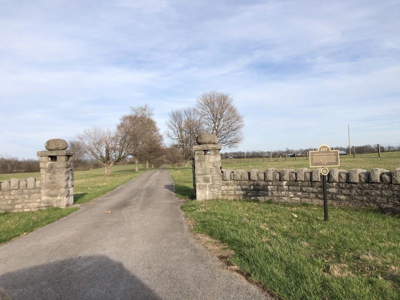
Glenworth/Robert Mosby Davis House Marker
| On Buster Pike, 0.5 miles north of Bellows Mill Road, on the right when traveling north. |
| On Buster Pike, 0.7 miles north of Faulkner Lane (Kentucky Route 1896), on the left when traveling north. |
| On Lexington Road (U.S. 68), on the right when traveling north. |
| On Aspen Hall Drive at Aspen Hall Court, on the right when traveling south on Aspen Hall Drive. |
| On North College Street (U.S. 127) at Veterans Park Road, on the right when traveling north on North College Street. |
| On West Broadway, on the right when traveling west. |
| On East Poplar Street at South Main Street, on the left when traveling west on East Poplar Street. |
| On East Broadway at North Main Street, on the left when traveling east on East Broadway. |
| On North East Street just north of East Factory Street, on the right when traveling north. |
| On Beaumont Avenue, 0.1 miles south of Mooreland Avenue, on the right when traveling north. |
| On South Main Street just south of Short Street, on the left when traveling north. |
| On North Main Street just south of Pearson Street, on the right when traveling north. |
| On Beaumont Avenue just north of Dedman Street, on the left when traveling north. |
| On North College Street at Price Avenue, on the right when traveling north on North College Street. |
| On West Poplar Street just west of South Main Street, on the right when traveling west. |
| On North College Street at College Manor, on the right when traveling north on North College Street. |
| On Lexington Road (U.S. 68), on the right when traveling east. |
| On West Broadway, on the right when traveling west. |
| On North College Street just south of College View Street, on the left when traveling north. |
| On South College Street (U.S. 127) at West Lexington Street, on the right when traveling south on South College Street. |
| On Beaumont Avenue at Aspen Hall Drive, on the left when traveling north on Beaumont Avenue. |
| On Beaumont Inn Drive just west of Beaumont Avenue, on the right when traveling south. |
| On South Main Street just south of West Office Street, on the left when traveling north. |
| On South Main Street just south of East Office Street, on the right when traveling north. |
| On Dry Branch Road (County Route 1915), on the right when traveling north. |
| On East Factory Street at North East Street, on the right when traveling east on East Factory Street. |
| On Beaumont Avenue just south of Runyon Road, on the left when traveling north. |
| On South East Street, 0.1 miles south of East Lexington Street (U.S. 68), on the right when traveling north. |
| On East Lexington Street (U.S. 68) just west of Miarimon Avenue, on the right when traveling east. |
| On North Greenville Street at Ewing Avenue, on the left when traveling north on North Greenville Street. |
| On Lexington Road (Kentucky Route 33), on the right when traveling north. |
| On Short Street just west of South Main Street, on the right when traveling west. |
| On East Lexington Street (U.S. 68) just west of Marimon Avenue, on the right when traveling east. |
| On Beaumont Avenue, 0.1 miles north of Dixie Manor, on the left when traveling north. |
| On East Poplar Street at South Greenville Street, on the left when traveling west on East Poplar Street. |
| On Linden Avenue at Fairgrounds Road, on the left when traveling north on Linden Avenue. |
| On South Chiles Street just north of West Office Street, on the left when traveling north. |
| On East Lexington Street (U.S. 68) 0.1 miles east of Woodland Avenue, on the right when traveling east. |
| On South Chiles Street north of Mooreland Avenue, on the left when traveling north. |
| On Dry Branch Road (County Route 1915), on the right when traveling south. |
| On Beaumont Avenue just south of Dixie Manor, on the left when traveling north. |
| On North Main Street at Price Avenue, on the left when traveling north on North Main Street. |
| On North College Street (U.S. 127) just south of College Manor, on the left when traveling north. |
| On Spring Hill Cemetery Street at North Greenville Street and Stagg Street, on the right when traveling east on Spring Hill Cemetery Street. |
| On West Lexington Street (U.S. 68) just east of North College Street (U.S. 127), on the right when traveling west. |
| On Beaumont Avenue just south of Dixie Manor, on the left when traveling north. |
| On North Main Street just south of Pearson Street, on the right when traveling north. |
| On South Main Street at Mooreland Avenue & Beaumont Avenue, on the left when traveling north on South Main Street. |
| On North College Street (U.S. 127) just north of West Factory Street, on the left when traveling north. |
| On East Lexington Street (U.S. 68) east of South East Street, on the right when traveling east. |
| On South Chiles Street north of West Poplar Street, on the left when traveling north. |
| On South Main Street north of Beaumont Avenue, on the left when traveling north. |
| On Beaumont Avenue just north of Dedman Street, on the left when traveling north. |
| On South Magnolia Street at West Lexington Street, on the left when traveling north on South Magnolia Street. |
| On South Chiles Street at West Lexington Street (U.S. 68), on the left when traveling north on South Chiles Street. |
| On West Poplar Street at South Chiles Street, on the right when traveling west on West Poplar Street. |
| On North East Street at Woodsland Drive, on the right when traveling north on North East Street. |