“At four in the morning I had to be up. I went up and made the fire in [Johnson’s] room, shined his boots, and then made a fire in the kitchen stove. I stood by his side at the table . . . then I washed the dishes.” . . . — — Map (db m58428) HM
Andrew Johnson Patterson, son of Martha Johnson Patterson and grandson of President Andrew Johnson, was born and died in this house. To him and his loyal and devoted wife, Martha Barkley Patterson, the nation is indebted for their untiring efforts . . . — — Map (db m58437) HM
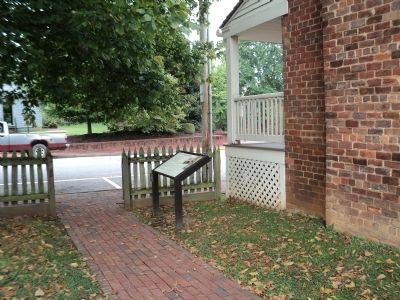
There are no written records describing the Homestead grounds as Andrew Johnson knew them from 1869 until 1875. The earliest descriptions of the landscape during that period come from the oral accounts of Andrew Johnson’s descendants twenty-five . . . — — Map (db m58436) HM
During the 1861 secession debates, Greene County was mostly Unionist, but Tusculum College students were divided. Before the June secession vote, then-U.S. Sen. Johnson spoke in Greeneville in support of the Union. Afterward, secessionist students . . . — — Map (db m69599) HM
Oldest house standing in Greeneville. Built circa 1795 by Valentine Sevier, wealthy political leader and philanthropist of the late 18th and early 19th centuries, it was later owned by President Andrew Johnson. After the War Between the States it . . . — — Map (db m81614) HM
Before the war began, Greene County had a long history of abolitionist sentiment. It was not surprising, then, that local residents overwhelmingly supported the Union when Tennessee seceded in June 1861. When 30 neighboring counties met in . . . — — Map (db m84761) HM
As the Union military occupation spread over Middle Tennessee, Federal commanders needed a supply depot on the Tennessee River. By 1863, they agree that such a depot, navigable year around, would provide Union armies in the west with a stream of . . . — — Map (db m176873) HM
This town was named for Andrew Johnson, military governor of Tennessee (1862 - 65). Although the community had been a steamboat landing prior to the Civil War, it was not until the Nashville and Northwestern Railroad was completed by the Union Army . . . — — Map (db m176880) HM
Born nearby; graduated from the US Military Academy in 1851, his Civil War duties included those of Provost Marshall of Nashville, later Adjt. General of Tennessee, to which he was appointed by Andrew Johnson. Promoted to Maj. Gen.; commanded the . . . — — Map (db m180011) HM
North of this marker lies the site of Old Columbus,
once an important landing on the Cumberland
River. In the winter of 1863–1864, the war
had disastrous consequences for this river village.
Late in December 1863, Gen. Ulysses . . . — — Map (db m68344) HM
In April 1861, before Tennessee seceded, Knoxville was deeply divided. Excited residents gathered in the streets and held rallies to sway public opinion. These divisions were never more visible then than during simultaneous Union and Confederate . . . — — Map (db m100524) HM
In 1862, Lincoln County and Fayetteville residents celebrated the completion of a local engineering marvel, a huge stone bridge over the Elk River, that they hoped would ensure the continual prosperity of this agricultural community. The 450-foot . . . — — Map (db m152122) HM
Used as a rostrum by
Presidents
James K. Polk • Andrew Johnson
U.S. Senators
A,O.P. Nicholson • E.W. Carmack
Congressmen
Geo. W. Jones • M.P. Gentry U.S.& C.S. • James D. Richardson • W.C. Houston . . . — — Map (db m152137) HM
Fifty yards north is the home (ca. 1856) of Union Col. Fielding Hurst, a slave owner but devout Unionist who raised the 6th Tennessee Cavalry during the Civil War. Hurst’s family controlled an area known during the war and long afterward as the . . . — — Map (db m74875) HM
On June 7, 1861, future president Andrew Johnson spoke forcefully against secession on the steps of this building, the Roane County Courthouse. Along with many others in East Tennessee, a majority in Roane County opposed separation from the Union, . . . — — Map (db m150757) HM
For most residents, Robertson County was a difficult place to live during the war. After the fall of Confederate Forts Henry and Donelson in 1862, Union forces occupied the county and made the town of Springfield a military base, where they guarded . . . — — Map (db m82328) HM
Built shortly after 1785 by William Deery. Stopping place for many distinguished travelers of early days, Andrew Jackson, James K. Polk, the Marquis de Lafayette, Prince Louis Phillipe, Andrew Johnson and others enjoyed its hospitality. It operated . . . — — Map (db m82955) HM
The Great Valley of Tennessee, the Southern Appalachian breadbasket, stretches from Bristol to Chattanooga and with its major turnpikes and railroads was strategically vital to both North and South during the war.
The “better half of . . . — — Map (db m143534) HM
In March 1775 Daniel Boone and a group of axmen met nearby at the Holston River and began blazing a trail through 200 miles of forested terrain to the Cumberland Gap and beyond to the Kentucky River. The Wilderness Trail, or Road, opened a new . . . — — Map (db m69694) HM
In 1802 William King of Saltville, Virginia purchased two lots in Christianville where he built a dwelling, wharfs, warehouses and a store.
In 1818 Richard Netherland, Esquire, purchased the property and established a tavern on the Great Stage . . . — — Map (db m158080) HM
Rosemont, a Greek Revival—style mansion completed in the 1840s, was the home of Judge Josephus Conn Guild, a state senator and representative who also served as a Lt. Colonel in the 2nd Tennessee Mounted Volunteers during the Seminole War. He . . . — — Map (db m68405) HM
Hazel Path Mansion is associated with the beginnings and legacies of the Civil War in Tennessee. The home of Confederate Gen. Daniel Smith Donelson, completed in 1857, became a camp for escaped slaves (“contrabands") during the war. . . . — — Map (db m149950) HM
During the Civil War, the hand of occupation landed heavily on farms, houses, and towns along the Louisville & Nashville (L&N) Railroad. This two-story brick Greek Revival-style house, first called Liberty Hall and then renamed Monthaven in 1953, . . . — — Map (db m149363) HM
This was the home of Landon Carter Haynes, a distinguished lawyer and politician who ran unsuccessfully for the U.S. House of Representatives before the onset of the Civil War. Haynes was born in Carter County on December 2, 1816. He attended nearby . . . — — Map (db m69684) HM
Built in 1797 by Dr. William P. Chester of Lancaster, Pa., it has been continuously occupied as an Inn, a hotel and an apartment house. Among the guests here have been three presidents of the United States, Andrew Jackson, James K. Polk and Andrew . . . — — Map (db m22845) HM
In November 1863, military governor Andrew Johnson ordered Union Maj. John Murphy, 5th Tennessee Cavalry, to take charges of two companies of Union Guards in Nashville. These 200 newly mustered men were from Wayne County and vicinity and were not . . . — — Map (db m53557) HM
Staunchly pro-Confederate Williamson County raised several large regiments in the spring of 1861. But after the fall of Nashville in February 1862, Federal regiments quickly occupied the region. They suppressed hostile Confederate sympathizers and . . . — — Map (db m142697) HM
On March 24, 1863, President Abraham Lincoln told Tennessee Military Governor Andrew Johnson, “The colored population is the great available, and yet unavailed of, force for restoring the Union.” In September 1863, Johnson gave permission to Maj. . . . — — Map (db m189735) HM
The Union Meeting House was built on this site in 1821. With the Restoration movement and the preaching of Andrew Craig and Joel Anderson, Leiper's Fork became the first Church of Christ south of Nashville. In 1831, Seth and Rebecca Sparkman were . . . — — Map (db m149654) HM
Lebanon, because of its proximity to the Cumberland River and its position as a turnpike crossroads, was soon caught in the crossfire of the Civil War. Federal troops first appeared early in 1862. An engagement on the Lebanon Square in May between . . . — — Map (db m107974) HM
A native of Alabama, Andrew Jackson Hamilton moved his family to Texas in the 1840s. He served as State Attorney General and as a member of the State Legislature before being elected to the U.S. Congress in 1859. An opponent of secession, he left . . . — — Map (db m25682) HM
Lee County. Lee County, the western-most county in Virginia, was formed from Russell County in 1792; a part of Scott County was added later. The county is named for Henry "Light Horse Harry" Lee, governor of Virginia from 1791 to 1794 and . . . — — Map (db m80237) HM
On April 20, 1863, Confederate Gens. William E. “Grumble” Jones and John D. Imboden began a raid from Virginia through present-day West Virginia on the Baltimore and Ohio Railroad. Taking separate routes, they later reported that they . . . — — Map (db m117118) HM
Born in New York, 1808, he moved to Wood County in 1835 and practiced law. Was officer of Northwestern Virginia Railroad and delegate to Virginia constitutional convention, 1850-51. Delegate to Wheeling and constitutional conventions during war, he . . . — — Map (db m124215) HM
Coal Production
The Aladdin Coal Mine began operation in 1898. One of the earliest descriptions of the coal operations at Aladdin is provided by this 1899 Wyoming Coal Mine Inspector report:
Aladdin No. 1 - This mine is situated at . . . — — Map (db m98065) HM
Side A By 1868 the community boasted 3,000 to 4,000 residents, plus business, schools, churches and newspapers. The UP's stone roundhouse was the first permanent structure (non-wood) built in town. The City's phenomenal growth produced its . . . — — Map (db m47182) HM
Part 1
Side A
The story of the Union Pacific Railroad is also a story of Wyoming and particularly Cheyenne. One cannot be told without the telling of the other. It is no exaggeration to say that Cheyenne, Fort D.A. Russell (now F.E. . . . — — Map (db m47178) HM
138 entries matched your criteria. Entries 101 through 138 are listed above. ⊲ Previous 100