[Written on the initial marker, provided for context]
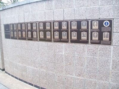
Our Constitution names the President of the United States the Commander in Chief of all the Armed Forces. Presidents who have served in our military are displayed on the following . . . — — Map (db m92384) HM WM
The Mount Ophir Mine is one of the most successful and conspicuous of the Mother Lode mines in Mariposa County. It includes the Mount Ophir Mint which was the first of such mints to turn gold into coins. The Mint was built by John Moffitt, who had . . . — — Map (db m46381) HM
East Granby
This area, first settled in 1664, was one of four Congregational parishes in Simsbury. The Turkey Hills Ecclesiastical Society in 1786 became a section of Granby, and in 1858 was incorporated as the Town of East Granby. An unusual . . . — — Map (db m97408) HM
On this site in 1814, "The Star-Spangled Banner" was first sung in public. The most famous of several hotels on this block was Brown's Marble Hotel (1851-1935), an innovative Greek Revival landmark, where John Tyler and Abraham Lincoln were guests. . . . — — Map (db m66714) HM
The neighborhood of Woodley Park owes its name to the Woodley estate of Philip Barto Key (1767-1815). Key, uncle of Francis Scott Key, who wrote “Star Spangled Banner”, was an officer on the British side during the Revolutionary War. . . . — — Map (db m87469) HM
Delaware, 1st State
December 7, 1787
1609 • Henry Hudson visited Delaware Bay
1638 • Swedish colonists established Fort Christina, Delaware's first permanent settlement, and founded the colony of New Sweden
1655 • Dutch captured New . . . — — Map (db m47214) HM
A Harvard graduate and lawyer who specialized in land litigations, George Huston helped found city's first bank in 1869. He owned and enlarged this antebellum house from the early brick section where Dr. Brady, Huston's father-in-law, lived. At . . . — — Map (db m123605) HM
In the years following the battle, this hill became sacred ground. A new patriotic spirit swept the nation in the 1820s. Americans looked to honor the sacrifice and service of their ancestors. For two decades, many men and women, led by the Bunker . . . — — Map (db m60139) HM
1843 • President Tyler deeded this property to Livingston County
1857 • The First Christian Church purchased this lot for $40.00 and built a small church for $2,000.00 which was used jointly by the Baptist Church.
1894 • The property was . . . — — Map (db m67316) HM
This bell was especially cast for the U.S.S. Princeton, which was commanded by our late fellow-townsman, the illustrious Captain Robert F. Stockton, under whose patronage “The Princeton” was built. On February 28th, 1844, she was taken . . . — — Map (db m10621) HM
This English Gothic structure designed by Richard Upjohn was built in 1840-41 and redecorated about 1888 from plans by Stanford White. "The Ascension," the well known mural by John LaFarge, is above the altar. Here President John Tyler married Julia . . . — — Map (db m106457) HM
Distinguished Indian chief
Brave in war ... valiant in peace
Algonquin Nation ... Osaukee Tribe
Bear Clan
Born Saukeenuk, IA, 1810
Died Cleveland, 1844
After the Black Hawk War where Joc-O-Sot received the wound that finally caused . . . — — Map (db m17900) HM
The Whig Convention of Dec. 1839 met in this church and nominated Wm. Henry Harrison for president, John Tyler for vice-president. Popularized as "Tippecanoe and Tyler Too", they were elected, 1840. — — Map (db m6660) HM
"Tippecanoe and Tyler Too" was the familiar political slogan of the 1839 Presidential Campaign. The Campaign began when William Henry Harrison and John Tyler were nominated as the Whig candidates for U.S. President and Vice President in this church, . . . — — Map (db m6662) HM
On Christmas Eve 1824, the Easton Centinel carried a notice calling upon residents of Northampton County "friendly to the establishment of a COLLEGE at Easton" to meet three days later at White's Hotel on Center Square. Local lawyers James Madison . . . — — Map (db m136107) HM
April 22, 1792 - March 22, 1862
Nissan 30, 5552 - Adar II 20, 5622
"I am an American, a sailor and a Jew."
Born in Philadelphia in 1792, Uriah Phillips Levy was a fifth generation American. According to family stories, he left for . . . — — Map (db m123962) HM
John C. Calhoun's Plantation Office was his private sanctuary and housed both his study and library during his twenty-five year residency at Fort Hill. In this building Calhoun developed and set forth his most historically significant . . . — — Map (db m9566) HM
In 1861, as the secession debate raged across Tennessee, Mary Catherine Sproul taught school here on the church grounds. She was excited to learn that pro-Union leader Horace Maynard would give a speech in Livingston. Then she overheard local . . . — — Map (db m82305) HM
In area opened 1839 to white settlers by Republic of Texas victories over Cherokee Indians whose trails led the way to good springs, fine farmlands, useful salines. The first Legislature of the state of Texas named the town (founded 1846) for . . . — — Map (db m91468) HM
Home ground of civilized tribes of Indians. Visited 1756 by Spanish explorers, who were trying to keep French trading expeditions out of Texas.
Site in 1831 of Fort Teran, commanded by Colonel Ellis Peter Bean, famous and colorful adventurer.
. . . — — Map (db m45672) HM
This was the home of John Tyler, Governor of Virginia, 1808-1811. His son, John Tyler, President of the United States, was born here, March 29, 1790. — — Map (db m200091) HM
To commemorate the efforts of John Tyler, native son, President of the United States 1841 - 1845, Chairman of the Peace Convention, 1861, to preserve the Union and to prevent the War Between the States. — — Map (db m175952) HM
During the 18th century this property was established as a Southall family seat. Notable family members include James Barrett Southall, owner of Williamsburg's Raleigh Tavern, Turner Southall, member of the committee to build Thomas Jefferson's . . . — — Map (db m18588) HM
Just to the south is Sherwood Forest, where President John Tyler lived after his retirement from the presidency until his death in 1862. He bought the place in 1842 and came to it as his home in March, 1845. Here Tyler, with his young second wife, . . . — — Map (db m9556) HM
John Tyler purchased this plantation one mile west in his native Charles City in 1842 while serving as tenth president of the United States, and made it his home from 1845 until his death in 1862. Tyler lengthened the wooden 18th-century house to . . . — — Map (db m9518) HM
This area was settled before 1622 by George Shinehow. Tobacco warehouses and docks were located at Swineyards and Willcox Wharf. A post office was established at Swineyards in 1848 and later located at Willcox Wharf. Landmarks have included Bethany . . . — — Map (db m9405) HM
Just east of here is Needham, location of Virginia's first proprietary law school and home of founder Judge Creed Taylor (1766 - 1836), politician, jurist, and legal educator. Taylor's law school at Needham, which opened in 1821 and closed by 1840, . . . — — Map (db m30239) HM
These trees were planted
in commemoration of the
eight Presidents of
the United States
who were sons of Virginia.
George Washington 1789-1797
Thomas Jefferson 1801-1809
James Madison 1809-1817
James Monroe 1817-1825 . . . — — Map (db m241179) HM
The gate to your right opens to Warrenton
Cemetery, the final resting place of 986 Confederate soldiers, of every Southern state, about
650 casualties of the Civil War. Many wounded
Confederates were evacuated to Warrenton and
vicinity after . . . — — Map (db m117019) HM
1. Fort Monroe — largest stone fort built in U.S. (1819-34). Home of Artillery School (1824-1906). Coast Artillery School (1907-1946) and other major commands.
2. Fort Wool — man-made island built on shoals by U.S. Army . . . — — Map (db m166588) HM
Letitia Christian Tyler, wife of President John Tyler, is buried at Cedar Grove Cemetery a mile northeast. Born on 12 November 1790, a daughter of Robert and Mary Browne Christian, she married John Tyler at her home, Cedar Grove, on 29 March 1813. . . . — — Map (db m16849) HM
Three miles west stands the third church of Hungars Parish, begun in 1742 and completed by 1751, one of two colonial churches remaining on Virginia's Eastern Shore. The parish built the glebe house or minister's residence, 5.5 miles west, about . . . — — Map (db m48938) HM
Erected 1835 by J.W. Collins, Portsmouth’s first five-story building and for many years a leading hotel. Presidents Van Buren, Tyler, and Fillmore were entertained here. — — Map (db m20461) HM
State Legislator, U.S. Congressman
Governor of Virginia,
U.S. Senator, Vice President of U.S.,
Peace Commissioner,
Confederate Congressman and
tenth President of the United States
This marker was placed in 1949 by
the Head . . . — — Map (db m4713) HM
The 10th U.S. President, Tyler was the first to succeed on death of an incumbent. He established "full presidential powers, not just acting power." His foreign policy opened trade with China and established the Maine boundary. He was the force . . . — — Map (db m165941) HM
Gilmer CountyFormed, 1845, from Kanawha and Lewis. Named for Thomas Walker Gilmer, Secretary of the Navy in President Tyler's Cabinet, who was killed by the explosion of a gun on board the United States battleship, Princeton, February 28, 1844. . . . — — Map (db m73437) HM
Built in 1834-1835 by Stephen Henderson First Summer White House Occupied by Martin Van Buren John Tyler Millard Fillmore Franklin Pierce James Buchanan — — Map (db m85210) HM
Work in the Smith and Forging Shop that stood here was dirty, smoky, noisy, and dangerous. Worse still, in the early 1800s armorers changed from skilled craftsmen - creating unique handcrafted weapons - into wage laborers tending machines for less . . . — — Map (db m23491) HM