17 entries match your criteria.
New York, Flushing Freedom Mile Historical Markers
By Devry Becker Jones (CC0), March 5, 2022
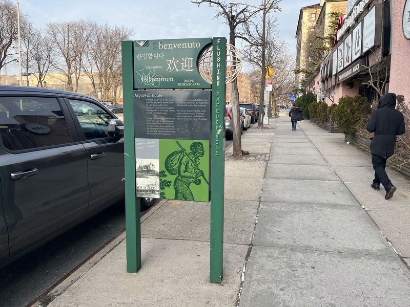
Aspinwall House Marker
| On Northern Boulevard (New York State Route 25A) just east of Union Street, on the right when traveling east. |
| On Bowne Street just south of 37th Avenue, on the left when traveling south. |
| On Main Street at Northern Boulevard (New York State Route 25A), on the right when traveling south on Main Street. |
| On Northern Boulevard (New York State Route 25A) just east of Union Street, on the right when traveling west. |
| On Lippman Plaza just south of 39th Avenue, on the right when traveling south. Reported damaged. |
| On Northern Boulevard (New York State Route 25A) just west of Union Street, on the right when traveling east. |
| On Northern Boulevard (New York State Route 25A) just east of Linden Place, on the right when traveling west. |
| On Northern Boulevard (New York State Route 25A) at Main Street, on the right when traveling west on Northern Boulevard. |
| On Northern Blvd. (New York State Route 25A) at Linden Place, on the right when traveling east on Northern Blvd.. |
| On Bowne Street just north of 37th Avenue, on the left when traveling north. |
| On 37th Avenue, 0.1 miles west of Parsons Boulevard, on the right when traveling west. Reported damaged. |
| On Union Street just south of 37th Avenue, on the right when traveling south. |
| On Bowne Street at 37th Avenue, on the right when traveling north on Bowne Street. |
| On Lippman Plaza just south of 39th Avenue, on the right when traveling south. Reported damaged. |
| On Leavitt Street at 137th Street, on the left when traveling north on Leavitt Street. |
| On 37th Avenue just west of Parsons Boulevard, on the right when traveling west. |
| On Lippman Plaza just south of 39th Avenue, on the left when traveling south. |
May. 5, 2024