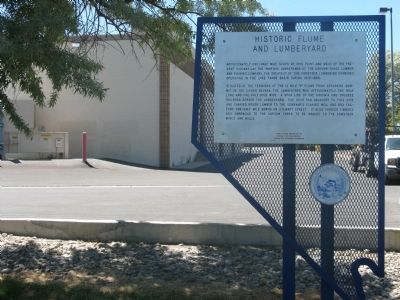
Approximately one-half mile south of this point and west of the present highway lay the immense lumberyard of the Carson-Tahoe Lumber and Fluming Company, the greatest of the Comstock lumbering combines operating in the Lake Tahoe Basin during . . . — — Map (db m20804) HM
On U.S. 95 at Nevada Route 165, on the left when traveling south on U.S. 95.
Eldorado Canyon runs east from here to the Colorado River and was the site of one of Nevada's mining booms. Prospectors began digging for gold and silver here, about 1859, forming the Colorado Mining District. The three largest mines, the . . . — — Map (db m29328) HM
Since 1935, Hoover Dam and Lake Mead have provided flood control, irrigation, drinking water, and power to communities in the desert. These resources have transformed the southwest into production farmland and thriving communities. The dam was . . . — — Map (db m31879) HM
On San Pedro Street, on the right when traveling east.
This small spring, first used by Anasazi and Paiute people, also sustained the caravan that pioneered a pack route now known as the Old Spanish Trail. En route to Los Angeles from Santa Fe, trader Antonio Armijo, 60 men and 100 mules camped here on . . . — — Map (db m39470) HM
On Spring Street, 0.1 miles west of Vegas Street, on the left when traveling west.
Ore deposits readily recognized in the faulted and folded limestone deposits of this district remained unworked until 1856, when the Mormons developed a single lead mine at Potosi—probably the oldest lode mine in Nevada.
Named for . . . — — Map (db m39471) HM
On South Valley View Boulevard at Meadows Lane, on the right when traveling north on South Valley View Boulevard.
Bubbling artesian springs flowed here until they were exhausted in the middle of the 20th century, over-pumped to serve the city's growing population.
These springs and the creek they created gave life to the center of the valley. They erupted . . . — — Map (db m51043) HM
Near South Valley View Boulevard at West Charleston Boulevard.
1905 - 1908
City of Las Vegas
Diamond Jubilee
From within this area flowing artesian springs and wells provided the lifeblood to the valley and it settlers.
This abundant supply of water has been the most important asset in the . . . — — Map (db m47888) HM
On Nevada Route 165, 12.9 miles east of U.S. 95, on the left when traveling east.
Toward the Colorado River from this point runs El Dorado Canyon where occurred one of the biggest mining booms in Nevada history. Gold and Silver mines were developed here about 1859 and soon rich mines were developed. In the 1860's the canyon . . . — — Map (db m29326) HM
On Nevada Route 165, 11.2 miles east of U.S. 95, on the right when traveling east.
Toward the Colorado River from this point runs El Dorado Canyon where occurred one of the biggest mining booms in Nevada history. Gold and Silver mines were developed here about 1859 and soon rich mines were developed. In the 1860's the canyon . . . — — Map (db m29327) HM
On Nevada Route 165, 12.9 miles east of U.S. 95, on the left when traveling east.
The Techatticup Mine, located in 1861, was the most important mine in El Dorado Canyon. It produced millions of dollars in gold ore, and was originally served by steamboats on the Colorado River. The mine's name is taken from two Paiute words . . . — — Map (db m29331) HM
Near Foothill Road (Nevada Route 206), on the right when traveling north.
Like many Nevada hot springs, these dot a fault break along which the mountains rise. In 1862, along this Carson branch of the Emigrant Trail, David and Harriet Walley developed a $100,000 spa with 11 baths, a ballroom and gardens. The thermal . . . — — Map (db m89511) HM
On West Idaho Street (Nevada Route 535) near Hot Springs Road, on the right when traveling east.
Directly south of this point and across the valley floor are the remains of a short-lived extraction plant, which reached the peak of its productive capacity in the early twenties. Driving of the main shaft began in 1916. Of several tries at . . . — — Map (db m76742) HM
On Highway 6 at Highway 265, on the right when traveling east on Highway 6.
Discovered 1863
Silver Peak is one of the oldest mining areas in Nevada. A 10-stamp mill was built in 1865, and by 1867 a 20-stamp mill was built. Mining camp lawlessness prevailed during the late sixties, and over the next 38 years, Silver . . . — — Map (db m3493) HM
On Gold Street, 15 miles south of U.S. 95, on the left when traveling south.
Known originally as Lime Point, this area was first settled about 1880. The early camp was abandoned by 1882. In March 1908, a silver strike brought a new camp into existence. Called Hornsilver, it flourished for about a year, boasting about 800 . . . — — Map (db m34251) HM
On State Highway 266 at State Highway 71 (State Route 774), on the right when traveling west on State Highway 266.
Gold Point was initially called Lime Point for the lime deposits found in 1868. Processing difficulties in the 1880’s discouraged silver mining locally.
Goldfield Ore discoveries in 1902 stimulated area mining interest and high grade hornsilver . . . — — Map (db m35148) HM
Near Interstate 80 at milepost 258, on the right when traveling east.
From this vantage point one can see the steam rising from the geysers located near the base of the far hill across the valley.
The U.S. Geological Survey has designated an area south of Beowawe a Known Geothermal Resource Area (KGRA). The . . . — — Map (db m240318) HM
On U.S. 50 at milepost 33.3 at Nevada Route 278, on the right when traveling east on U.S. 50.
"Mining is an art...one of the most ancient, the most necessary and the most profitable to mankind."
Agricola, De Re Metallica, 1556
In 1864, a group of prospectors from Austin, Nevada discovered rock containing a silver-lead . . . — — Map (db m69607) HM
These beehive-shaped kilns were built in the mid-1870's to produce charcoal for the silver mills of Pioche and Bullionville, Nevada. Skilled stone masons quarried Rhyolitic tuff from nearby outcrops. The blocks were carefully dressed, then joined . . . — — Map (db m89432) HM
On U.S. 93 at milepost 132, on the left when traveling north.
Local legend attributes the discovery to the locator picking up a rock to throw at a jackrabbit and finding himself holding high grade silver. The Jack Rabbit District, named for the mine, was located in 1876 by Isaac Newton Garrison. Early mine . . . — — Map (db m69484) HM
On Main Street (Nevada Route 321) 2.4 miles west of U.S. 93, on the left when traveling west.
Silver ore was discovered in this range of mountains in 1864, but no important development took place until 1869 when mines were opened and the town of Pioche appeared. Pioche soon became the scene of a wild rush of prospectors and fortune seekers . . . — — Map (db m132469) HM
Near Point of Rocks Road, 1.5 miles east of Spring/Ash Meadows Road.
These photos were
taken not far from where you
are standing. Since that time,
fields of alfalfa and cotton have
been replaced by mesquite trees
and other native plants. Spring
pools and natural flowing streams
have replaced concrete . . . — — Map (db m184840) HM
Near Point of Rocks Road, 1.5 miles east of Spring/Ash Meadows Road.
Why are there holes in the
limestone? They're not old fence posts, or
dinosaur footprints, but the place where Native
Americans ground mesquite beans into flour. The whole
pod was ground up and pounded to powder with a blunt
sturdy piece of . . . — — Map (db m184850) HM
One of many early 1900 gold camps, Round Mountain is unique because: ...It has been a producer for more than 60 years. ...All the gold occurred in free, visible, metallic form. ...Many small, high-grade veins were easily mined with hand tools. . . . — — Map (db m89414) HM
On Veterans Memorial Highway (U.S. 6) at Bryan Avenue, on the left when traveling north on Veterans Memorial Highway.
This statue depicts Big Bill Murphy, hero of the tragic Tonopah Belmont Mine fire that killed 17 miners on February 23, 1911. Murphy went down in the mine cage a number of times to bring up stricken miners.
On the last trip he did not return. . . . — — Map (db m62320) HM
On Burro Avenue, on the right when traveling east.
It didn't matter how long or small a mine was. Miners tools and dynamite had to be hauled in, and ore, tools and miners had to be hoisted out.
The Whim
The simplest hoist - a pully with a rope leading down into the shaft.
The Whip . . . — — Map (db m188137) HM
Eight miles northwest of this point lies what was formerly one of the leading lead-producing districts in the nation. Producing erratically from ore discovery in 1866 to the present (the last mill closed in 1937), Tybo has managed to achieve an . . . — — Map (db m89416) HM
On South D Street, on the right when traveling north.
Founded by William “Billy” Chollar (pronounced collar) in 1859, the original Chollar claim was 1,400 feet in length and 400 feet in width. In 1861, the nearby Potosi mine discovered an ore body that dipped into Chollar . . . — — Map (db m22054) HM
First located in 1859, the Chollar was consolidated with the Potosi in 1865. As the Chollar-Potosi, it was one of the leading producers on the Comstock. The Nevada Mill was erected here in 1887 to process low-grade Chollar ore. It was the last to . . . — — Map (db m50109) HM
On Nevada Route 341 near Nevada Route 342, on the right when traveling north.
The Combination Shaft began in 1875 when the owners of the Chollar-Potosi, Hale & Corcross and the Savage mines combined their efforts to sink a shaft to explore the Comstock Lode at a greater depth. The Combination was the deepest shaft ever . . . — — Map (db m22842) HM
Built in 1874, the mill went into operation in January of 1975, and was destroyed later that year in the great fire of October 25th, but was quickly rebuilt at a cost of $350,000. The Con Virginia Pan Mill was built by Pacific Mill and Mining . . . — — Map (db m50100) HM
Founded in 1859, the Hale & Norcross contained about 400 feet of original Comstock Lode located between the Savage and Chollar Mines. In 1868, a fierce stock battle was waged for ownership over this property. At the time, the mine was thought to be . . . — — Map (db m45902) HM
On South D Street, on the right when traveling north.
Once the residence of John Mackay, this elegant mansion also served as the office for the Gould & Curry Mining Company. Mackay, an Irish-born immigrant, was the richest man the Comstock ever produced. Built in the 1860s, this building survived the . . . — — Map (db m21596) HM
On South C Street (State Highway 341), on the left when traveling north.
Built in 1860 by the Ophir Mining Company to facilitate the hauling of ore to the mills in the Washoe Valley, it was operated as a toll road until 1871 when its popularity declined due to the completion of the V and T Railroad from Carson City to . . . — — Map (db m45574) HM
Claimed on July 4, 1859 by R. Crale, C. Chase, H. Carmack, W. Surtevant, A.O. Savage and L.C. Savage, the original Savage claim consisted of 1,800 feet along the Comstock Lode. In 1865, the company built a mill in Washoe Valley to process ore. . . . — — Map (db m22437) HM
The “Big Bonanza” was the greatest mining strike in the history of the American West. In 1872, John Mackay, James Fair, James Flood & William O’Brien formed an alliance and took control of the “Consolidate Virginia” and . . . — — Map (db m50103) HM
On C Street (Nevada Route 341), on the right when traveling north.
Near this spot was the heart of the Comstock Lode, the fabulous 2 ½ mile deposit of high-grade ore that produced nearly $400,000,000 in silver and gold. After the discovery in 1859, Virginia City boomed for 20 years, helped bring Nevada into . . . — — Map (db m22630) HM
On Washington Street at R Street on Washington Street.
[Panel 1]:
Comstock Trail
You will find the trail head sign a hundred yards ahead, next to the recycling/dump site. Beyond the dump site is a ridge extending to your left. The trail winds along this ridge for two miles through . . . — — Map (db m46131) HM
On Sutcliffe Highway (Nevada Route 446) near Pyramid Lake Road (Nevada Route 445), on the left when traveling north.
This site contains natural springs that were once used by the Tribe for cultural purposes. The springs have been destroyed from years of accumulated mine waste. The mine was active in the 1920s with low metal production. It has been abandoned since . . . — — Map (db m97605) HM
The Galena Creek Fish Hatchery represents an attempt to make amends after Nevada's Comstock Lode ravaged the region's ecosystem in the 1860s and 70s. Fishing decimated local streams and lakes to feed a growing population. Eventually, restocking . . . — — Map (db m94432) HM
On Alternate U.S. 395, 0.2 miles north of Rhodes Road, on the right when traveling north.
These natural hot-springs are notable for their curative qualities. They were nationally acclaimed by President Ulysses S. Grant when he visited them in 1879.
Early emigrants so named them, because of their puffing and blowing. Located in 1860 . . . — — Map (db m94118) HM
On U.S. 93 at milepost 93, on the right when traveling north.
Schellbourne, in the foothills of the Schell Creek Range, was a Shoshone village site long before it began its recent historic career in 1859. Captain James Simpson passed through the site and this point, looking for a short route across the Great . . . — — Map (db m1304) HM
On East Aultman Street (Lincoln Highway) (U.S. 50) at 4th Street, on the right when traveling east on East Aultman Street (Lincoln Highway).
Digging began on the Liberty Pit in 1908, the same time that the Nevada Northern Railway tracks reached Copper Flat from Ely.
When work started, the pit was not a pit at all, but two small hills instead. The old map below shows the original . . . — — Map (db m126499) HM