On Church Road at Railroad Street (County Route 20), on the right when traveling south on Church Road.
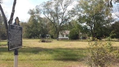
Nimrod Washington Long moved to Alabama from Georgia in the 1830s. A planter, mill owner and state legislator, he had real estate and railroad interests in Russell County. This house was the plantation home of Nimrod Washington Long in Spring Hill, . . . — — Map (db m69433) HM
Near Dillingham Street at Brickyard Road (Route 61).
Coweta was the home of many influential Creek leaders, including three individuals who figured prominently in the history of the Creek people; "Emperor” Brims, Mary Musgrove, Chief William McIntosh.
The Coweta chieftain Brims, who . . . — — Map (db m101336) HM
On 5th Avenue at 15th Street, on the left when traveling north on 5th Avenue.
(side 1)
Born at New Site, Alabama, he grew up working on his parents’ farm. In 1916 he worked in the oil fields in Texas and joined the Texas National Guard. He married Agnes Benson of Alabama in 1917. In 1918 he was commissioned an . . . — — Map (db m69114) HM
During the Federal occupation of the former Confederate States of America, the Alabama Legislature created Lee County primarily from the northern half of Russell County in 1866 and ordered the selection of the county seat "more centrally located." . . . — — Map (db m53160) HM
Near Montevallo Road (Alabama Route 119) 0.3 miles south of Alex Mill Road, on the right when traveling south.
The Colonial Courthouse
This building is inspired by the Courthouse at Williamsburg, Virginia, built in 1770. The County Court heard petty crimes and civil cases such as debtors’ disputes with creditors from abusive masters. Serious capital . . . — — Map (db m101501) HM
Near Montevallo Road (Alabama Route 119) 0.3 miles south of Alex Mill Road, on the right when traveling south.
(side 1)
The Liberty Bell was commissioned November 1, 1751, to commemorate the 50th anniversary of William Penn’s Charter of Privileges for his Pennsylvania colony. The radical charter granted religious liberty to persecuted faiths, . . . — — Map (db m101506) HM
Near Montevallo Road (Alabama Route 119) 0.3 miles south of Alex Mill Road, on the right when traveling south.
(side 1)
The Lucille Ryals Thompson Colonial Chapel
Inspired by Bruton Parish Church of Williamsburg, Virginia, it was named to honor Lucille Ryals Thompson. The Chapel was built in thanksgiving for God’s blessings on America, and . . . — — Map (db m101505) HM
Near Montevallo Road (Alabama Route 119) 0.3 miles south of Alex Mill Road, on the right when traveling south.
(side 1)
Washington Hall
The exterior of the hall is inspired by George Washington's beloved Mount Vernon. It has beveled-edge block walls. When mixed with paint and sand it gives the appearance of stone masonry, a process called . . . — — Map (db m101504) HM
On Pelham Parkway (U.S. 31) at Church Street, on the right when traveling south on Pelham Parkway.
Near this site stood Shelbyville, A. T., first county seat of Shelby County; named for Isaac Shelby, governor of Tennessee. Shelby County was established February 7, 1818 by an act of the Alabama Territorial legislature. The first orphans’ court was . . . — — Map (db m28441) HM
On 5th Street (U.S. 411) at 7th Avenue, on the right when traveling south on 5th Street.
Greek revival antebellum home built by Moses Dean in 1852, acquired by John W. Inzer in 1866. Home occupied by Inzer family from 1866 to 1987. In July 1987 home and its contents, including extensive law library, deeded by family heirs to St. Clair . . . — — Map (db m28092) HM
Margaret traces its roots to the Alabama Fuel & Iron Company, which organized in the early 1900s and developed Margaret coal mines under the leadership of its president Henry F. DeBardeleben. Named after DeBardeleben’s wife Margaret, the town was . . . — — Map (db m50759) HM
On Washington Street South at Franklin Street, on the right when traveling north on Washington Street South.
Side 1
Livingston, Alabama
Prior to the signing of the Treaty of Dancing Rabbit Creek on September 27, 1830, this site belonged to the Choctaw Nation. Early settlers to the area came from the Carolinas, Georgia, Tennessee, and . . . — — Map (db m92665) HM
On South Street East (State Highway 77) at East Street South, on the right when traveling east on South Street East.
By action of the Alabama Conference of The Methodist Episcopal Church, South in session at Talladega, December 13-18, 1854, Auburn University and Birmingham - Southern College were born. The delegation resolved to “have a college within the . . . — — Map (db m28202) HM
On Brignola St, 0.2 miles east of N East st (Alabama Highway 77).
The distinguished Joiner family lived here in an imposing mansion, demolished in 1970.
James H. Joiner: Pioneer in Talladega's progress while publisher, 1844-73, of one of Alabama's most influential newspapers - The Democratic Watchtower. . . . — — Map (db m37220) HM
Boyhood home of N.E. Stewart, Alabama state representative, poor keeper for the state
House of Representatives.
Member of Bibb County Commission, Bibb County Road Commissioner, and member of county board of education.
A 59-year career of . . . — — Map (db m215694) HM
On 28th Avenue south of 2nd Street, on the right when traveling south.
The Trail of Tears led thousands of Creek Indians through Tuscaloosa, capital of Alabama in 1836. Chief Eufaula addressed the legislature with these words:
"I come here, brothers, to see the great house of Alabama and the men who make laws and . . . — — Map (db m119308) HM
After the seat of government was moved to Montgomery in 1847, the Tuscaloosa Capitol and its furnishings were deeded to the University of Alabama to be used for educational purposes.
In 1857, the University Board of Trustees leased the building . . . — — Map (db m29064) HM
He inherited the financial woes brought on by the collapse of the "Flush Times". Despite chaotic banking conditions during the Panic of 1837, chancery courts and a penitentiary system were both created, and Alabama settled its boundary dispute with . . . — — Map (db m29030) HM
He oversaw the closing of the unstable State Bank. In 1845 the legislature amended the constitution to allow the removal of the capital from Tuscaloosa. The growing wealth and population of the Black Belt brought the seat of government to Montgomery. — — Map (db m29033) HM
He served during Alabama's years of great prosperity known as the "Flush Times." With the economy booming, the legislature abolished all state taxes. — — Map (db m29029) HM
During his term our state moved from frontier to urbanity. The University of Alabama was officially opened. Construction was begun on our first canals and railroads, supplementing existing steamboats and unpaved roads. The Choctaws exchanged their . . . — — Map (db m29023) HM
On Capstone Drive at Colonial Drive, on the right when traveling west on Capstone Drive.
Built 1829 as University dining hall.
Remodeled as a residence 1840.
Occupied by Gorgas family 1879-1953
(Reverse):
Preserved as a memorial to:
General Josiah Gorgas (1818-1883)
Chief of Ordnance, C. S. A. 1861-1865 . . . — — Map (db m29301) HM
On 15th Street at Greensboro Avenue, on the right when traveling west on 15th Street.
Tuscaloosa’s oldest house, The McGuire-Strickland, was built on this site ca. 1820; first occupant, Moses McGuire, Tuscaloosa County’s first Probate Judge, State Representative 1845; sold to Dr. Rueben Searcy 1849; to the Presbyterian Church 1851 as . . . — — Map (db m35375) HM
Near Greensboro Avenue near 2nd Street (Jack Warner Parkway).
Born a slave in South Carolina in 1807, Horace King became a master bridge builder while working with John Godwin. With the aid of Tuscaloosan Robert Jemison, King was freed by act of the Alabama legislature in 1846. He went on to build many bridges . . . — — Map (db m235771) HM
As president of the state senate, he became governor when Clay resigned to succeed Gabriel Moore in the U. S. Senate. He remained in office for only four months. — — Map (db m29031) HM
He extended state laws into Indian lands and actively encouraged illegal white settlement there. A treaty with the Creek Indians in 1832 forced them to leave the state and resulted in nine new counties in east Alabama. Their "Trail of Tears" took . . . — — Map (db m29028) HM
He initiated construction of the Capitol, the University of Alabama, and the State Bank. The legislature passed laws, known as slave codes, to severely restrict the rights of slaves, while citizens began to press for the removal of Alabama's . . . — — Map (db m29020) HM
He presided over the transfer of the capital from Tuscaloosa to Montgomery in 1847. When the United States invaded Mexico Alabamians readily joined to fight, just as they would in 1861. — — Map (db m29034) HM
Named for John Tyler Morgan (1824-1907).
As U.S. Senator, Morgan led the 1882 campaign to obtain federal funds in reparation for the destruction of the University of Alabama campus by Union Troops in 1865.
A member of the Alabama Secession . . . — — Map (db m29223) HM
On 28th Avenue at University Blvd, on the right on 28th Avenue.
Built in 1827 three blocks east on Broad Street. Stage stop and inn frequented by many political leaders while Tuscaloosa was State Capital. Moved to Capitol Park, 1966. — — Map (db m29119) HM
Near 21st Avenue at 6th Street, on the right when traveling south.
Alabama state government collapsed with the end of the Civil War in 1865. US President Andrew Johnson established a provisional government with a constitution repealing secession and abolishing slavery. In 1867 “Radical” Republicans in Congress . . . — — Map (db m217185) HM
Near 6th Street at 21st Avenue, on the right when traveling west.
Senator Richard Shelby, attorney and businessman, has been a public servant much of his life. He began his political career as a state senator representing Tuscaloosa in 1970. He served 8 years in the U.S. House of Representatives and was elected to . . . — — Map (db m217165) HM
Near 6th Street west of 21st Avenue, on the left when traveling west.
Alabama's first seat of state government at Cahaba proved to be unsuitable. In 1825 Tuscaloosa was chosen as the new capital city. For over 20 years in an era known as the “Flush Times”, this area prospered with the establishment of the State Bank, . . . — — Map (db m217179) HM
On Paul W. Bryant Drive east of 2nd Avenue, on the right when traveling east.
Founded in 1872 as the first law school in Alabama. Henderson M. Somerville was the first professor and later an Alabama Supreme Court Justice. The first dean was William L. Thorington (1897-1908). The school occupied, in turn, parts of Woods, . . . — — Map (db m35471) HM
Near Jack Warner Parkway Northeast north of Hackberry Lane.
From 1887-1915, seventeen locks and dams were constructed on the Warrior - Tombigbee Rivers. The first 3 were built on the fall line in Tuscaloosa. This was the site of No. 3, later No. 12.
The Warrior - Tombigbee Development Association, . . . — — Map (db m28786) HM
On 6th Street at 28th Avenue, on the right when traveling west on 6th Street.
This stone commemorates the
City of Tuscaloosa as the second
state capital, January 1826
to January 1846.
Erected by the Alabama Centen-
nial Commission and the citizens of
Tuscaloosa, and dedicated December
14, 1919. On . . . — — Map (db m28996) HM
On University Blvd at 22nd Avenue, on the right when traveling east on University Blvd.
Constructed in 1909 as US Post Office. First occupied April 1910, with Mrs. Maggie Miller as Postmistress. Federal courtroom, now City Council Chamber, with magnificent design and detail, on second floor, 1910-1968. Thomas A. Jones first Federal . . . — — Map (db m35376) HM
On University Blvd. at Queen City Avenue, on the right on University Blvd..
Built 1834 by James Dearing. Purchased by Arthur P. Bagby who occupied the house 1837-41 while Governor of Alabama and since known as the Governor's Mansion. Presented to the University of Alabama 1944 by Herbert David Warner and Mildred Westervelt . . . — — Map (db m29120) HM
Near University Boulevard west of 6th Avenue, on the right when traveling west.
Endowed by Congress 1819
Ordained by State constitution 1819
And established by General Assembly 1820
Instruction Begun 1831
Unofficial Training School Confederate Officers 1861-65
Destroyed by Federal Army April 4, 1865, Rebuilding Begun . . . — — Map (db m29612) HM
On 17th Street at Birmingham Avenue, on the right when traveling east on 17th Street.
A lifelong champion of universal access to education, Carl Elliott
(1913-1999) served eight terms in the U.S. House of Representatives
(1949-65), and ran for Governor of Alabama in 1966. Elliott's
Library Services Act of 1956 brought books to . . . — — Map (db m153252) HM
Created December 26, 1823
Named for John W. Walker
of Madison County, Alabama
Chairman, State Constitutional Convention, July 5, 1819
Alabama's first United States Senator, 1819~1823 — — Map (db m29982) HM
William Brockman Bankhead served Alabama in the U.S. Congress from 1917 until 1940. For the last four years of his life, during Franklin D. Roosevelt's presidency, he served as the 47th Speaker of the House. He was the son of U.S. Senator John . . . — — Map (db m29980) HM
243 entries matched your criteria. Entries 201 through 243 are listed above. ⊲ Previous 100