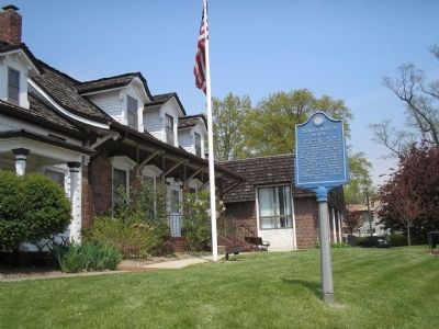
This example of Dutch Colonial architecture was built between 1780-1790 by Derick Banta, soldier in the American Revolution, after his birthplace here was burned by Tories. Owned by the Quackenbush family from 1792, it was sold to Isaac Dixon in . . . — — Map (db m7507) HM
Built 1872 at “Demarests Station” on the Northern Railroad of New Jersey. Designed by noted architect J. Cleveland Cady, it was considered the “handsomest on the line.” The depot was built of Palisades stone quarried on the . . . — — Map (db m7508) HM
This old colonial lane was named Dunkerhook meaning Dark Corner by the Dutch who settled the area in the early 18th century. Along this road, the Zabriskie family, who bought the land from the Indians in 1702, built houses and a school for the use . . . — — Map (db m8314) HM
In Revolutionary days this area of Paramus was known by the unusual name of Sluckup. The name was derived from a local legend. A Dutch farmer hung his shirt on a nearby fence while working in his field. When he saw the shirt disappear into the . . . — — Map (db m8313) HM
First named Carterette Road, this section, from Rockleigh Road to the state line, was constructed in 1859 as an extension of the road from Closter. For local farmers it was an easier wagon route to New York State and for carrying produce to the . . . — — Map (db m8631) HM
He saw the redcoats on the eastern hills. This Closterman who galloped through the mist to warn the troops encamped down the road at Fort Lee. His plow horse carrying him to glory on the most important ride in history, the hinge on which the door . . . — — Map (db m63549) HM
In memory of those soldiers who gave their lives for their country while on duty in Camp Merritt.
This monument marks the center of the camp and faces the highway over which more than a million American soldiers passed on their way to and from . . . — — Map (db m7496) HM
In the 1800s, wealthy entrepreneurs from New York City established farm estates in the Ramapo Valley, employing so many people that the properties grew into small hamlets. As the number of children increased, estate owners Alfred B. Darling and . . . — — Map (db m150298) HM
Native American Settlement • Colonial Settlement • Battleground in The American Revolution • 20th Century Recreation • Historic Site New Bridge Site of 11 Engagements during the American Revolution (1775 – 1783)Much more than a revolt . . . — — Map (db m186516) HM
Christopher Columbus Memorial Plaza Dedicated Oct. 11, 1971 Leonardo da Vinci Society Bergen County New Jersey ( Lower Plaques : ) Granite Monument donated by Anthony K. Macagna Bronze sculpture donated by Adeline Bracco in memory of . . . — — Map (db m62906) HM
Erected about 1831 by the Washington Banking Company. The first bank in present Bergen County, it opened in the nearby Mansion House in 1825-26. After the bank failed in 1833, it housed the offices of prominent lawyers and judges. Later the home of . . . — — Map (db m6817) HM
In memory of hundreds of thousands of women and girls from Korea, China, Taiwan, the Philippines, the Netherlands, and Indonesia who were forced into sexual slavery by the Armed Forces of Imperial Japan before and during World War II. Dedicated on . . . — — Map (db m64465) HM
Located in “Ramapough” near the site of an Indian trading post, this Dutch Colonial house was built about 1750 by Jacobus Laroe. The small wing was added at a later date, the porch about 1840. Some later owners were Jacobus Bogert who . . . — — Map (db m43801) HM
“Bergen County is chiefly inhabited by Dutch people. There is a peculiar neatness in appearance of their homes, having an airy stoop supported by pillars in front, and their kitchens at the ends in the form of wings. The land is good and . . . — — Map (db m29938) HM
At Lower Closter Dock – on the riverfront just south of here – a British invasion force of 5,000 troops commanded by Lord Cornwallis landed before dawn on November 20, 1776. Guided by three Bergen County residents, they climbed the . . . — — Map (db m144530) HM
Site of the French Church and Cemetery of Kinkachemeck, New Jersey. Deeded to David Desmarest June 8, 1677 by Tapan Indians.
Erected by the Bergen County Historical Society 1935. — — Map (db m7234) HM
British close the Port of Boston in response to Boston Tea Party, Mar 25. 1st Continental Congress is called in response to the Intolerable Acts, Oct 20, 1774. Jan Zabriskie & Annetje Ackerman enlarge the 1752 house in 1767. He dies; . . . — — Map (db m190753) HM
Indian peoples inhabited this land from about 10,500 B.C. up to the early historic period. At the time of the European Settlement, they were referred to as the Munsee Delawares. In 1694 Arent Schuyler, on a fact finding mission to the Indians in . . . — — Map (db m62873) HM
Ridgewood Station
Date: 1916
W. W. Drinker and Frank A. Howard, Engineers
Ridgewood Station is a fine, and possibly unique (for New Jersey) example of the Mission Revival style, first popularized in California during the 1890's. Distinctive . . . — — Map (db m108051) HM
Lower Closter or New DockHere a British invasion force of 5,000 troops commanded by Lord Cornwallis landed before dawn on November 20, 1776. Guided by three Bergen County residents, Joseph Hawkins, Isaac Perkins, and John Aldington, they climbed . . . — — Map (db m142465) HM
Radburn Station, located in the Borough of Fair Lawn, was built in 1930 and designed by the architect Clarence S. Stein. Stylistically, the building is significant since the station is a fine example of the Dutch Colonial Revival trend in . . . — — Map (db m62968) HM
The Bergen County Jail is an impressive and oppressive building. It has a cruciform plan with a castellated exterior, marked by a heavily corbelled battlement and a squat central octagonal tower. Its fortress style of architecture, a prototype of . . . — — Map (db m62941) HM
A Bench by the Road
There is no place you or I can go, to think about or not think about, to summon the presences of, or recollect the absences of slaves; nothing that reminds us of the ones who made the journey and of those who did not . . . — — Map (db m130327) HM
Archibald Campbell – 1730 – 12/28/1798, age 68. Born on the Isle of Man, came to Hackensack in 1765. Tavern keeper, host to General George Washington. Hackensack’s first Postmaster. Exemplary in all the duties of life, a . . . — — Map (db m62947) HM
Maywood Station, located in the Borough of Maywood, Bergen County, New Jersey was built in March 1872. Stylistically, the building is significant as the station is a fine example of Railroad Architecture with Carpenter Gothic features. The . . . — — Map (db m291239) HM
This barn and the house across the road were at the center of Frederick Wortendyke’s farm. Frederick built them about 1770 on the eve of the American Revolution. He was a “Dutchman” who raised a large family here. He passed the farm on . . . — — Map (db m29933) HM
A United Empire Loyalist, Ryerse was commissioned in the
4th New Jersey Volunteers during the American Revolution,
following which he took refuge in New Brunswick. In 1794
he came to Upper Canada, and the following year received
3,000 acres . . . — — Map (db m234354) HM
Purchase in 1860 for the “coloured population of Hackensack” and in 1901 incorporated by African-American Trustees as the Gethsemane Cemetery. The one acre lot has about 500 interments of free blacks, former slaves as well as a number of . . . — — Map (db m43693) HM
Native American Settlement • Colonial Settlement • Battleground in The American Revolution • 20th Century Recreation • Historic Site Historic New Bridge Landing Park remarkably preserves a scenic fragment of the Jersey Dutch . . . — — Map (db m186399) HM
1) Steuben House. Jan and Annetje (Ackerman) Zabriskie prospered as miller and merchant at this site. They built a five-room stone cottage in 1752 and enlarged the house to the present size in 1767 by adding a second story along the rear and . . . — — Map (db m237183) HM
Ecology Along the Hackensack River
Van Buskirk Island is located in a transition zone between river and ocean environments. This zone is demarcated by the dam on the northern side of the island. Above the dam there is no tidal influence and the . . . — — Map (db m129874) HM
Thin black lines indicate changes in relevance. Between each pair of lines entries are ordered geographically but all have the same relevance.
* Inflectional forms of words are their plurals, singulars, and possessives as well as gramatical tenses and similar variations.