12 entries match your criteria.
Historical Markers in Battleford, Saskatchewan
By Cosmos Mariner, July 14, 2022
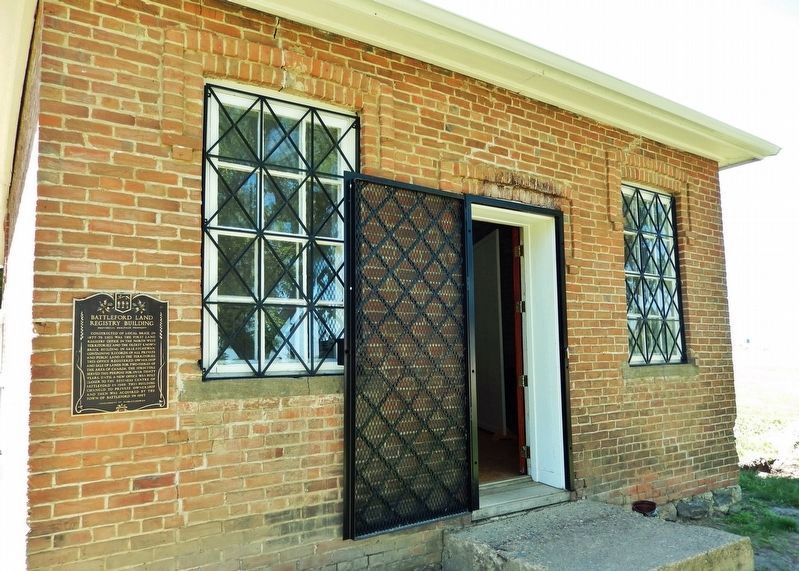
Battleford Land Registry Building Marker
| On Old Saskatchewan Highway 4 (Provincial Highway 658) 1.1 kilometers west of Provincial Highway 4, on the left when traveling west. |
| Near Central Avenue just north of Campbell Innes Way, on the right when traveling north. |
| Near 3 Avenue West, 0.5 kilometers south of Old Saskatchewan Highway 4 (Provincial Highway 658), on the left when traveling south. |
| On 3 Avenue West, 0.4 kilometers south of Old Saskatchewan Highway 4 (Provincial Highway 658), on the left when traveling south. |
| On 3 Avenue West, 0.4 kilometers south of Old Saskatchewan Highway 4 (Provincial Highway 658), on the right when traveling south. |
| Near 3 Avenue West, 0.5 kilometers south of Old Saskatchewan Highway 4 (Provincial Highway 658), on the left when traveling south. |
| On Old Saskatchewan Highway 4 (Provincial Highway 658) 1.1 kilometers west of Provincial Highway 4, on the left when traveling west. |
| On 2 Avenue West just south of 25 Street, on the right when traveling south. |
| Near 3 Avenue West, 0.5 kilometers south of Old Saskatchewan Highway 4 (Provincial Highway 658), on the left when traveling south. |
| On 3 Avenue West, 0.4 kilometers south of Old Saskatchewan Highway 4 (Provincial Highway 658), on the right when traveling south. |
| Near 3 Avenue West, 0.5 kilometers south of Old Saskatchewan Highway 4 (Provincial Highway 658), on the left when traveling south. |
| Near 3 Avenue West, 0.5 kilometers south of Old Saskatchewan Highway 4 (Provincial Highway 658), on the left when traveling south. |
Jun. 15, 2024