Copper king William A. Clark and other prominent businessmen platted the Warren and Kingsbury Addition in 1878 just above Clark’s Original Mine. In 1888, a small wooden dwelling occupied this lot. This one-story duplex, with a rubble stone . . . — — Map (db m184980) HM
As its population tripled in the 1890s, Butte began its transformation from a mining camp to a small city. The percentage of married men grew by 10 percent, and local builders worked busily to fulfill the increasing demand for single-family homes. . . . — — Map (db m184482) HM
Copper Is King
Future Copper King Marcus Daly acquired his first property in the area in 1880, a silver mine near the top of Butte Hill called Anaconda. Although the Anaconda was purchased as a silver mine, Daly soon discovered rich veins . . . — — Map (db m185047) HM
Long known as the "Richest Hill on Earth" Butte produced more mineral wealth than any other mine district in the world up to the middle of the 20th century. To date over $43 billion of wealth has been unearthed from this hill. This extraordinary . . . — — Map (db m184260) HM
Butte owes its existence to placer gold discovered on Silver Bow Creek in 1964. But the gold soon played out and it was demand for Butte's copper that made it "the richest hill on Earth." The hill produced over two billion dollars worth of gold, . . . — — Map (db m186109) HM
Swiss-born Rocco Campana came to Butte in 1886 when it was still a mining camp with a precarious future. Rocco first opened a saloon then, confident of the town’s potential, invested his savings in property on this corner. By 1890, three brothers . . . — — Map (db m185245) HM
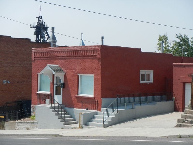
Immigrants to Butte during the mining boom often lived, socialized, and worshipped with fellow nationals. Swedish Lutherans first congregated in 1896, and in 1901 they built a small wooden chapel on the back of this lot. They quickly outgrew the . . . — — Map (db m185632) HM
Butte's reputation of being boisterous, boastful and rough was built on the stories and lives of the earliest mining prospectors who found gold on the Silver Bow Creek. Butte grew to be known as "The Richest Hill on Earth." "The Mile High City," "A . . . — — Map (db m186108) HM
For almost one hundred years, members of a single family lived in this Queen Anne style cottage. Carpenter R. R. Williams, who lived in the duplex next door, built the residence in 1898. By 1900, Irish immigrants John and Catherine Powers had . . . — — Map (db m184480) HM
Pay gold was discovered in Silver Bow County near this site in July 1864 by Barker and party
To commemorate the event, this tablet was placed by Silver Bow Chapter Daughters of the American Revolution Butte, Montana
Original marker dedicated . . . — — Map (db m145676) HM
On October 15, 1892, the federal government opened the land around Absarokee for settlement. The area had been part of the Crow Indian Reservation, but a year before, Crow tribal leaders bowed to political pressure and ceded the coveted territory. . . . — — Map (db m190741) HM
The Bozeman Trail was located ten miles south of here. John Bozeman pioneered the trail in this area in July 1864. After crossing the Bighorn River eight miles below the opening of the Bighorn Canyon, he led his wagon train northwest to the . . . — — Map (db m4326) HM
Columbus, located ten miles west of here, has a rich and colorful history. In 1874, whiskey trader Horace Countryman built a trading post a few miles west of the future site of Columbus. The Crow Reservation was then on the south side of the . . . — — Map (db m190922) HM
n 1878, a local farmer named Alonzo Young established a boat landing on the Yellowstone River several miles east of here. In addition to the boat landing, Young and his wife operated a stage station on the road to Coulson and Fort Keogh. In addition . . . — — Map (db m190926) HM
Settlers from Ripon, Wisconsin, established Park City in 1882, arriving just ahead of the railroad. The pious community organized a Christian club and Sabbath School within its first year. Originally, traveling ministers served Park City. Among . . . — — Map (db m190843) HM
In 1866 William Thomas, his son Charles, and a driver named Schultz left southern Illinois bound for the Gallatin Valley, Montana. Travelling by covered wagon they joined a prairie schooner outfit at Fort Laramie, Wyoming, and started over the . . . — — Map (db m28975) HM
In the days of the fur traders and trappers, immediately following the time of the Lewis and Clark Expedition (1804-1806), all of this country bordering the Rocky Mountains from here north into Canada and south to the three forks of the Missouri and . . . — — Map (db m127284) HM
In 1916, the Great Northern Railroad extended their branch line north from Choteau. Mr. James Hill, the president of the railroad had promised his friend L.B. Pendroy he would build a railroad to his home. Since the railroad was never extended . . . — — Map (db m130226) HM
A narrow gauge railroad nicknamed the "turkey track" used to connect Great Falls, Montana, and Lethbridge, Alberta. When the main line of the Great Northern crossed it in 1891, Shelby Junction came into existence. The hills and plains around here . . . — — Map (db m161386) HM
Montana's small towns have traditionally been places where people by supplies and services, socialize, and ship their products to markets on the railroads or highways. Hysham is typical of those many rural communities scattered across this great . . . — — Map (db m165442) HM
As workers poured in to work on Fort Peck Dam, the population of this quiet area boomed.
Barracks and dormitories were built in Fort Peck to house individual workers, but families had nowhere to live. More than 20 boomtowns sprang up just . . . — — Map (db m162092) HM
Today, the quiet countryside surroundings Fort Peck Dam is very different from the energy and bustle than once occurred here. During the height of the dam's construction in the mid-1930s, it was a mass of men, materials , and machines.
Before . . . — — Map (db m162093) HM
In 1876, this was strictly buffalo and Indian country. From 1876 to 1881, the U.S. Army rounded up the Indians and forced them onto reservations while buffalo hunters cleared the range for the cattle boom of the Eighties.
Pierre Wibaux ran one of . . . — — Map (db m163386) HM
In 1876 this was strictly buffalo and Indian country, There wasn't a ranch between Bismarck, North Dakota and Bozeman, Montana. But the U.S. Cavalry rounded up the hostile Indians from 1876 and 1881 and forced them onto reservations while the . . . — — Map (db m163389) HM
Pierre Wibaux, scion of a distinguished French textile family, arrived here at the settlement of Mingusville in 1883, establishing a cattle ranch about 12 miles north. His herds fared well during the devastating “Hard Winter of . . . — — Map (db m163387) HM
Named Boothill because so many of its occupants went to their deaths with their boots on, this cemetery was the burying ground for Coulson, Yellowstone River town existing from 1877-1885 on the edge of what was to be Billings. Most famous buried . . . — — Map (db m28939) HM
Billings was founded as a railroad town in 1882. The first passenger depot was the Headquarters Hotel, located on what was then North 28th and Montana Ave. It served as the stopping point for passengers and freight. In 1891, the Headquarters Hotel . . . — — Map (db m167971) HM
The Northern Pacific Railroad Company was created by an Act of Congress and signed by President Lincoln on July 2, 1864. Along the developing tracks, new towns were spaced apart every 100-120 miles. In the Yellowstone River Valley, Glendive, . . . — — Map (db m167972) HM
The original Zimmerman Trail was built during the summers of 1890 and 1891 by the brothers Joseph and Frank Zimmerman, born in Fellering, (Alsace-Lorraine) Germany. Joseph immigrated to the United States in 1872; two years later, upon enlisting . . . — — Map (db m169996) HM
Offering an eclectic architectural mix, Old Town tells the story of Billings’ growth. The Northern Pacific founded the community as a railroad hub in 1882, and by the end of 1883, some 400 canvas tents and crude buildings lined the streets. The 1882 . . . — — Map (db m165811) HM
The town of Billings is named for Frederick Billings. He was a gold rush lawyer, railroad baron, and conservationist. Born and educated in Vermont, he arrived in California with his law degree during the 1849 gold rush. He was California's first . . . — — Map (db m168301) HM
Founder
City of Billings
Northern Pacific Railway President from 1879-1881
His foresight and keen business mind resulted in the establishment of Billings - The Magic City - where it is today.
This statue was presented to the City of . . . — — Map (db m165861) HM
The town of Coulson was founded along the north bank of the Yellowstone River in 1877. Residents named the community after the Coulson Steamboat Packet Company, hoping to prosper from expected steamboat traffic. The town hosted a post office, a . . . — — Map (db m168157) HM
The Moss Mansion Historic House Museum faces Division Street on the west edge of downtown Billings. Preston Boyd Moss, who moved to Billings in 1892, was a prominent civic leader who owned and operated the First National Bank, Billings Light and . . . — — Map (db m168304) HM
The Northern Pacific Railroad steamed through the Yellowstone Basin in 1883, passing the small agricultural community of Carlton. The town was renamed Laurel, and a post office opens there in 1886
The Rocky Fork Railroad, an affiliate of the . . . — — Map (db m190774) HM
335 entries matched your criteria. Entries 301 through 335 are listed above. ⊲ Previous 100