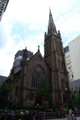
On Sixth Avenue 0.1 miles south of Wood Street, on the right when traveling south.
This whole city block at one time held as many as 4,000 graves. An ancient Indian tumulus (burying ground) originally occupied part of the site and, subsequently, the French of Fort Duquesne (1754) and the British from Fort Pitt (1758), along with . . . — — Map (db m74735) HM
Near Commonwealth Place north of Fort Pitt Boulevard. Reported permanently removed.
Fort Duquesne
End of Forbes Road
Occupied by General Forbes
November 25, 1758 and by him named
Pittsburgh.
His victory determined the destiny of the
Great West and established Anglo-Saxon
supremacy in the United States.
"His name . . . — — Map (db m42022) HM
On Grant Street just south of 5th Avenue, on the right when traveling north.
"I pledge allegiance to the flag of the United States of America and to the republic for which it stands, one nation under God, indivisible, with liberty and justice for all."
This Pledge of Allegiance was . . . — — Map (db m156213) HM
On Fifth Avenue south of Bigelow Boulevard, on the right when traveling south.
Fulfilling Our Mission
Soldiers & Sailors Memorial Hall & Museum stands as a memorial to those uniformed military personnel who have served our country in war and peace. The architectural landmark continues today to serve the community . . . — — Map (db m259539) HM
On Fifth Avenue south of Bigelow Boulevard, on the right when traveling south.
Origin of Soldiers & Sailors Memorial Hall
In 1891, some thirty years after the Civil War began, a committee of Allegheny County veteran organizations proposed the erection of a memorial honoring soldiers, sailors and marines from Allegheny . . . — — Map (db m259550) HM
On West Lincoln Avenue (Pennsylvania Route 980) 0.1 miles west of 6th Avenue, on the right when traveling east.
Oil was first struck here in 1890, and in 1891 and 1892 the field yielded the highest levels of oil in the world. Second only in Pa. history to the Bradford Oil Field in both size and production, it was instrumental in achieving the state's highest . . . — — Map (db m58541) HM
On Liberty Avenue at Grant Street on Liberty Avenue.
In 1877, The Pennsylvania Railroad Company (PRR) was the largest corporation in the world. In that year the PRR, like railroads across the country, instituted massive lay-offs and wage cuts—reportedly due to declining profits. When workers on . . . — — Map (db m26104) HM
On Fox Chapel Road, on the right when traveling north.
It took a lot of clams (among other marine invertebrates) to make up the Ames Limestone bed, which extends westward into Ohio and eastward through Pennsylvania. Evidence of the vastness of the sea is shown in the speculative map.
This map at . . . — — Map (db m248323) HM
Near Main Street north of Rices Landing Road (County Route 1010), on the left when traveling north.
Coal Seam
The Pittsburgh Coal Seam is the thickest and most extensive coal bed in the Appalachian Basin. The Upper Pennsylvanian Pittsburgh coal bed extends over 11,000 square miles through 63 counties. It extends from Allegany County, . . . — — Map (db m182022) HM
On Noblestown Road (Pennsylvania Route 980), on the right when traveling east.
The McDonald Oil Field
The "Great Oil Boom Excitement” of 1891
In the early 1890's, just about the time that the commercialization of oil was becoming big business, the Great McDonald Oil Field was the highest producing oil field in the . . . — — Map (db m178928) HM
This log cabin, typical of the log cabins built by the first white settlers, is one of the very few original log cabins in Allegheny County. It was in cabins such as this that our forefathers established their hold on the soil and raised the first . . . — — Map (db m78438) HM
On Diamond Park Square north of East Cherry Street, on the right when traveling north. Reported missing.
Formed March 12, 1800 from Allegheny County. Meadville, in 1788, was the first permanent settlement in northwest Pennsylvania. In 1842 the nation's first direct primary was held here. Cradle of the oil and zipper industries. Named for Colonel . . . — — Map (db m313808) HM
Near North French Street south of Mead Avenue, on the right when traveling south.
David Mead was born in Hudson, NY on January 17, 1752, the eldest son of Darius and Ruth Curtis Mead of Connecticut. In 1774, he married Agnes Wilson of Northumberland County, Pennsylvania, and the couple had nine children, of whom five lived to . . . — — Map (db m175200) HM
According to The Brookville Republican, Douglas Stahlman was committed to the local jail on August 20, 1915. The paper further states that "a commission was appointed to examine him which declared him insane, and he was sent to the county home." . . . — — Map (db m195997) HM
Stephen F. Austin hoped his colony in Texas would help his family prosper. But the business of
being an empresario proved financially disappointing. Hoping a family business - like a store - would generate income, Austin encouraged his . . . — — Map (db m206267) HM
On Hancock Avenue, on the right when traveling north.
(Front):First Pennsylvania Cavalry 1 Brigade 2 Division Cavalry Corps Army of the Potomac (Right): Recruited in Montgomery, Berks, Blair, Cumberland, Juniata, Mifflin, Centre, Clinton, Greene, Fayette, Washington and Allegheny . . . — — Map (db m16133) HM WM
On Fox Chapel Road, on the right when traveling north.
They call themselves Haudenosaunee (ho DEE no Sho nee), meaning “they form a cabin.” It was the longhouse (shown below) that was the symbol of this people. Known by the French term, Iroquois, they were an alliance called the Five Nations; the . . . — — Map (db m248508) HM
On Smallman Street at 18th Street, on the left when traveling east on Smallman Street.
☆ Born May 27, 1907 ☆
A marine biologist who became well known as a writer and conservationist, Rachel Louise Carson authored books that helped to ignite the global environmental movement. Her 1962 international bestseller "Silent . . . — — Map (db m314506) HM
On Corrigan Drive at Stone Manse Drive, on the right when traveling north on Corrigan Drive.
At the house of Oliver Miller, where the Old Stone Manse stands, two hundred feet from this plaque, the first shot in the famous Whiskey Insurrection was fired on July 14, 1794, when Major John Lennox, a United States Marshal from Philadelphia, . . . — — Map (db m225437) HM
Near Orange Plank Road (County Route 621) at Brock Road (County Route 613), on the right when traveling east.
Once schoolmates, friends, and neighbors, they came here as soldiers from Yorkville, South Carolina; Pen Yan, New York; Clarksville, Virginia; Barre, Vermont; and a hundred other towns, North and South. Their deaths in these woods on May 5 and 6, . . . — — Map (db m155885) HM
Alfred Packer was born on January 21, 1842, in Allegheny County, Pennsylvania. He served in the Union Army during the Civil War and was discharged in June 1863 for epilepsy. Packer traveled to the Rockies and worked for the mines for 9 years. In . . . — — Map (db m182105) HM
On Lincoln Highway (County Route 30A) at Iowa Street, on the right when traveling west on Lincoln Highway.
Side A
Mifflin was founded in 1816. Originally known as Petersburg, the name was changed in 1827 in honor of the settlers that moved here from Mifflin Township, Allegheny County, Pennsylvania. The first village jailhouse and crossroad . . . — — Map (db m97113) HM
Side A
E.V. Babcock - The Father of Allegheny County Parks
We have E.V. Babcock to thank for starting Allegheny County's remarkable park system. Edward Vose Babcock (1864-1948) was born and raised on a farm near Fulton, New York. He . . . — — Map (db m114185) HM
Near Gulf Prairie Road 0.2 miles south of Texas Highway 36, on the left when traveling south.
A native of Allegheny County, Pennsylvania, James Franklin Perry moved to Potosi, Missouri, in 1808. He joined the mercantile business of his relatives Samuel and John Perry, and became a partner in 1818.
While living in Potosi, Perry met and . . . — — Map (db m90627) HM
Near Forbes Avenue just east of Grant Street, on the right when traveling west.
Was held at Point State Park
Pittsburgh, Pennsylvania
Citizens of Allegheny County
offers daily prayers for
their safe return.
Dear God, we ask you in Your infinite Mercy, to safely return those still Missing in Action in Southeast . . . — — Map (db m156218) WM
On Division Street (New York State Route 5) at Main Street, on the right when traveling east on Division Street.
Buffalo History Architecture
The City Beautiful Movement was a Progressive reform of architecture and urban planning that flourished from 1890 to 1915. It espoused beautification and monumental grandeur to counteract the "moral decay and . . . — — Map (db m65921) HM
The Site of
Fort Pitt
Built
1758 - 1761
Visited by
George Washington
1753 - 1758 - 1770
————————
This tablet placed by the
Daughters of the
American Revolution
of Allegheny . . . — — Map (db m98829) HM
On Corrigan Drive, on the right when traveling north.
The Allegheny County Fair started in 1846 as a plowing competition on William Martin's farm in Manchester Borough. Momentum grew in the community to organize an annual fair. The first official Allegheny County Fair was held in 1849 at the Market . . . — — Map (db m225474) HM
On Corrigan Drive, on the right when traveling north.
The Allegheny County Fair offered something for everyone - headline entertainment, the best of the
harvest, industrial exhibits, product and service displays, farm machinery, livestock, flowers, sports, parades and fashion shows. It was the top . . . — — Map (db m225475) HM
Near Butler Street north of Umpire Way, on the right when traveling north.
Civil War Dead
An estimated 700,000 Union and Confederate soldiers died in the Civil War (1861-1865). As the death toll rose, the U.S. government struggled with the urgent but unplanned need to bury fallen Union troops. This propelled the . . . — — Map (db m99059) HM WM
On Forbes Avenue at Grant Avenue, on the right when traveling east on Forbes Avenue.
"In the courthouse and jail the man was bigger than the style." Frank Lloyd Wright [1935]
In 1841 the second Allegheny County Courthouse was erected on Grant's Hill, a more prominent site than the Market Square location of the first . . . — — Map (db m156234) HM
Near Walbridge Street south of Herschel Street, on the right when traveling south.
Steve Beshenich is a graduate of Langley High School (1968). He attended Community College of Allegheny County to study Criminology and graduated from Alliance College of Pennsylvania.
Steve worked as a Corrections Officer at Graterford . . . — — Map (db m256555) HM
On Greentree Road at Pocono Drive, on the left when traveling north on Greentree Road.
History of the Green Tree
The Borough of Green Tree was named after a stately sycamore that stood in the heart of the town at this location. The borough's logo is a depiction of this majestic tree which was the center of the community . . . — — Map (db m262688) HM
On Lincoln Avenue/Pennsylvania Avenue at Lock Street, on the left when traveling north on Lincoln Avenue/Pennsylvania Avenue.
Lock Four was the original community name for the lower floodplain area of present North Charleroi. This area was originally settled by the Frye family in the 1770s. In 1838, the Monongahela Navigation Company began building a series of locks and . . . — — Map (db m234595) HM
Thin black lines indicate changes in relevance. Between each pair of lines entries are ordered geographically but all have the same relevance.
* Inflectional forms of words are their plurals, singulars, and possessives as well as gramatical tenses and similar variations.