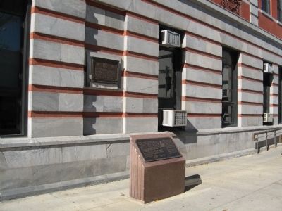
Near Mansion Street at Civic Center Plaza, on the right when traveling west.
United States Post Office Poughkeepsie New York Has been placed on the National Register of Historic Places by the United States Department of the Interior — — Map (db m141963) HM
Near Parker Avenue (New York State Route 9G) 0.2 miles east of Washington Street ( Route 9G), on the left when traveling east.
Established in 1683, Dutchess County was home to New York's second capital during the Revolutionary War and achieved prominence as an important rail hub. Dutchess County is also Franklin D. Roosevelt's birthplace.
Background photo . . . — — Map (db m145004) HM
On Market Street north of Cannon Street, on the left when traveling north.
In appreciation and recognition of Lucille P. Pattison who served in this office building for nearly two decades. Serving as County Legislator and both Minority and Majority Leader, she won a special election for Dutchess County Executive in 1978 . . . — — Map (db m142538) HM
On Empire State Trail (New York State Route 199) west of River Road (County Road 103), on the right when traveling east.
Welcome to New York State’s Mid-Hudson region. Situated halfway between Albany and New York City, this year-round vacation destination is famous for its history, country estates, scenic beauty, performing arts, galleries, and cuisine. With Ulster . . . — — Map (db m303690) HM
On U.S. 6 at Willow Spur, on the right when traveling east on U.S. 6.
Served in Nathaniel Scribner’s Company of the 7th Dutchess County Regiment New York Militia in the Revolutionary War. This allowed him to purchase this farm in 1813. — — Map (db m54291) HM
On Harlem Valley Rail Trail at Under Mountain Road, on the left when traveling north on Harlem Valley Rail Trail.
The Harlem Valley derives its name from "The New York and Harlem Railroad", chartered in 1831 and opened in lower Manhattan in 1832 with horse drawn cars. In 1842 the line crossed the Harlem River, and in 1873 joined the New York Central Railroad, . . . — — Map (db m245244) HM
Near Parker Avenue (New York State Route 9G) 0.2 miles east of Washington Street ( Route 9G), on the left when traveling east.
A tributary of the Hudson River, the Fall Kill supplied water power to Poughkeepsie's 18th - and 19th - century industries, including mills, cloth production, a brewery, and a carpet factory.
Background photograph courtesy of Linda T. . . . — — Map (db m145294) HM
John Howland Wood (1816-1904) was born in Dutchess County, New York. Trained in the mercantile trade and apprenticed to a painter, Wood enlisted in the New York Battalion to aid the Texas revolution. He arrived in Texas in 1836 in time to . . . — — Map (db m207915) HM
On Market Street at Main Street, on the left when traveling north on Market Street.
On this site in July of 1788, the opposing views of Federalists, led by Alexander Hamilton and John Jay, and Anti-federalists, under Governor George Clinton, were joined in compromise by Dutchess County Ratification Convention delegate Melancthon . . . — — Map (db m37732) HM
On Franklin Avenue at Front Street, on the left when traveling east on Franklin Avenue.
Welcome to Millbrook
In 1697, when this area was thickly forested and unexplored, nine men formed a partnership and were granted a royal charter to a huge tract of land that stretched from the Hudson River to what would become the . . . — — Map (db m139866) HM
On South 500 West, on the right when traveling south.
Born Oct. 16, 1800 in Dutchess County, New York. Died Apr. 15, 1892.
Baptized into the Church of Jesus Christ of Latter-day Saints Feb. 20. 1833, Errestown, Canada by Brigham Young. Persecuted with Saints in states of Ohio Missouri and . . . — — Map (db m245944) HM
Near Historic Sully Way 0.8 miles south of Air and Space Museum Parkway, on the right when traveling south.
At the time of the Civil War, the farms of Sully and Little Sully (no longer standing) were the homes of the Barlow and Haight families respectively. These families, connected by marriage, had come to Virginia from Dutchess County, New York, and . . . — — Map (db m217) HM
On New York State Route 344 east of Miles Road, on the right when traveling east.
The Harlem Valley derives its name from "The New York and Harlem Railroad," chartered in 1831 and opened in lower Manhattan in 1832 with horse drawn cars. In 1842 the line crossed the Harlem River, and in 1873 joined the New York Central . . . — — Map (db m116811) HM
Near Wheeler Hill Road at Carnwath Farms Lane, on the right when traveling south.
Mr. William Henry Willis built Carnwath Manor Home in 1850 and called it Carnwath Farms. The name is derived from a Manor home set in Scotland. Just after the ending of the Civil War, General Barclay purchased the estate from Mr. Willis. In 1870, . . . — — Map (db m144442) HM
On New York State Route 311 at Maple Avenue, on the right when traveling west on New York State Route 311.
Christ Church (Episcopal) 1763
Christ Church was organized as the “Episcopal Mission at Fredericksburgh” by three former English officers who settled in the area after the end of the French and Indian War. Although the present . . . — — Map (db m24878) HM
On Bryan Park Road, on the right when traveling north.
In memory of
Erastus Mitchell Birch
born – Jan. 19, 1801 – died- July 7, 1884
native of Dutchess County New York ** friend and
neighbor of Horace Mann * trustee * treasurer and
member of the executive committee board of . . . — — Map (db m79789) HM
On Slocum Avenue, on the right when traveling north.
(Front):150th New York Infantry 2nd Brigade (Lockwood's). 1st Division. 12th Corps. July 2nd & 3rd. 1863. This regiment defended these works on July 3rd from 6.30 to 9 a.m. and from 10 a.m. to 12 m. and captured 200 prisoners The Dutchess . . . — — Map (db m13985) HM WM
On Oakwood Drive 0.5 miles west of North Genessee Street, on the right when traveling west.
Bishop Kemper lived on these premises 1846-1870. Missionary Bishop of American Episcopal Church 1835-59. Inspired founding of the Nashotah House in 1842. Bishop of Wisconsin 1854-70. Facing countless Frontier hardships, he traveled far and wide . . . — — Map (db m43595) HM
On Fiddlers Bridge Road at Schultz Hill Road on Fiddlers Bridge Road.
On September 7, 1808, a local fiddler was murdered on a bridge here. The bridge is gone but his ghost still plays a fiddle on moonlit nights. — — Map (db m252697) HM
On New York State Route 9G south of Wurtemburg Road, on the right when traveling south.
History This beautiful hill, rising 550 feet above the Hudson River, has a long history. The region was first populated at the end of the last ice age, nearly 10,000 years ago, by bands of roaming hunter-gatherers who gradually established . . . — — Map (db m204987) HM
Near Duncan Road (Virginia Route 670), on the left when traveling south.
Charles H. Carr, a native of New York, purchased twenty acres from the Boisseaus of Tudor Hall in March 1859. He began construction of the house in front of you shortly afterwards. Carr died in July 1862 while enlisted in the Confederate army. In . . . — — Map (db m285347) HM
Each generation of the Robinson family left a mark on Rokeby's history. Here are a few of the family members who contributed to the rich history of Rokeby.
Thomas Richardson Robinson (1761-1851) and Jemima Fish Robinson (1761-1846) . . . — — Map (db m281221) HM
On Southwest Washington Street near Peoria Park District Rock Island Greenway when traveling west.
Lt. John Dusenberry died in Peoria
County, Illinois, on September 26, 1833.
He was buried in the 'Old French Cemetery'
which became Block 35 when the Town
of Peoria was formed in 1835.
Descended from mid-1600s immigrants
from the . . . — — Map (db m259405) HM WM
Near Van Dam Road east of Albany Post Road (New York State Route 9), on the right when traveling east.
WOODLANDS OF A GREAT ESTATE
The Winnakee Land Trust Nature Preserve was once part of the Crumwold estate, one of three magnificent Hudson River estates which supported the people of Hyde Park. Built by Colonel Archibald Rogers in the 1800s, . . . — — Map (db m210666) HM
On New York State Route 199 0.6 miles west of River Road, on the right when traveling east.
Built 3.5 miles south of Kingston by the New York State Bridge Authority from 1954-1957, the Kingston-Rhinecliff Bridge is a vital link between the New York State Thruway and the Taconic State Parkway. Located 60 miles from Albany and 96 miles from . . . — — Map (db m166156) HM
Near Clermont Avenue 0.3 miles Woods Road (County Route 35).
All the land visible from this point was once owned by the Livingston family. Robert Livingston, Sr., "The Founder" (1654-1728), acquired a 160,000-acre land patent in 1686. His property extended 9.5 miles along the eastern shore of the Hudson . . . — — Map (db m149847) HM