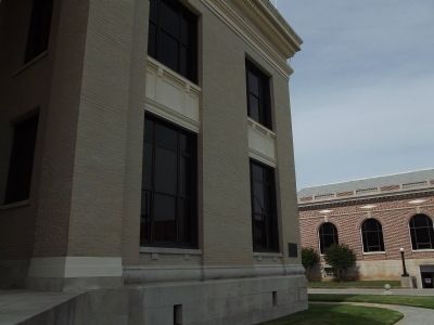
[West Side]
C.S.A.
1861-1865
To the Confederate
dead of Union District
Comrades Confederate Soldiers
[South Side]
From North to South
From East to West
Their ashes scattered lie
But in the regions of
the . . . — — Map (db m59078) HM
On West Main Street (State Highway 49) just east of South Enterprise Street, on the right when traveling west.
In 1871, one of the worst waves of white supremacist violence in S.C. history unfolded in Union County. During two raids in Jan. and Feb. of that year, twelve Black men were forcibly taken from this jail by the Ku Klux Klan while awaiting trial. . . . — — Map (db m196465) HM
On Cross Keys Highway (State Highway 49) at Blackstock Road, on the left when traveling east on Cross Keys Highway.
This battle of the Revolution took
place on William Blackstock’s
plantation, 3 miles N. on the south
side of the Tyger River, November 20,
1780. Gen. Thomas Sumter
commanded the American patriots who
repulsed Lt. Col. Banastre
Tarleton’s . . . — — Map (db m11111) HM
On East Bankhead Street (State Highway 178) at Court Avenue, on the right when traveling east on East Bankhead Street.
Union County was established on July, 7, 1870, during the post—Civil War Reconstruction era, from portions of Tippah, Lee, and Ponotoc counties. Governor James L. Alcorn appointed Union County's first officials and set New Albany as the county . . . — — Map (db m96777) HM
During two separate terms as a member of the South Carolina State Highways and Public Transportation Commission Representing the 16th Highway District, 1975 ~ 1979 and 1983 ~ 1987, and as Chairman of the Commission 1978 ~ 1979, Mr. Fendley rendered . . . — — Map (db m54562) HM
[East Side]:
In Memory of the
Confederate Soldiers
of Union County,
South Carolina.
[North Side]:
Truth, courage,
and patriotism
endure forever.
[South Side]:
These were men who gave
their live and . . . — — Map (db m13536) HM
On Main Street (Tennessee Route 33) at Ailor Gap Road, on the right when traveling east on Main Street.
Named for Captain John (Racoon) Miller whose blockhouse stood near this site. Captain Miller, born in 1747 in Newberry County, South Carolina, served in the Washington County, Virginia, militia in 1776 before migrating to this area in 1777. He . . . — — Map (db m100164) HM
John Callaham
Born in Virginia 1770
Migrated to South Carolina 1790
Died Level Land 1855
First Wife, Nancy Jarrett - Three
of Twelve Children of This Union
Married Sons of Zachariah Carwile.
Second Wife, Nancy Pinson - Eleven . . . — — Map (db m49923) HM
During the Revolutionary War, river fords were a vital resource in controlling communication and transportation in the South Carolina backcountry. With few bridges or roads, these fords offered a tremendous tactical advantage to whomever . . . — — Map (db m13857) HM
On North Pinckney Street, on the right when traveling north.
[Front]:
This cemetery, the oldest in Union, was established ca. 1817 and sometimes called the "village cemetery." In 1818 a Presbyterian "union" church used by other denominations as well moved here from a 1783 site about 2 mi. E. . . . — — Map (db m81836) HM
On Old Buncombe Road at Jones Ford Road, on the left when traveling east on Old Buncombe Road.
[Front]:
A post office was established in 1809 at Cross Keys, S.C. In 1812-1814, Barrum Bobo erected this house at the intersection of the Piedmont Stage Road and the Old Buncombe Road. During the ante-bellum period, it was the center of . . . — — Map (db m13390) HM
On East Marietta Street 0 miles north of Elizabeth Street, on the right when traveling north.
Born April 15, 1821 in Pickens District, South Carolina, he grew up in Union County, Georgia. He taught to pay for his education and while teaching in Canton he read law at night, being admitted to the bar in August, 1845. He graduated from the . . . — — Map (db m21891) HM
On Jonesville Highway, on the right when traveling south.
Led by Philip Mulkey, thirteen converts of the Great Awakening movement traveled from N.C. to S.C. in 1759, settled on the Broad River, and organized a Baptist congregation, the oldest in the upcountry. Three years later, they moved to what is . . . — — Map (db m13442) HM
On Cross Keys Highway (State Highway 49) at Police Club Road, on the left when traveling east on Cross Keys Highway.
1.5 miles SW stood the original Fairforest Baptist Church. The members, led by the Reverend Philip Mulkey, came from North Carolina to Broad River about 1759. In 1762, the church moved to Fairforest where, as the first Baptist church in the up . . . — — Map (db m13393) HM
On Main Street (Route 49) at Enterprise Street on Main Street.
[Front]:
The S. C. Board of Public Works had at least fourteen public buildings under contract in 1822-23, when Robert Mills, Acting Commissioner of the board, rejected a partially built jail of inferior brick before proceeding with this . . . — — Map (db m11109) HM
On Georgia Route 60 0.1 miles north of Hello Road.
Joseph Emerson Brown (1821-1894), born in Pickens District, South Carolina, moved to Union County, Georgia, as a boy. The old Brown home was on the present site of the Woody Gap School, opened in 1941 for mountain students. Brown worked on his . . . — — Map (db m33341) HM
On El Bethel Church Road (State Highway 11-15) when traveling east.
The family cemetery of Lt. Col. James Steen (d. 1781), S.C. militia officer during the American Revolution, is on his plantation nearby, along Thicketty Creek. Steen, who commanded units in several campaigns from 1775 to 1781, was killed in 1781 . . . — — Map (db m44670) HM
Near Advent Street 0.1 miles south of East Main Street.
Cornerstone:
Church of the Advent
Parish House
1912
Except the Lord build the house, their labor is in vain that build it.
Nearby marker:This property has been
placed on the
National Register
of Historic . . . — — Map (db m13511) HM
On Cross Keys Highway (State Highway 49) 0.5 miles west of Riley Road, on the right when traveling west.
Fair Forest Plantation. Fair Forest, named for nearby Fair Forest Creek, was the plantation of Col. Thomas Fletchall (d.1789), prominent militia officer before the Revolution and Loyalist during it. Captured in 1775 and briefly jailed, . . . — — Map (db m13394) HM
On Brattonsville Road 0.1 miles north of Percival Road, on the right when traveling south. Reported missing.
The Homestead was built between 1823 and 1826 for Dr. John Simpson Bratton and his wife Harriet Rainey Bratton, the second generation of the Bratton family to live at Brattonsville. Bricks for the chimneys were made on the plantation. The two . . . — — Map (db m272030) HM
On County Road 238, on the left when traveling west.
Providence is believed to be the second oldest Florida settlement next to St. Augustine. The Lonnie Summers Family found this statement written on the wall of the Old Odem House they purchased in 1936: "St. Augustine was founded in 1565. Shortly . . . — — Map (db m55808) HM
On West Brooks Street 0.1 miles west of Jenkins Avenue, on the right when traveling west.
This building is named for Arthur Barto Adams, the first dean of the College of Business Administration. Adams was born in Union County, South Carolina on January 24, 1887, and studied at the University of South Carolina and at Columbia. He came to . . . — — Map (db m277498) HM
On White Horse Road (U.S. 25) at Banner Drive, on the right when traveling north on White Horse Road.
One of the first stores in this section of the state stood near this spot. Its day book shows that it was in operation in 1794, three years before the founding of the town of Greenville. — — Map (db m9131) HM
On West Main Street (South Carolina Route 49) west of South Herndon Street, on the left when traveling west.
Lynching in America
During the Reconstruction period that followed emancipation in 1865, thousands of Black people were lynched by white people intent on maintaining racial hierarchy. Federal officials ended Reconstruction in 1877 when they . . . — — Map (db m196451) HM
On Sam Drenan Road at Skyland Avenue, on the right when traveling east on Sam Drenan Road.
Sam Billings was born a slave in Union County, South Carolina.
Billings became the first recorded African American landowner
in Mecklenburg County. In 1892, he purchased 50 acres of land
for $913.50, and another substantial parcel in 1893 for . . . — — Map (db m237706) HM
On Galilee Church Road, on the left when traveling east.
Ancestral Cemetery of
the Gist Family
Among those buried here are
the secession Governor of
South Carolina
William H. Gist
Aug. 2, 1805 - Sept. 30, 1874
Mary Rice Gist
His second wife
Also
Col. William M. Gist C.S.A. . . . — — Map (db m13468) HM
On Manning Mill Road at West Armuchee Road, on the left when traveling east on Manning Mill Road.
William Little (1801-1884) was born in Union County, South Carolina, and married Elizabeth "Betsy" Young (1815-1884) in 1835. With Betsey's parents, James Marion Young and Sarah Ann Foster Young, the families moved around 1836 to the West Armuchee . . . — — Map (db m307690) HM
Near Metropolitan Avenue south of Charlottetown Avenue, on the right when traveling south.
(left panel)
In 1887, William Henry Belk opened The New York Racket Store in Monroe, NC, which he advertised as "The Cheapest Store on Earth."
Belk pioneered what were considered at the time to be innovative business practices. He set . . . — — Map (db m249171) HM
On South Main Street (State Highway 124) at East Broad Street, on the left on South Main Street. Reported permanently removed.
As a tribute to his skills exploiting enemy weaknesses, Pickens became known as the "Wizard Owl" or "Skyagunsta" - a bird known for seeing clearly, acting wisely and striking quickly.
Pickens was a tall, religious Presbyterian from . . . — — Map (db m259654) HM
On North Mountain Street at Hames Street, in the median on North Mountain Street.
[Front Side]:
This Greek Revival house was built ca. 1857 for Benjamin Dudley Culp (1821-1885) and his wife Cornelia Meng Culp (1830-1888). Culp, a Union merchant, owned stores on Main Street with partners J.T. Hill and H.L. Goss from . . . — — Map (db m13542) HM
On Asbury Road (State Highway 211), on the right when traveling west.
This African American church, the first in what is now Cherokee County, was most likely built between 1880 and 1890. It served the Whig Hill, Asbury, and Thickety communities of what was Union County before Cherokee County was created in 1897. . . . — — Map (db m19724) HM
On Asbury Road 0.1 miles east of Arrowhead Trail, on the right when traveling east.
This house was built in 1843 for William Thompson Nuckolls (1801-1855) and later owned for many years by John D. Jefferies (1838-1910). Built in the Greek Revival style of the antebellum period and altered in the Neo-Classical style of the . . . — — Map (db m17737) HM
Near Leigh Street near Riverside Drive, on the left when traveling north.
Abraham Bonnells Tavern Forgotten History Trail
Bonnell's Tavern & the Minutemen/Militia
Bonnell's Tavern: A Crossroads of Rebellion
This ground once echoed with the voices of rebel Minutemen, weary travelers, Sons . . . — — Map (db m314023) HM
On Greenwood Highway (US 221), on the right when traveling south.
About 2½ miles southwest, a granite monument stands on the site of Rosemont, birthplace and home of Ann Pamela Cunningham, founder and first regent of the Mount Vernon Ladies' Association of the Union. Through her efforts Mount Vernon was . . . — — Map (db m74870) HM
On U.S. 29 at Brooklyn Road, on the right when traveling west on U.S. 29.
At dawn on the morning of June 6, 1903, floodwaters roared through the Pacolet River valley. As the high water thundered downstream from mill village to mill village, people in the path of the flash flood had no warning it was coming. Before the . . . — — Map (db m56461) HM
Thin black lines indicate changes in relevance. Between each pair of lines entries are ordered geographically but all have the same relevance.
* Inflectional forms of words are their plurals, singulars, and possessives as well as gramatical tenses and similar variations.