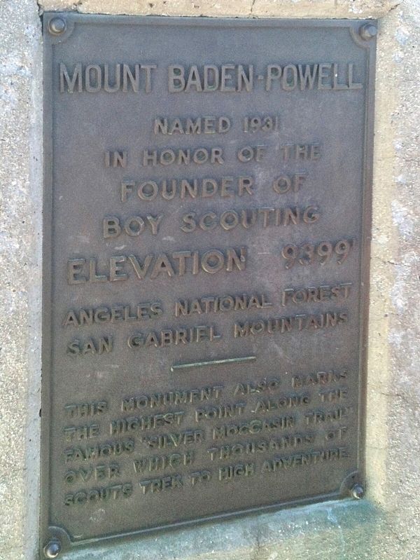
Near Angeles Crest Highway (California Route 2) at Vincent Gap.
This monument is dedicated to the memory of Lord Baden-Powell of Gilwell, O.M. Founder of Boy Scouting In the year of his 100th anniversary 50th anniversary of world Scouting 47th anniversary of Scouting in America September 1957
Erected . . . — — Map (db m189748) HM
On Rim of the World Highway (State Highway 18), on the right when traveling east.
In 1932, during the Great Depression, California launched a large public works project to aid recovery. A major component was the construction of masonry walls, parapets and fountains along the historic "Rim of the World" highway. This work, widely . . . — — Map (db m51261) HM
On Holcomb Valley Road (Forest Road 3N16) 0.5 miles east of 3N09.
The water came first.
Melting snow from the surrounding mountains drains into
Holcomb Valley. The underlying rocks and soils prevent the
water from percolating down, thus creating a wet meadow.
The water stays for most of the . . . — — Map (db m256238) HM
On Holcomb Valley Road (Forest Road 3N16) near 3N76.
A typical miner's dwelling during the Gold Rush Days.
Built in 1860, called The Pigmy Cabin, it was partially
destroyed over the years by vandals seeking firewood and souvenirs.
Restoration done as a Boy Scout Eagle Project
by Michael . . . — — Map (db m256240) HM
Near Greenway Drive 0.3 miles north of Big Bear Boulevard, on the right when traveling north.
The stamp mill was an early machine
used to crush gold bearing ore.
Many miners were employed at the
large scale mines and Big Bear
was one of the many mining towns.
Gold Mountain and Rose mines were
the largest, having 40 stamps each
on . . . — — Map (db m197824) HM
Near Greenway Drive 0.3 miles north of Big Bear Boulevard, on the right when traveling north.
Southern California's largest gold rush followed the discovery of rich placer deposits by William F. Holcomb and Ben Choteau on May 4, 1860. Miners rushed to the valley and established boom towns. Belleville, the largest, rivaled San Bernardino in . . . — — Map (db m50702) HM
On Greenway Drive 0.3 miles north of Big Bear Boulevard, on the right when traveling north.
This building was built by Guy Maltby of
Big Bear Valley Milling & Lumber Company in 1927-1928.
It was the original community market in
Big Bear City, & was sold to Frank & Freda Jakobi
who lived upstairs. It was replaced in 1936
with todays . . . — — Map (db m236792) HM
Near Greenway Drive 0.3 miles north of Big Bear Boulevard, on the right when traveling north.
Originally located in Bear City Park, this
miniature Maltby building was once the golf
shack of the Peter Pan Woodland Club. The
club was known for its beautiful golf course,
pools, and equestrian trails. Builder Guy
Maltby was known for . . . — — Map (db m197826) HM
On North Shore Lane near North Shore Drive, on the left when traveling west.
BBSO is home to the world's largest aperture,
and highest resolution solar telescope. The 1.6
meter primary mirror of the New Solar
Telescope (NST) is housed in the first facility-class solar telescope made in the USA in a
generation. The . . . — — Map (db m197808) HM
On North Shore Drive 0.7 miles west of Stanfield Cutoff, on the left when traveling west.
Big Bear Lake, as you see it now, is a hub for recreation and outdoor activities.
Did you know if you stood on this spot in the 1880's you wouldn't see a lake at all?
Until 1885, the lake in front of you was a sprawling wet meadow laced by a . . . — — Map (db m197780) HM
Near Road 2N11 1 mile west of Road 2N10, on the right when traveling west.
Over 400 years ago, as the Spanish adventurer Cabrillo was
exploring what is now Southern California, the mighty pine
above you had just peeked through the soil. By the time
Benjamin Davis Wilson discovered our valley in 1845, this tree
had . . . — — Map (db m197487) HM
In January 1996: A family of "Three Strikes" Grizzly Bears were captured outside of
Yellowstone National Park. US Fish and Wildlife Bear Management guidelines directed the
rangers to either find them a permanent home in a zoological facility . . . — — Map (db m197752) HM
Near Holcomb Valley Road (Road 3N16) 0.5 miles east of Van Dusen Canyon Road (Road 3N09), on the right when traveling west. Reported missing.
Named for William Francis "Bill" Holcomb, pioneer prospector who, in this valley discovered Southern California's richest gold field - May 5, 1860. — — Map (db m50610) HM
On Big Bear Boulevard (Route 18) 0.1 miles east of North Shore Drive (Route 38).
In 1884 Frank Brown built an unusual dam here to supply irrigation water for the Redlands area. The single-arch granite dam formed Big Bear Lake, then the world’s largest man-made lake. Engineers claimed the dam would not hold, and declared it “The . . . — — Map (db m128510) HM
On Holcomb Valley Road (Forest Road 3N16) 0.5 miles east of Forest Road 3N09, on the left when traveling east.
Founded in late 1859, Bellevill was named after Belle Van Dusen, the first child born in Holcomb Valley. She was the daughter of Ted Van Dusen, the town blacksmith and early pioneer. — — Map (db m78590) HM
On Arrowhead Villa Road, on the left when traveling north.
Club Arrowhead Villas was constructed and dedicated in 1926 by The Atkins Corporation as seen on the pillared entrance to Arrowhead Villas. It was to be a luxury resort catering to wealthy patrons from across the country seeking adventure and . . . — — Map (db m94403) HM
On Rim of the World Highway (California Route 18).
"I never thought I would outlive the trees"
A century old herself in 2005, and seeing many of her beloved trees bow to beetle and flame, Pauliena Lafuze had done just that. She has been a Lake Arrowhead Woman's Club member since the . . . — — Map (db m30409) HM
On Peninsula Drive just east of Rhine Road, on the left when traveling east.
Founded in 1986 as the Crest Forest Historical Society, the Rim of the World Historical Society now operates the Mountain History Museum in this renovated San Bernardino County Firehouse.
Today, in its 25th anniversary year, the society . . . — — Map (db m72092) HM
On Lytle Creek Road, on the right when traveling west.
Lytle Creek Canyon in the San Gabriel Mountains has a long and interesting history. It is named for Andrew Lytle, who served as a company commander in the famed Mormon Battalion during the Mexican War. Lytle was among the earliest settlers of the . . . — — Map (db m78514) HM
On California Route 18 at Hunsaker Drive, on the right when traveling east on California Route 18.
The two-wheel logger placed
at this location was used in the
last part of the 19th century by
Brookings Lumber Company to
harvest timber from this location.
Pulled by oxen, the wheels which
stand seven feet tall straddled
the large pine logs, . . . — — Map (db m197747) HM
On Keller Peak Road 5.5 miles south of Highway 18.
This plaque is dedicated to
the brave men and women who have served
in the armed forces of
the United States of America,
especially:
1. 2d Lt Frank A. Kobal
2. 2d Lt Joseph B. Maloney
3. Tsgt Waldo C. Jensen
4. Sgt Roger F. . . . — — Map (db m277300) WM
On Evergreen Road west of Park Drive, on the right when traveling west.
Dedicated to the men and women who
honorably serve in the armed forces of
the United States, past, present and future
during war and peace.
Their devotion to duty, since the birth
of this nation, shall never be forgotten. — — Map (db m240833) HM