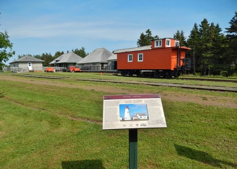
Near Elmira Road 1.6 kilometers south of Northside Road (Prince Edward Island Route 16), on the right when traveling south.
English:
The eastern terminus of the Confederation Trail is Elmira. It is a further nine kilometres by road to East Point, the eastern tip of land. The site is dominated by an octagonal white lighthouse built in 1867. Exceeding 19 . . . — — Map (db m141202) HM
Near Elmira Road 1.6 kilometers south of Northside Road (Prince Edward Island Route 16), on the right when traveling south.
English:
The Elmira Branch of the P.E.I. Railway opened for business on 26 October 1912, one of the last expansions of rail service in the province. The terminus at Elmira was similar to other "ends," with an engine house and . . . — — Map (db m141203) HM
Near Elmira Road 1.6 kilometers south of Northside Road (Prince Edward Island Route 16), on the right when traveling south.
English:
Elmira became the new eastern terminus of the P.E.I. Railway in 1912 when the main line was extended from Harmony. The early decades of the 1900s were the last period of expansion for the provincial railway. They were . . . — — Map (db m141204) HM
Near Lighthouse Road 2 kilometers east of East Point Road (Prince Edward Island Route 16), on the right when traveling east.
English:
The original fog alarm building was added to the East Point Light Station in 1885 as a navigational aid. It was replaced in 1908 with a larger building at a cost of $8000.00, and remains one of the few intact fog alarm . . . — — Map (db m140620) HM
Near Georgetown Road near Grafton Street, on the left.
To the glorious memory of
our native sons who paid the supreme
sacrifice in the two World Wars.
1914 — 1918
Our Honoured Dead
Stephen F. Cherry • John P. Dalton • Martin P. Dalton • John W. Lavers • Temple W. Macdonald, M.C. . . . — — Map (db m80294) WM
On Richmond Street close to West Street, on the left when traveling west.
[English:]
The railway and the steamship lines serving Prince Edward Island became major drivers to a new industry which became known as tourism. Realizing soon after the railway was open for service in 1875 that more and more . . . — — Map (db m293402) HM
Near Georgetown Road close to Grafton Street, on the left when traveling south.
English:
The Honorable Andrew Archibald (A.A.) Macdonald
was born February 14, 1829 in Three Rivers.
He carried on the family business in Georgetown
until called to serve in the Legislature.
He was in Ottawa, a member of the . . . — — Map (db m80295) HM
On Richmond Street close to West Street, on the right when traveling west.
English:
The Three Rivers - Montague, Brudenell, and Cardigan - wind through towns, villages and communities in Kings County, draining into Cardigan Bay, known to the Mi’Kmaq people as Samkook (sandy shore). One of the first . . . — — Map (db m80296) HM
Established in 1720, Havre Saint
Pierre was once the largest
settlement in the colony of Isle Saint
Jean. On a summer day in the 1730s
this was a busy place. Here - a fleet
of tiny shallops, sails snapping as
they set out for the . . . — — Map (db m139397) HM
The bottom of the bay is like a giant compost bin. Seaweed and shellfish collect here when they
die, and form a thick, black mud. The decomposing shells create high lime content, making "mussel
mud” a perfect fertilizer for the . . . — — Map (db m139444) HM
Early British settlers were more
interested in farming than in
fishing. By the early 1800s, a small
village began to grow farther
inland. Here the bay was narrow
and easily crossed - first by ferry,
later by bridge. St. Peters . . . — — Map (db m139407) HM
It is believed that Charles
Sanderson started farming here around 1820. Until the farm was
sold in the early 197os, different
generations of Sandersons cared
for this land. Always mindful of the ever-changing sand dunes, they
helped . . . — — Map (db m139448) HM
Near Lighthouse Road 0.2 kilometers north of Chemin Panmure Island ( Route 347), on the right when traveling north.
This plaque commemorates the designation of Panmure Head Lighthouse under the Heritage Lighthouse Protection Act. Cette plaque commémore la désignation du phare de Panmure Head en vertu de la Loi sur la . . . — — Map (db m269391) HM
On Saint Peters Road, on the right when traveling east.
Bishop A. B. Mac Eachern
Angus Bernard MacEachern, a pioneer missionary, emigrated
from Scotland in 1790. For forty-five years he ministered
zealously to the people of Prince Edward Island, the Magdalen
Islands, and to large . . . — — Map (db m293403) HM
Near Black Brook Road 0.3 kilometers north of Cape Bear Road ( Route 18), on the right when traveling north.
John Whalen built the square tapered, 12.4 m Cape Bear Lighthouse in 1881. In 1947, it was moved back from eroding cliffs. Ewart A. Keeping was lightkeeper from 1926-1959. The attached dwelling was removed in 1960. The Marconi Wireless Station was . . . — — Map (db m198787) HM
On Station Lane just south of Cape Bear Road (Main Street) ( Route 18), on the right when traveling south.
English:
Cape Bear is located on the Northumberland Strait side of the southeast corner of Prince Edward Island. The name survives in translation from the French period of Island history. The lighthouse was built in 1881, one of . . . — — Map (db m147964) HM
On Station Lane just south of Cape Bear Road (Main Street) (Provincial Route 18), on the right when traveling south.
English:
The normal way to build a railway is to start at one end using an engine and flatcars to deliver materials to the end-of-track. The branch built between Charlottetown and Murray Harbour between 1901 and 1904 required a . . . — — Map (db m147962) HM
On Main Street (Prince Edward Island Route 18) just north of Cape Bear Road ( Route 18A), on the right when traveling south.
In grateful tribute to the living
and the dead who through their
valiant efforts and bitter
sacrifice have made Canada great
is this shrine dedicated Killed in action or died in service War of 1914-1918
Gordon Mackay
Clarence Reynolds . . . — — Map (db m139450) WM
On Main Street (Prince Edward Island Route 18) just north of Westview Drive, on the right when traveling west.
English:
Murray Harbour began to achieve status as an important PEI port in the late 1700s. The earliest settlers in the area sustained themselves by fishing and farming but John Cambridge, the proprietor of Lot 64, was actively . . . — — Map (db m140239) HM
On Station Lane just south of Cape Bear Road (Main Street) ( Route 18), on the right when traveling south.
English:
A well-protected fishing harbour lies a short distance down the South River from the end of the trail. Fishing boats are lined up on both sides of the waterway and storage sheds dominate the wharves. The quiet ripple-free . . . — — Map (db m147963) HM
On School Street just west of Main Street ( Route 4), on the left when traveling west.
English:
The original planners of the P.E.I. Railway in the early 1870s were very focused on connecting all of the major Island ports. The export of farm produce was at the heart of the economy. The railway made it easier for . . . — — Map (db m147965) HM