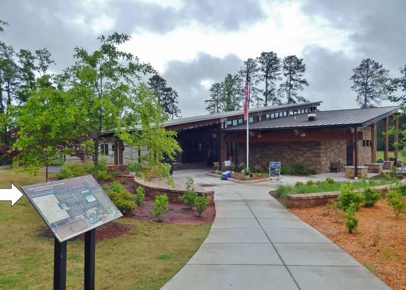
On Fort Yargo Road 0.2 miles east of South Broad Street (State Highway 81), on the left when traveling south.
Between the Oconee & Ocmulgee In the late 1700s, the (Muscogee) Creek village of Snoden, present-day Winder, was located within the unbroken forests of Georgia's wilderness. Numerous waterways crisscrossed the landscape supplying . . . — — Map (db m187100) HM
On Green Street NE (Georgia Route 60) at Riverside Drive (U.S. 129), on the right when traveling north on Green Street NE.
In memory of the pioneer citizens who gave a great heritage to this area, this plaque was presented December 19, 1968 to commemorate the 150th anniversary of the creation of Hall County, 44th county of Georgia. Named for Lyman Hall, one of the three . . . — — Map (db m23154) HM
On School Circle at Alabama Street, on the right when traveling north on School Circle.
In 1833, a deaf man, John Jacobus Flournoy, of Jackson County, great grandson of Jacob Flournoy, a French Huguenot, urging education for the deaf, interested Governor Wilson Lumpkin and the Georgia Legislature in the educational movement. At first . . . — — Map (db m47908) HM
On South Elm Street (Business U.S. 441) 0 miles east of Oak Street, on the right when traveling east.
Lamartine Griffin Hardman was governor of Georgia from 1927 to 1931. A physician, businessman, manufacturer, and farmer, Hardman served in the Georgia house and senate before becoming governor. In the state legislature, Hardman sponsored . . . — — Map (db m22967) HM
On Dahlonega Highway (Georgia Route 9) at Browns Bridge Road ( Route 369), on the left when traveling north on Dahlonega Highway.
The highway crossing east and west at this intersection is the Old Federal Road, first vehicular way and earliest postal route west of the Chattahoochee. Beginning to the east on the Hall-Jackson county line, it linked Georgia and Tennessee across . . . — — Map (db m21287) HM
On County Road 90 0.1 miles east of Alabama Route 73, on the right when traveling east.
Ebenezer Baptist Church is the oldest church on the northern end of Sand Mountain. Its origins date back to an 1850s log church and school called Gordon Chapel. Renamed Ebenezer, the church became a member of the Tennessee River Baptist Association . . . — — Map (db m156122) HM
On Gus Barnett Road at Antioch Church Road, on the right when traveling north on Gus Barnett Road.
Antioch Church was founded in Jackson County, Georgia in 1799, on land given by the James Glenn family. The original building, along with an 1825 addition, stands to the rear of the present sanctuary forming the "T" and was bricked over in 1954 with . . . — — Map (db m26023) HM
On Dacula Road 0.6 miles south of Hog Mountain Dacula Road ( Route 324), on the left when traveling south.
This house was built by Elisha Winn around 1812. In 1818, the Georgia General Assembly created Gwinnett County from Cherokee and Creek cessions and part of Jackson County. The first Gwinnett elections and sessions of the Inferior Court were held in . . . — — Map (db m16937) HM
On Atlanta Highway (Georgia Route 13) at Radford Road on Atlanta Highway.
The route leading west from this point is the Old Federal Road, an early thoroughfare which linked Georgia and Tennessee across the Cherokee Nation. Rights to open the passage were granted informally by the Indians in 1803 and confirmed by treaty in . . . — — Map (db m24718) HM
Near East Broad Street east of First Street, on the right when traveling east.
In 1783 the Oconee River basin was the western boundary of the new United States of America. The first U.S. frontiersmen included surveyors, mapmakers, native guides, and naturalists.
To entice farmers to the new territory, the U.S. . . . — — Map (db m206381) HM
Near Georgia Route 17 north of Unicoi Turnpike, on the right when traveling west.
Welcome to Hardman Farm State Historic Site
Nestled in teh Nacoochee Valley, Hardman Farm features a number of historic structures built on approximately 170 acres. Construction of the mansion and other buildings began in 1869. The Nichols, . . . — — Map (db m296816) HM
On Etheridge Road just south of Carruth Road (Johnson Mill Road), on the left when traveling south.
This Piedmont Homestead, originally settled by brothers James and Patrick Shields in 1798, contains a collection of intact historical buildings on a total of 152 acres set aside for preservation. This is one of the most diverse collections of farm . . . — — Map (db m184289) HM
On General Daniels Avenue (U.S. 29) at Madison Street, in the median on General Daniels Avenue.
Front:
Discoverer of the use of sulphuric ether as an anaesthetic in surgery on March 30, 1842 at Jefferson, Jackson County, Georgia, U.S.A.
Born at Danielsville, Georgia Nov. 1, 1815
Died at Athens, Georgia June 16, 1878 . . . — — Map (db m60609) HM
On Washington Street at North Avenue, on the left when traveling north on Washington Street.
(Side 1)
Lawyer, Patriot, Hero of the American Revolution, General of Georgia Militia, Congressman, Twice Governor, Twice U.S. Senator, Author of the 1798 State Constitution, Designed of the State Seal, and "Prince of Duelist."
"If . . . — — Map (db m184816) HM
On Gainesville Highway (Georgia Route 53) at Rockwell Church Road, on the right when traveling north on Gainesville Highway.
Organized 1839 — second oldest Universalist Church in Georgia. Located here near original site of Rockwell School, oldest school in this section, and Rockwell Masonic Lodge. Confederate Soldiers enlisted and drilled here 1861-1865. Church . . . — — Map (db m19548) HM
Near East Walnut Street (County Highway 202) 0.2 miles east of North Highway 123 Byway.
A San Jacinto Veteran • Born in Georgia, February 14, 1807 Died December 14, 1890 His Wife Jane Johnson Dale Born in Ohio, August 3, 1821 Died June 17, 1896 — — Map (db m239512) HM
On Fort Road (State Road 69) at Bryan Street (State Road 71), on the left when traveling east on Fort Road.
The house was built in the 1830's by John A. Syfrett. It is likely the oldest residence in Jackson County. It faces Fort Road, believed to have been routed by Andrew Jackson. In 1861, it became the home of Colonel John M.F. Erwin and his wife, . . . — — Map (db m67531) HM
On Hurricane Shoals Park Road 0.1 miles south of Wheeler Cemetery Road, on the right when traveling south.
On this site in 1882, the original Hurricane Shoals Covered Bridge was completed, spanning some 127 feet at the cost of a mere $1,433. Vandals burned the old bridge in 1972, spoiling a community landmark and transportation corridor that had been in . . . — — Map (db m109855) HM
On Randolph Street north of Lee Street ( Route 15/ 82), on the left when traveling north.
On Nov. 20, 1818 the Georgia Assembly approved an Act calling for the formation of a coed school for Jefferson. It was called Jackson County Academy and was also called Jefferson Academy. In Dec. 1859, the charter was amended to change the name to . . . — — Map (db m262090) HM
Side A One of the Five Lower Towns established by the Chickamauga Cherokees in 1782 under the leadership of Dragging Canoe. Territorial Governor William Blount reported to the Secretary of War in 1792 that: “Crow Town lies on the north . . . — — Map (db m28473) HM
On Etheridge Road 0.2 miles north of Johnson Mill Road, on the left when traveling north.
Construction of this schoolhouse in 1909 was supervised by Ira Ethridge who had been a teacher before he married Susan Ella Shields. Alex and Emory Shields, grandsons of James Shields, donated two acres of land and the school was named Bachelors' . . . — — Map (db m201048) HM
On Lawrenceville Street at Morton Street, on the right when traveling east on Lawrenceville Street.
has been placed on the
National Register
of Historic Places
by the United States
Department of the Interior
Circa 1854
Nominated 2002 by JHPC — — Map (db m199914) HM
On Lakeview Drive at Mulberry Street, on the left when traveling south on Lakeview Drive.
Nicholson, Georgia, located in Jackson County, was originally named Cooper in honor of the Willis Cooper Farm. The town's name officially changed to Nicholson on February 2, 1882 as a tribute to J. Nicholson, President of the Northeastern . . . — — Map (db m180491) HM
On Walnut Street (U.S. 149) at South 17th Street, on the right when traveling west on Walnut Street.
"True craftsmen of their historic trade…civic minded contributors to Murphysboro and Southern Illinois"
The Southern Illinoisan: April 17, 1966
Born in Macon, Georgia, Jim and Benjamin Deal moved to Murphysboro in 1922. The . . . — — Map (db m302367) HM
On County Road 186 at County Road 185 on County Road 186.
Established in 1878, this burial ground served the former community of Armour. The cemetery is located on property deeded by community founder, James Armour (d. 1896). For school, church and burial purposes. James Armour was born in 1825 in Jackson . . . — — Map (db m92125) HM
On John T Reid Parkway (U.S. 72) at Church Street, on the right when traveling south on John T Reid Parkway.
(side 1)
The History of Paint Rock, Alabama
Originally Camden circa 1830, the post office was renamed Redman in 1846 and became Paint Rock on May 17, 1860. After the Memphis and Charleston Railroad Co. built a depot and water . . . — — Map (db m69756) HM
On Sycamore Street (Georgia Route 15/82) at East Public Square, on the right when traveling east on Sycamore Street.
(front)
Dedicated to the valor of Jackson County Troops that served the Confederate States of America
In 2008 the City of Jefferson and Historic Preservation Commission approved the replacement of the CSA Statue broken in 1940 . . . — — Map (db m182638) WM
Near Georgia Route 17 north of Unicoi Turnpike, on the right when traveling west.
The Minish Family
The small farmhouse on the hill was completed by Dr. Hardman around 1908 and served as the home for several farm manager families prior to 1920. The original house was L-shaped and included indoor plumbing, wood floors and . . . — — Map (db m296811) HM
Near Florida Route 2 1 mile east of Timberlake Road, on the right when traveling east.
Creek Town of the Spanish Era
Ekanachatte ("Red Ground") was an important Creek Indian town that stood here at Neal's Landing Park during the latter half of the 18th century and the first two decades of the 19th.
This site was known as . . . — — Map (db m201244) HM
On Cowan Road at Pinehurst Circle, on the left when traveling south on Cowan Road.
Occupied by S. D. Cowen ca. 1858 to 1900
Has been placed
on the
National Register
of Historic Places
by the United States
Department of Interior — — Map (db m228030) HM
Near Streetman Road west of Ephesus Church Road, on the left when traveling west.
Family History
William Clinton (1754-1847) married Violet Perry (1760-1852) in South Carolina
Their known children are:
1. David - Born 1785. Moved to Campbell County (Douglas), then to Louisiana.
2. John P. - Born . . . — — Map (db m298430) HM
Thin black lines indicate changes in relevance. Between each pair of lines entries are ordered geographically but all have the same relevance.
* Inflectional forms of words are their plurals, singulars, and possessives as well as gramatical tenses and similar variations.