On Magnolia Street south of Watts Avenue, on the left when traveling south.
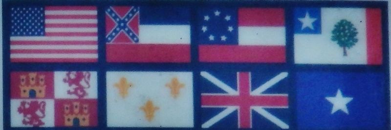
Jackson County has seen many governments. The first European settlement in the Mississippi gulf coast area was at present-day Ocean Springs in 1699. The French found the area already occupied by several American Indian tribes, with the primary . . . — — Map (db m117281) HM
In tribute to
the courageous men and women
of Jackson County, Mississippi,
who fought in World War II
for the democratic ideals
which we hold so dear. — — Map (db m102311) WM
On Shortcut Road 0.1 miles east of Hospital Road when traveling east.
Front
The Mississippi Gulf Coast Blues & Heritage Festival, one of the longest running blues festivals in the Deep South, was founded in 1991 by the Mississippi Gulf Coast Blues Commission, Inc. At the Mississippi Coast Coliseum in . . . — — Map (db m102158) HM
On Main Street (Mississippi Route 613) near Robinson Avenue.
Born in Escatawpa, Mississippi on September 18. 1930.
Killed in action June 7, 1951
Entered service in Galveston, TX. G.O. Number 15, Feb. 1. 1952.
Citation (Posthumous Award) Near Pachi-Dong, Korea PFC Hanson, as a machine gunner with . . . — — Map (db m289314) HM
On Beach Boulevard west of Buena Vista Street, on the left when traveling west.
William Faulkner (1897-1962) is considered one of the great Southern writers. Faulkner is traditionally associated with northern Mississippi. For much of his life, Oxford, Mississippi was his home, and many of his stories were set in his fictional . . . — — Map (db m122540) HM
On Park Road west of Brunkhurst Avenue, on the right when traveling north.
Captain William Boone, the nephew of the famous Daniel Boone, is thought to have been the first white settler in Jackson county, having arrived shortly after Lewis and Clark discovered Tower Rock. William Boone's son, Benningen, was the first white . . . — — Map (db m180340) HM
On South 10th Street at Chestnut Street, on the left when traveling north on South 10th Street.
The first coal mine in Illinois was located one-half mile south of here along the south bank of the Big Muddy River. William Boone and his indentured servant, a man named Peter, loaded a small raft with coal from an outcropping and, after floating . . . — — Map (db m160955) HM
Near North Blackford Street near Indianapolis Cultural Trail, on the right when traveling north.
The Jackson Washington State Forest offers spectacular vistas of wooded hills and filled fields. The tranquility was disrupted in the fall of 1866 when the nation's first train robbery took place near Seymour. The Reno Gang, who lived in Jackson . . . — — Map (db m238780) HM
Near East Walnut Street (County Highway 202) 0.2 miles east of North Highway 123 Byway.
A San Jacinto Veteran • Born in Georgia, February 14, 1807 Died December 14, 1890 His Wife Jane Johnson Dale Born in Ohio, August 3, 1821 Died June 17, 1896 — — Map (db m239512) HM
On Lexington Avenue near Main Street, on the right when traveling west.
The Battle of Independence was fought at this and other locations on Aug. 11, 1862. On that day, a force of Confederate soldiers launched a dawn surprise attack on the Union garrison stationed at Independence and compelled it to surrender. It was . . . — — Map (db m34924) HM
On South Main Street at Water Street, on the right when traveling north on South Main Street.
The overland route linking St. Charles with the future sight of Fort Osage in present-day Jackson County was likely the earliest trail used by American settlers heading west. On its eastern end the trail passed in the vicinity of the later towns of . . . — — Map (db m124814) HM
On Delmas Avenue west of Canty Street, on the right when traveling west.
Today's downtown Pascagoula used to be the town of Scranton, Mississippi, until the two towns merged in 1912. The early history of the area was marked by two fires in 1921 that leveled the downtown area.
A new fire hall was built in 1925 . . . — — Map (db m117278) HM
When did it start?
Almost as soon as European colonists arrived in the 1600s, conflict arose with Indian tribes. For the next 300 years, numerous conflicts and wars took place throughout the present-day continental United States. . . . — — Map (db m268155) HM
Near East Broad Street east of First Street, on the right when traveling east.
In 1783 the Oconee River basin was the western boundary of the new United States of America. The first U.S. frontiersmen included surveyors, mapmakers, native guides, and naturalists.
To entice farmers to the new territory, the U.S. . . . — — Map (db m206381) HM
On Beach Boulevard east of Hague Street, on the right when traveling east.
Jackson County, being on the Confederate side during the American Civil War, suffered numerous incursions by Union forces. However, it was the one of April 9, 1863, which, although small by combat standards, had far-reaching import to Union . . . — — Map (db m102301) HM
On Cypress Street west of Pascagoula Street, on the right when traveling west.
Round Island is located in the shallow Mississippi Sound only 3 miles offshore of the entrance to the Pascagoula River. By the early 19th Century increasing coastal commerce had made the need for a lighthouse critical. This first Round Island . . . — — Map (db m102363) HM
Near Beach Boulevard 0.3 miles west of Hague Street.
Jackson County is known for shipbuilding. Early settlers hand-crafted utility, fishing and local transportation boats to one-of-a-kind designs, but World War I saw explosive development of a modern industry. Dierks-Blodgett in Pascagoula, and . . . — — Map (db m102361) HM
On Delaware Street at U.S. 24, on the left when traveling north on Delaware Street. Reported missing.
Side A:
Independence, famed "City of the Trails," was for two decades the starting point of the great western trade and travel routes to Santa Fe, Oregon, and California. Settled mainly by Southerners on land ceded the U.S. by the Osage . . . — — Map (db m44323) HM
On South Logan Avenue south of East Main Street (Illinois Route 13), on the right when traveling north.
The first memorial service in Illinois, and one of the first in the nation, to honor those who had died in the Civil War, took place at Woodlawn Cemetery on April 29, 1866. On that day, a group of more than 200 veterans gathered at the old "Blue . . . — — Map (db m163493) HM
On Shawnee Mission Parkway near Melrose Lane, on the right when traveling east.
The Santa Fe Trail went through two decades of change in the Kansas City area before evolving into it's final form by about 1840. In the early years of that decade it also became the route of the Oregon Trail and California Trail.
1821 - . . . — — Map (db m50679) HM
On Iberville Drive east of Ames Avenue, on the left when traveling east.
Marble Springs Park History
Sawmill Operators, James Lynch and Reverend P.P. Bowen (Tidewater Baptist Church) first discovered the mineral springs on the south bank of Old Fort Bayou in 1852 after noticing a small stream which left some . . . — — Map (db m290182) HM
On 1st Avenue at Porter Avenue, on the right when traveling north on 1st Avenue.
It is fascinating to look over the population figures through
the decades of Ocean Springs' history and growth.
The following population figures are from Federal Census counts,
and from calculations by regional historian Ray Bellande,
as . . . — — Map (db m290289) HM
On Main Street north of East 2nd Street, on the right when traveling north.
On June 26, 1804 the Lewis & Clark Expedition known as President Jefferson's Corps of Discovery passed this place on their way west.
In 1825, treaties with the Kaw and Osage Indians opened up for settlement an area between Fort Osage to the . . . — — Map (db m252086) HM
Thin black lines indicate changes in relevance. Between each pair of lines entries are ordered geographically but all have the same relevance.
* Inflectional forms of words are their plurals, singulars, and possessives as well as gramatical tenses and similar variations.