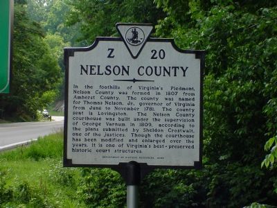
On Rockfish Gap Turnpike (U.S. 250) east of Afton Mountain Road (Virginia Route 6), on the right when traveling west.
Albemarle County. Albemarle County was formed in 1744 from Goochland County and named for William Anne Keppel, the second Earl of Albemarle, titular governor of Virginia from 1737 to 1754. A portion of Louisa County was later added to . . . — — Map (db m4030) HM
Near Three Notched Mountain Highway (U.S. 250) 0.9 miles north of Interstate 64, on the left when traveling north.
The Blue Ridge Tunnel was constructed between 1849 and 1859 beneath Rockfish Gap in the Blue Ridge Mountains of central Virginia. The tunnel first opened in 1858 to allow rail access through Afton Mountain. It was designed by French immigrant . . . — — Map (db m172945) HM
On Blue Ridge Tunnel Trail just west of Afton Depot Lane, on the left when traveling west.
The Blue Ridge Tunnel was constructed between 1849 and 1859 beneath Rockfish Gap in the Blue Ridge Mountains of central Virginia. The tunnel first opened in 1858 to allow rail access through Afton Mountain. It was designed by French immigrant . . . — — Map (db m170605) HM
On Thomas Nelson Highway (U.S. 29) east of State Route 6, on the right when traveling west.
Nelson County. In the foothills of Virginia’s Piedmont,
Nelson County was formed in 1807 from Amherst County. The county was named for Thomas Nelson, Jr., governor of Virginia from June to November 1781. The county seat is Lovingston. The . . . — — Map (db m44042) HM
On Patrick Henry Highway (Route 151) north of Warrick Barn Road, on the right when traveling south.
Nelson County. In the foothills of Virginia's Piedmont, Nelson County was formed in 1807 from Amherst County. The county was named for Thomas Nelson Jr., governor of Virginia from June to November 1781. The county seat is Lovingston. The . . . — — Map (db m295854) HM
On James River Road (State Highway 56), on the right when traveling north.
Buckingham County. Buckingham County was formed from Albemarle County in 1761. The county seat is Buckingham, originally known as Maysville. In 1822 a courthouse, Virginia's first temple-form porticoed courthouse, was constructed there based . . . — — Map (db m31757) HM
Near Patrick Henry Highway (Virginia Route 151) 0.4 miles south of Firehouse Road ( Route 675), on the left when traveling south.
On the night of August 19th, 1969, Hurricane Camille passed over a sleeping Nelson County, forever changing the land and the people who lived here. The storm initially made landfall in Mississippi and weakened as it headed inland, thus forecasters . . . — — Map (db m92927) HM
On Blue Ridge Tunnel Trail 0.1 miles west of Afton Depot Lane, on the right when traveling west.
At the close of the eighteenth century, Virginia stretched from the Atlantic Ocean to the Ohio River. The coastal plain, Piedmont, Blue Ridge Mountains, and Alleghany Mountains lay between, with the James River running east to west. From the . . . — — Map (db m170607) HM
On Louisville/Bardstown Road (U.S. 31E/150) 0 miles north of Wheeler Wright Lane, on the right when traveling north.
The first settlement in Nelson County, KY. Three miles east of this spot stood Cox's Station, established in 1775 by Colonel Isaac Cox, a Colonial and Revolutionary War officer who came from Virginia to Kentucky and who was killed by the Indians in . . . — — Map (db m74267) HM
On Beechland Road (Kentucky Route 438) at Lincoln Park Road ( Route 528), on the left when traveling east on Beechland Road.
Pioneer Spirit
The westward movement was an enticement felt by many nineteenth century families, and the Lincolns were in the heart of it. A friend of the family was the infamous frontiersman Daniel Boone, and it has been reasoned that . . . — — Map (db m46249) HM
On Blue Ridge Tunnel Trail 0.4 miles west of Afton Depot Lane, on the right when traveling west.
Chief engineer Claudius Crozet divided the Blue Ridge Railroad into sixteen construction sections, but not all at once. Section one was the Blue Ridge Tunnel and 1,000 feet beyond each portal. Sections two, three and four moved east from Nelson . . . — — Map (db m170628) HM
Nelson County's most famous musician, Jimmy Fortune, was inducted into the Virginia Music Hall of Fame in 2018. He toured with the legendary Statler Brothers for 21 years, during which time he wrote several songs for the group including three . . . — — Map (db m233030) HM
On Thomas Nelson Hwy (Virginia Route 29) at Cooperative Way, on the right when traveling south on Thomas Nelson Hwy.
In 1803, the Virginia General Assembly established Cabellsville one mile west of here on the Old Stage Road, on 25 acres owned by Congressman Samuel Jordan Cabell. The village was platted before Nelson County was formed from Amherst County in 1807, . . . — — Map (db m18829) HM
On Crabtree Falls Highway (State Highway 56) at Dickie Road (State Route 666) on Crabtree Falls Highway.
One mile from here is "Level Green," the home of Major Thomas Massie (1747-1834). Commander of the Sixth Virginia Regiment of Infantry, later Aide to Governor Thomas Nelson at the siege of Yorktown, and one of the first magistrates of Nelson County . . . — — Map (db m40720) HM
On Rose Hill Drive at Henry Avenue, on the left when traveling north on Rose Hill Drive.
The City of Charlottesville and Albemarle County opened Jackson P. Burley High School in Sept. 1951 to serve nearly 550 African American students. The 26-classroom building reflected an effort to provide "separate but equal" facilities in an era . . . — — Map (db m246901) HM
Near George Collin Parkway (County Route 305), on the right when traveling south.
In front of you is one of only two monuments erected by veterans of the battle. This one was placed by members of Woodson’s Company of Missouri Cavalry. The unit followed perhaps the strangest path to this field of conflict.
Captured in . . . — — Map (db m13197) HM
On Richmond Highway (U.S. 60) west of Pidemont Road, on the left when traveling east.
Nelson County. Area 473 Square Miles. Formed in 1807 from Amherst, and named for General Thomas Nelson, Governor of Virginia, 1781. Oak Ridge, an old home, is in this county.
Amherst County. Area 470 Square . . . — — Map (db m86235) HM
On Crabtree Falls Highway (State Highway 56) just south of Dickie Road (State Route 666).
Hurricane Camille struck central Virginia in August 1969, and many Nelson County people lost their lives and homes. Communities situated on riverbanks such as Massie's Mill on the Tye River were hardest hit. This park is dedicated to their memory. . . . — — Map (db m40722) HM
Near Three Notched Mountain Highway (U.S. 250) 0.8 miles north of Interstate 64, on the left when traveling north.
Dr. Robert Sumter Griffith's life involved railroads. Even the fact that he practiced medicine in Waynesboro is because of the railroad. The popular physician, never seen without his round wire spectacles and his trademark western bowtie, was born . . . — — Map (db m237790) HM
On Rockfish Gap Turnpike (U.S. 250) at Skyline Drive and Blue Ridge Parkway, on the right when traveling east on Rockfish Gap Turnpike.
Nelson County. Nelson County was named for Thomas Nelson, Governor of Virginia from June to November, 1871. It was formed in 1807 from Amherst County. Oak Ridge, birthplace of William Cabell Rives and later the residence of Thomas Fortune . . . — — Map (db m21701) HM
Nelson County Courthouse
Erected 1809
Placed by Board of Supervisors
Honoring American Bicentennial
1776 - 1976
September 1974
Nelson County Courthouse
has been registered as a
Virginia
Historic
Landmark . . . — — Map (db m179867) HM
Near Kenneth Jones Drive just west of Montgomery Avenue, on the left when traveling west.
"I give and bequeath to my beloved wife Ann M. Peyton...four negro men and four negro women to be selected by herself from all I may own..." Will of John Howe Peyton
Remembering their Humanity
The dehumanizing nature of . . . — — Map (db m282982) HM
Thin black lines indicate changes in relevance. Between each pair of lines entries are ordered geographically but all have the same relevance.
* Inflectional forms of words are their plurals, singulars, and possessives as well as gramatical tenses and similar variations.