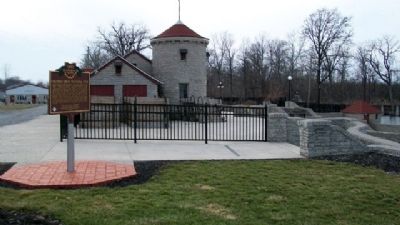
On Local Road 8P 0.2 miles south of State Route 12, on the right when traveling south.
The construction of Putnam County's first public swimming pool helped Columbus Grove weather the Great Depression of the 1930s. President Franklin D. Roosevelt's Works Progress Administration (WPA) and the Village of Columbus Grove planned the pool . . . — — Map (db m28616) HM
On Broad Street (Ohio Route 115) at Napoleon Street ( Route 115), on the left when traveling north on Broad Street.
Side A:
Described as a Columbus "institution" when he died in 1969, Emerson C. Burkhart was born on a farm in Union Township, Putnam County in 1905. The son of Albert and Nora Burkhart, Emerson graduated from Kalida High School in 1924 and . . . — — Map (db m28597) HM
On 4th Street at Main Street, on the right when traveling north on 4th Street.
Side A: First Putnam County Government Seat
February 19, 1829, an appointed Ohio Legislative Commission granted 160 acres of the southwest quarter of Section 5, Town 1 south, range 6 east for a government seat to Commissioners Thomas Gray, . . . — — Map (db m29937) HM
On East Main Street at Broad Street, on the left when traveling east on East Main Street.
Early gatherings of the Putnam County Pioneer Association were held in various villages, but the annual Kalida "Pioneer Day" was established in the by-laws as the first Saturday in September. The meeting drew people from throughout the county to . . . — — Map (db m227877) HM
On West Main Street (U.S. 224) just west of South Walnut Street, on the left when traveling west.
[Front Side]:
The Ottawa, or "Tawa" Indians had inhabited the Maumee Valley since the middle of the 1700s. By the 1790s, Ottawa settlements included villages along the Blanchard River at the present-day Village of Ottawa. During the War . . . — — Map (db m21570) HM
On E. Main Street east of W. Canal Street, on the left when traveling east.
Construction began July 1825, opening navigation between Cincinnati and Toledo, Ohio in 1845 and encouraging settlement in the Black Swamp.
Built in segments, the Canal extended 248.8 miles, joining the Ohio River and Lake Erie. The segment . . . — — Map (db m69005) HM
The Samuel Myers, Sr. Grist Mill 1834-1860 After Christmas Day 1833, Samuel Myers, Sr., a native of Hagerstown, Maryland, and Margaret (Hardin), first couple wed in Putnam County, moved ito their log home on the Auglaize River west bank. Because . . . — — Map (db m79559) HM
On Ohio Route 114 at Route 694, on the right when traveling north on Ohio Route 114.
Home in the wilderness 1821-1870. Built in 1821 downstream a quarter mile on the Auglaize west bank by Sebastian Sroufe, War of 1812 veteran, and wife Mary, this home was postal stop Sugar Grove on the Ft. Recovery-Ft. Defiance route and in 1828, . . . — — Map (db m79533) HM
On Broad Street just north of East Main Street, on the right when traveling north.
In 2013, Oscar Velasquez, Putnam County native and well known national artist, was commissioned to paint this mural. Pioneer Days, Ohio's oldest festival, dates back to the establishment of the Putnam County Pioneer Association in 1873. History . . . — — Map (db m188570) HM
On County Route 5, on the left when traveling north on County Route 5. Reported permanently removed.
John Crawfis, Fairfield County, Ohio native, and wife Sarah (Moorehead) bequeathed two grants of $25,000 and five acres for schools in Fairfield and Putnam counties in Ohio in 1880.
Constructed in 1889, Crawfis College, Putnam County, a . . . — — Map (db m283552) HM
Near Winfield Road (West Virginia Route 817) north of Ventroux Road, on the right when traveling north. Reported unreadable.
The 1861 Kanawha Valley Campaign
Union and Confederate leaders both wanted control of the Kanawha Valley, an approach to the Confederate capital at Richmond, Virginia, filled with such important resources as salt and soldiers, whose loyalty . . . — — Map (db m268902) HM
On South Vine Street at East Washington Street (U.S. 231), on the right when traveling south on South Vine Street.
The name Indiana means “Land of the Indians”. For untold centuries, some say millennia, the Indians moved across the land. It was their hunting ground. Permanent Indian settlements in Indiana were to the north and to the south. And then . . . — — Map (db m56396) HM
On Kanawha Valley Road (U.S. 35) 0.9 miles north of Anderson Hollow Road (County Road 17/1), on the right when traveling south.
Putnam County. Formed in 1848 from Cabell, Mason and Kanawha. Named for Gen. Israel Putnam, a Revolutionary War hero. The county is cut by trails made by American bison to the Ohio River. Its oldest town, Buffalo is named for them.
Mason . . . — — Map (db m178695) HM
On Cross Lanes Drive (West Virginia Route 62) just north of Melton Avenue, on the right when traveling south.
Kanawha County. Authorized, 1888; organized 1789 from Greenbrier and Montgomery. Named for the Kanawha River, bearing name of Indian tribe. Salt making brought early settlers into the valley and from it grew vast modern chemical plants.
. . . — — Map (db m85987) HM
On Winfield Road (West Virginia Route 817) 0.4 miles north of Tompkins Crossing Road, on the right when traveling north.
Putnam County. Formed in 1848 from Cabell, Mason, and Kanawha. Named for Gen. Israel Putnam, a Revolutionary War hero. The county is cut by trails made by American bison to the Ohio River. Its oldest town, Buffalo, is named for them. . . . — — Map (db m178696) HM
Near West Jefferson Street west of North Main Street (Indiana Route 9), on the right when traveling west.
1. Robert Adams 1783-1854 Reared in Putnam County, New York. Raised family in Delaware County, Ohio; moved to Whitley County in 1838, buying land for $2.50 an acre. Seven children Lewis, Allen, Levi, Rachel, Eliza (Hartstock), Zillah (Thinkham), . . . — — Map (db m226588) HM
On Stoneleigh Road (County Route 35) at Drewville Road (County Route 36), on the right when traveling south on Stoneleigh Road.
Hopkins Corners
Homestead of Addison J. Hopkins was in this area in the 1800's. Descendant of Stephen Hopkins, signer of the Mayflower Compact and Joseph Hopkins of Cape Cod one of Carmel's original settlers.
Placed here by Richard C. Hopkins . . . — — Map (db m37529) HM
Dedicated to
Captain Sheldon O. Hall
8/17/1919 - 12/4/2012
Putnam County, Ohio's Only
World War II Flying Ace Pilot
Capt. Sheldon O. Hall, U.S. Marine Air Corps,
Fighter Squadron VMF 213, Guadalcanal, South Pacific,
Plane . . . — — Map (db m196146) WM
On N. Locust Street, on the right when traveling north.
May 29, 1929- The first night game in Putnam County
took place at Beutler Field, on Ottawa's Northwest end
near the St. Rt. 224 bridge crossing. American Athletic
Girls baseball team set up their $20,000 light plan of
50,000 candle power and . . . — — Map (db m200272) HM
Near Main Street north of Rices Landing Road (County Route 1010), on the left when traveling north.
Coal Seam
The Pittsburgh Coal Seam is the thickest and most extensive coal bed in the Appalachian Basin. The Upper Pennsylvanian Pittsburgh coal bed extends over 11,000 square miles through 63 counties. It extends from Allegany County, . . . — — Map (db m182022) HM
On Courthouse Drive at Emergency Lane / Sabre Street, on the right when traveling south on Courthouse Drive.
A Microcosm
Historians use the word microcosm as shorthand to show that a piece is
representative of the whole. “A house divided against itself,” Putnam
County sent approximately 10% of its population to war, nearly half to . . . — — Map (db m137355) HM
On Lafayette Street (West Virginia Route 62) at High Street, on the right when traveling north on Lafayette Street.
Chartered in 1837, the town of Buffalo predates the formation of Putnam County in 1848. Possibly named
after the nearby Big Buffalo Creek, the town was from its beginnings inextricably tied to river trade and
to agriculture. In its early days, . . . — — Map (db m137327) HM
On West Virginia Route 34 east of Sycamore Road (County Route 50), on the right when traveling east.
Lincoln County. Formed in 1867 from Cabell,
Kanawha, Boone and Putnam.
Named for Abraham Lincoln,
the sixteenth president of the
United States. Producer of oil,
gas and coal. Also noted for
high quality of tobacco grown
on its . . . — — Map (db m178199) HM
On Charleston Road (U.S. 119) south of River Road (Local Route 34), on the left when traveling north.
The Pocatalico River keeps alive the Indian word which meant “Plenty of Fat Doe.” Here early hunters and trappers brought their furs and by canoe made their way down this stream to Great Kanawha River and markets. — — Map (db m137923) HM
Thin black lines indicate changes in relevance. Between each pair of lines entries are ordered geographically but all have the same relevance.
* Inflectional forms of words are their plurals, singulars, and possessives as well as gramatical tenses and similar variations.