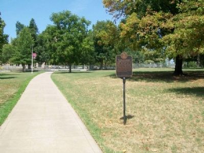
On Dickson Street at Arkansas Avenue, on the right when traveling west on Dickson Street.
The University of Arkansas came into being under the Morrell Land-Grant College Act of 1862, through which federal land sales established colleges devoted to “agriculture and mechanic arts,” scientific and classical studies, and . . . — — Map (db m59913) HM
Near East Rock Street west of Walker Road, on the right when traveling west.
David Walker was born Feb. 19, 1806, near Elkton,
Ky. He moved to Arkansas in 1830, earning his
law license and settling in Fayetteville. Walker
was elected circuit prosecutor in 1832, then to
the Arkansas territorial legislature in 1835. . . . — — Map (db m224142) HM
On North Winslow Boulevard at Main Street, on the left when traveling north on North Winslow Boulevard.
This 1882 Date Stone was removed from the South Portal of the original Winslow Tunnel. The tunnel was completed on August 30, 1882, as part of the Frisco rail line. Due to reconstruction to
accommodate larger trains in the late 1960's, the stone . . . — — Map (db m309530) HM
On Wilson Park Trail north of North Park Avenue, on the left when traveling north.
As early as 1906, Wilson Park, Fayetteville's original City Park, was first owned, maintained and operated privately by civic-minded A. L. Trent. Each spring, Trent's Pond, now used as a softball field on the east side of the park, was used by . . . — — Map (db m224241) HM
On Dunn Avenue south of West 11th Street, on the right when traveling south.
Lynching in America. Before the Civil War, millions of African people were kidnapped, enslaved, and shipped across the Atlantic to the Americas under horrific conditions that frequently resulted in starvation and death. Over two centuries, . . . — — Map (db m258636) HM
Legendary high school football coach Wilson Matthews was indispensable to the Razorbacks as an assistant coach in building a highly successful football program. Later, as an administrator, he was instrumental in establishing and developing the . . . — — Map (db m306059) HM
On Center Street at East Avenue, on the left when traveling west on Center Street.
The earliest known inhabitants of the hardwood forest of the Ozarks migrated to Arkansas over 12 thousand years ago through the Great Bering Strait. For the next two thousand years Bluff Dwellers hunted the mountain plateaus before the Quapaws, . . . — — Map (db m59882) HM
On East Douglas Street (U.S. 62), on the right when traveling west.
The circular stone wall that encloses the Battle Monument is built of stones from historic structures of Washington County. Some 40 communities are represented, including the pioneer settlements at Cane Hill, Cincinnati, Viney Grove, Rhea's Mill, . . . — — Map (db m35360) HM
On Central Avenue (State Highway 7) just south of Spring Street, on the right when traveling north.
The Miss Arkansas Pageant has been held in Hot Springs since 1958 and is regarded as one of the top five state pageants. In 1964, Donna Axum became Arkansas’s first Miss America. Her homecoming to Hot Springs included a parade down Central Avenue . . . — — Map (db m264290) HM
On North Main Street (Business U.S. 65) at West Rush Avenue, on the right when traveling south on North Main Street.
Modern historical research has yielded information which was not readily available to those who designed the 1955 monument. Here is presented updated information and a modified more accurate map of the emigrants' route. Dedicated . . . — — Map (db m225248) HM
On East Main Street at South Lincoln Street, on the right when traveling west on East Main Street.
Battery B 2d Battalion 142d Field Artillery
Honoring those who served in Operation Desert Shield/Desert Storm
Nov. 1990 - May 2001
Commander Cpt. Commerford, J. B.
Executive Officer 1Lt. Huey, Eddie G.
Fire Direction Officer 2Lt. . . . — — Map (db m309919) WM
On Center Street at East Avenue, on the left when traveling west on Center Street.
Near this spot a flag was presented to the First Confederate Company organized in Washington County Co. E, 2nd Cavalry Reg’t Arkansas Volunteers Capt. T.J. Kelly May 1861 — — Map (db m59902) HM WM
With his Empresario contract in hand, Stephen F. Austin searched out a suitable location for the "capital" of his colony. Together with surveyors and guides, Austin selected a site where a ferry crossed the Brazos River. By late October . . . — — Map (db m206331) HM
Near North Street (Business U.S. 59) north of Griffith Boulevard, on the right when traveling north.
Republics often point to one person whose vision and leadership led to their creation. For the Republic of Texas (1836-1845) that person is Stephen Fuller Austin.
Austin, the son of Moses and Maria Brown Austin, was born on the Virginia . . . — — Map (db m313281) HM
On College Road near McClellan Road, on the left when traveling north. Reported permanently removed.
As James Blunt's First Division of the Army of the Frontier massed in front of the Confederate artillery at the Cane Hill Cemetery, General John Marmaduke ordered J.O. Shelby's Rebels to (unreadable) through the hamlet of Boonsboro. As the . . . — — Map (db m261490) HM
On Jackson Place north of McClure Avenue (County Road 923), on the left when traveling north.
The Old Wire Road at Mudtown was used by the
Butterfield Overland Mail Co. and both Union and
Confederate soldiers during the Civil War. In
February 1862, Union troops ate food left behind
at a Confederate camp and were sickened. Some
died, . . . — — Map (db m224817) HM
On Center Street at East Avenue, on the left when traveling west on Center Street.
Significant dates in Fayetteville history include: Incorporated town in 1836; Old Wire road from Jefferson City, Mo. to Ft. Smith cut in 1835; Washington County Fair first held on the Square in 1856; first telegraph installed around 1860; . . . — — Map (db m59877) HM
On West Dickson Street east of North University Avenue, on the right when traveling east.
Designed by Euine Fay Jones as the home for Underwood's Jewelers founded in 1957 by William G. Underwood, CG. Fay Jones was named by the AIA as one of the 10 most influential living architects and in 1990 was awarded the AIA Gold Medal, the highest . . . — — Map (db m224243) HM
Near East Munyon Road (County Road 442) 0.3 miles south of State Route 45, on the left when traveling south.
First public cemetery for
Washington County Arkansas
has been placed on the
National Register
of Historic Places
by the United States
Department of the Interior
c. 1830 — — Map (db m225062) HM
Near East Munyon Road (County Road 442) 0.3 miles south of State Route 45, on the left when traveling south.
This is the site of
the first church established
in Washington County Arkansas
Bethlehem
Methodist-Episcopal
Church South
established April 17th, 1827 — — Map (db m225061) HM
On College Street west of Church Avenue, on the right when traveling west.
This Ante-Bellum Home was built on land granted to Washington County by an Act of Congress to build a court house, entitled “An Act for the Relief of Fayetteville, in the Territory of Arkansas,” and signed June 26, 1834 by . . . — — Map (db m59911) HM
Near West Mount Comfort Road west of Rupple Road, on the right when traveling west.
After the Aug. 10, 1861, Battle of Wilson's Creek,
Mo., four of Washington County's first Confederate
war dead – Capt. S.R. Bell, Sgt. Wm. Brown, Pvt.
Henry Fulbright and Pvt. Samuel McCurdy – were
buried in Mount Comfort Cemetery. The . . . — — Map (db m224775) HM
On Cemetery Circle, on the right when traveling east.
In memory to those soldiers
who fought for American
Independence during the
Revolutionary War.
These veterans of the
American Revolution came to
live and died in Northwest
Arkansas
Benton County . . . — — Map (db m21227) HM WM
Near Dutch Mills Road North (County Road 419) north of Dutch Mills Road (County Road 418), on the left when traveling north.
R. L. Leach
Grocery Store,br>
Dutch Mills, AR
has been placed on the
National Register
of Historic Places
by the United States
Department of the Interior
Circa 1925 — — Map (db m302949) HM
Pathway to a Political Future
Born near Greenville, South Carolina, January 26, 1790, Daniel Dunklin moved first to Kentucky and then to Missouri, settling with his widowed mother at Mine-a-Breton, near Potosi, in 1810. Dunklin studied law . . . — — Map (db m248681) HM