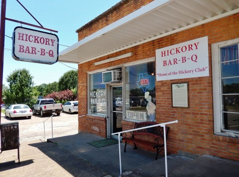
On East Sam Rayburn Drive (State Highway 56) east of North Center Street (State Highway 78), on the right when traveling east.
Texas Ranger, T.C. Robinson once described him, “He kills men just to see them kick. He can take two six shooters and turn them like wheels in his hands and fire a shot from each at every revolution.” Others have described Fannin . . . — — Map (db m128660) HM
On North Main Street at West Sam Rayburn Drive, on the left when traveling north on North Main Street.
The first influx of settlers into the area now known as Fannin County began in the early winter of 1836 when Dr. Daniel Rowlett brought ten families up Red River to a site about 16 miles northeast of present day Bonham. Because of the ease of river . . . — — Map (db m234067) HM
On North Main Street at West 6th Street, on the left when traveling north on North Main Street.
Probably the most colorful and altogether mysterious figure of the Red River Valley was a man named Thomas C. Bean. Bean's death in 1887 "about 70 years of age" set off untold numbers of lawsuits by bogus heirs to his estate, claiming literally . . . — — Map (db m234061) HM
On North Kentucky Street south of West Virginia Street, on the left when traveling south.
Formed from Fannin County Created April 3, 1846 Organized July 13, 1846 Named in honor of Collin McKinney 1766-1861 Land surveyor Signer of the Texas Declaration of Independence Member of Congress, Republic of Texas Member of the Texas . . . — — Map (db m171047) HM
On East Sam Rayburn Drive (State Highway 56) at North Main Street on East Sam Rayburn Drive.
In 1848, a young graduate of Indiana Medical College arrived in Bonham with his wife and young son, seeking new horizons and a place to practice his medical profession. Dr. Eli S. Penwell constructed a building on the south side of the Bonham square . . . — — Map (db m234078) HM
On North Center Street at East Sam Rayburn Drive, on the right when traveling north on North Center Street.
Even twenty years after the close of the Civil War, a certain lawlessness reminiscent of frontier days still prevailed in areas of Texas. This was the age of the western gunfighter and numerous Texas feuds. This nation seemed to be in a state of . . . — — Map (db m234135) HM
On North Main Street at West 5th Street, on the right when traveling north on North Main Street.
This area was first settled by Anglo - Americans who traveled up the Red River by steamboat in 1836. Fannin County was created in 1837, organized 1838, and named for James W. Fannin (1805-36), who was massacred with his soldiers at Goliad (March 27, . . . — — Map (db m96688) HM
On Founders Oak Way at Pennington Ln., on the right when traveling east on Founders Oak Way.
Born in Fannin County, Texas, during the Republic of Texas period, John Parker Pennington (1840-1904), lived as a young man in Arizona territory. As a member of one of the first families to settle in the territory he survived several deadly . . . — — Map (db m201945) HM
On Cemetery Road north of Brammer Road, on the right when traveling north.
Georgia native George Lawson Bledsoe (b. 1805), a carpenter and cotton gin builder, came to Texas in 1834. A veteran of the Texas Revolution and the Battle of San Jacinto, he received a pension for his military service and patented land grants in . . . — — Map (db m183376) HM
On West 5th Street at North Main Street, on the right when traveling west on West 5th Street.
Longtime Bonham residents well remember that this corner (intersection of North Main & Fifth Streets) was for a time the most popular spot in Bonham. The corner became the focal point for riders on "Dummy" the affectionate nickname of Bonham's lone . . . — — Map (db m234140) HM
On East Center Street (State Highway 78) at East 5th Street, on the left when traveling north on East Center Street.
The oldest of Bonham's two premiere opera houses was constructed on this site in 1874. Home to many locally produced productions, this facility was also the site of many performances from the popular traveling companies of the era. One such . . . — — Map (db m234137) HM
Came to Texas 1836. Caused Fannin County to be created, 1837. Served as congressman, Republic of Texas, 1837-38, 1839-40, 1843-44. Helped (1840) organize Constantine Lodge No. 13, A.F. & A.M., and was its first Worshipful Master. Was most versatile . . . — — Map (db m234167) HM
On East 10th Street east of Chestnut Street, on the left when traveling east.
Formally chartered in 1881, Carlton College began under the direction of Charles Carlton (1821-1902) as the Bonham Female Institute. Carlton, a native of England and a Disciples of Christ minister, had come to Bonham in 1867 to take charge of the . . . — — Map (db m306535) HM
On North Center Street at East 5th Street, on the right when traveling north on North Center Street.
Although the Civil War was raging far from the Red River Valley in 1863, certain events occurred to remind the citizens of Bonham of the blood being shed by many of its young men. The most compelling of the events concerned Captain William C. . . . — — Map (db m234136) HM
On East Sam Rayburn Drive at Center Street, on the right when traveling east on East Sam Rayburn Drive.
As the Bonham business community neared the end of the nineteenth century, nearly all the traces of its frontier past had disappeared. The arrival of the Texas and Pacific Railway in 1873 helped stimulate a diversity of retail enterprises around the . . . — — Map (db m234133) HM
On Fannin Street, on the right when traveling north.
Virginia native Edward Thomas Branch came to Texas in 1835 and settled in Liberty. As a First Sergeant in the Texas Volunteers, he participated in the Battle of San Jacinto, and remained in the army as a Second Lieutenant until October 1836. He . . . — — Map (db m243127) HM
On State Highway 78 0.1 miles north of County Road 2005, on the right when traveling north.
Joseph Sowell In September 1836, Joseph Sowell (1804-1841) came to Texas shortly after the republic was established. Settling on his 1280-acre land grant just south of the Red River, Sowell made his home about 1.5 miles northwest of this site.
In . . . — — Map (db m119511) HM
On S Ferguson Pkwy (County Road 367) 0.1 miles south of W White Street, on the right when traveling south.
In the 1850s, North Texas attracted settlers from border states like Kentucky with the promise of inexpensive land for farming and stock raising. One such man was Dr. William Dixon Lair (1814-1887), a pioneer physician, former Kentucky state . . . — — Map (db m309928) HM
On Travis Street south of Houston Street (Texas Highway 56), on the left when traveling north.
In the mainstream of Texas history for more than a century, this area was, in 1837, the site of Colonel Holland Coffee's trading post, a landmark structure at the Preston Bend crossing of the Red River.
It was a focal point, beginning in . . . — — Map (db m73242) HM
On Farm To Market Road 1553 0.7 miles north of County Road 4800, on the right when traveling north.
The earliest settler in this area was George W. Smith, a native of Georgia, who moved here in 1844. By the early 1850s, a community had developed and a post office was established under the name Oak Hill. The first church, a Baptist congregation, . . . — — Map (db m307274) HM
On Post Oak Drive at Creekside Drive, on the right when traveling north on Post Oak Drive.
Originally part of the Republic of Texas’ Fannin County, Denton County was established in 1846, when the first legislature of the State of Texas created and organized thirty-one new counties. Efforts to colonize the area eventually resulted in . . . — — Map (db m309101) HM
On North Main Street at West 6th Street, on the left when traveling north on North Main Street.
Organized at the former county seat of Warren on Nov. 3, 1840, this was one of the earliest Masonic lodges in Texas. Dr. Daniel Rowlett (1786-1848), Fannin County pioneer and Republic of Texas congressman was one of the first officers. The lodge . . . — — Map (db m234000) HM
On East Paris Street (State Highway 34) at East Side Plaza on East Paris Street.
Operating under a dispensation issued in 1853, this organization was formally chartered by the Grand Lodge of Texas in 1854. Wesley C. Walker served as the first Worshipful Master. The membership, like the general population of the area, was . . . — — Map (db m234203) HM
Near River Leagcy Park Trail 0.2 miles west of North Collins Street (Farm to Market Road 157), on the left when traveling east.
In the spring of 1838, Captains Robert Sloan and Nathaniel T. Journey led a group of about 90 northeast Texas frontiersmen on a punitive expedition against the Indians who had raided their homes in present-day Fannin County. The trail led them to . . . — — Map (db m75807) HM
On County Road 214 0.2 miles east of Highway 2481, on the right when traveling east.
A minister in the Primitive Baptist Church, the Rev. Henry Hurley came to Texas in 1844. His years in the state were spent organizing frontier churches and helping pioneers settle in new communities. He established churches in Hunt, Fannin and . . . — — Map (db m248536) HM
On West Sam Rayburn Drive (State Highway 56) at Chinner Street, on the right when traveling west on West Sam Rayburn Drive.
In 1837, Bailey Inglish moved his family to this area from western Arkansas, where he had been an influential leader of pioneer settlers. Here he was active in the formation of Fannin County, serving on the land board and later as chief justice. To . . . — — Map (db m128647) HM
In the cause of independence, raised company of 36 riflemen in his native Kentucky, starting for Texas November 1835. City of San Antonio was liberated by time they arrived. Although an officer, Tarleton fought in the ranks in the victory at San . . . — — Map (db m234166) HM
A native of Alabama, William Chamberlayne Jones migrated to Texas in 1852 and resided near the Monkstown settlement in northeastern Fannin County. Trained as an attorney, he sold his Red River plantation after the Civil War and began studying . . . — — Map (db m163234) HM
On County Road 4550 0.5 miles State Road 11, on the left when traveling east.
Alexander Buchanan (1796-1846), his wife Delilah (1806-1870), and their eleven children moved to the Republic of Texas from Illinois in 1844. They settled on a 320-acre farm at this site in January 1846. Alexander Buchanan died that same year and . . . — — Map (db m263802) HM
On Interstate 30 Frontage Road 0.2 miles west of Division Street, on the right when traveling west.
In the aftermath of the Civil War, plans were enacted for the Reconstruction of the Union with the creation of the Freedmen's Bureau in 1865, and the passages of the Civil Rights Act of 1866 and the Reconstruction Act of 1867. Texas would not . . . — — Map (db m282770) HM
On Farm to Market Road 274 4 miles west of State Highway 78, on the right when traveling west.
Gideon Smith (b. 1815), a native of Alabama, moved to Fannin County in 1851 and purchased a 3000-acre tract. He deeded half of the property to his brother John C. Smith, who joined him in 1855. Gideon smith served one term in the Texas Legislature . . . — — Map (db m203438) HM
On East Sam Rayburn Drive (State Highway 56) west of North Center Street (State Highway 78), on the right when traveling west.
Commissioners’ Court first met at Jacob Black’s cabin on Feb. 26, 1836, before Fannin County was officially organized. In 1838 Warren (near present Ambrose in Grayson County) was named the county seat. The courthouse built there in 1840 was a . . . — — Map (db m128644) HM
On Star Street at West 8th Street, on the left when traveling north on Star Street.
Founded in 1844 in the Republic of Texas by a circuit rider, the Rev. James H. Graham (1815-1884), this church met first in a log cabin, which it shared with Baptist and Presbyterian congregations. Charter members included the families of Bailey . . . — — Map (db m234063) HM
On Lynn Street at East 6th Street, on the left when traveling north on Lynn Street.
County's oldest. Bailey Inglish donated plot near Old Fort Inglish (called Bois d'Arc. Later Bonham).
Pioneers buried here include 1838 Indian massacre victims Andrew Daugherty. Wm. McCarty; 1836 Fannin County colonizers Bailey Inglish and Daniel . . . — — Map (db m234162) HM
On West 7th Street 0.2 miles west of State Highway 121, on the left when traveling west.
Significant for his contributions to the formative years of Bonham and Fannin County, Tennessee native John P. Simpson arrived in Texas about 1837. In that year he signed the petition to create Fannin County and began to farm his land in this area. . . . — — Map (db m233957) HM
On Bonham Street (Texas Route 34) at Richards Street, on the right when traveling east on Bonham Street.
Built 1894 by craftsmen
Martin and Krause for local
merchant, J.B. Haden, and wife
Elizabeth. Remained in Haden
family until 1963.
Cypress construction with
ornate gingerbread trim.
Interior has fine woodwork.
Late Victorian . . . — — Map (db m308527) HM
On State Highway 121 0.1 miles north of County Highway 4236, on the right when traveling north.
Tennessee native Thomas Lindsey (b. 1794) brought his family to this part of Fannin County in 1837. In the late 1840s, Lindsey donated four acres of his farmland for a school and cemetery. The first burial in the cemetery was for one of Lindsey's . . . — — Map (db m233951) HM
On Old Springtown Road south of Sandlin Lane, on the right when traveling south.
William (Bill) Woody (1824-1915), one of the first Anglo settlers in Parker County, was born in Roane County, Tennessee. While living in the eastern Tennessee hills bordering North Carolina, he married Elisabeth Lydia Farmer (1822-1879) in 1846. . . . — — Map (db m192530) HM
On Farm to Market Road 128 at County Road 3500, on the right when traveling east on Farm to Market Road 128.
Early settlers, who came to this area from Giles County, Tenn., founded an academy at this site in 1859, hired fellow-Tennessean Thomas Hart Benton Hockaday (1835-1918) as the first teacher, and named the new school in memory of their southern . . . — — Map (db m311131) HM
On Grayson Drive at Marrett Ave, on the left when traveling west on Grayson Drive.
Plans began in early 1941 for a U.S. Army Air Corps installation to be located in Grayson County. This 1,160-acre site was acquired in June, and Air Corps personnel began arriving in August. The base was to serve as a basic flight training facility. . . . — — Map (db m238003) HM
On Farm to Market Road 121 at Pilot Grove Road, on the left when traveling west on Road 121.
Founded in early 1850's. On Bonham-McKinney stage line. Called Lick Skillet; renamed, 1858 for J.P. Dumas Ranch. Site of Lee-Peacock feud, 1865-1871, between ex-Confederate Capt. Bob Lee with his gold and Union supporter Lewis Peacock. Although Lee . . . — — Map (db m256940) HM
Attracted to the area by its fertile soil, good water supply, and abundant building materials, pioneers from Tennessee, Missouri, Georgia, Arkansas, and Wisconsin settled here in the 1850s. Their colony, located on the Ben Rue Survey, was first . . . — — Map (db m246070) HM
On North Main Street at East 5th Street, on the right when traveling north on North Main Street.
This Monument Dedicated to the Men and Women Who Served Their Country So Gallantly. Particularly Those Who Went From Fannin County
Texas
They Served for a Righteous Cause
Operation
Desert Shield and Desert Storm
Vietnam War . . . — — Map (db m235964) WM
On Bonham Street (Business U.S. 82) at West Kaufman Street, on the right when traveling east on Bonham Street.
Designed as a military highway, intended to make linkage with United States military road built to the north of the Red River in the 1820s.
This was part of the national effort of Republic of Texas to open a good road system. Congress in . . . — — Map (db m303831) HM
On West Sam Rayburn Drive at Willow Street, on the right when traveling west on West Sam Rayburn Drive.
Oldest bank in Fannin County, chartered December 12, 1883.
At that time, county had 25,000 people; farming and industry prospered; a new railroad was being built; seven schools and colleges and three newspapers were in operation.
Growth . . . — — Map (db m234071) HM
On East 5th Street at North Main Street, on the right when traveling west on East 5th Street.
When General Henry McCulloch arrived in Bonham in 1863 to take command of the Northern Sub-District of the Confederate Army, one of his first charges from his superiors was to ferret out the large number of suspected army deserters and possible . . . — — Map (db m234139) HM
Thin black lines indicate changes in relevance. Between each pair of lines entries are ordered geographically but all have the same relevance.
* Inflectional forms of words are their plurals, singulars, and possessives as well as gramatical tenses and similar variations.