By Michael Herrick, November 2, 2010
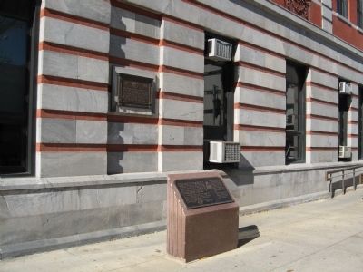
In Affectionate Memory Marker
RANKED BY RELEVANCE
| On Market Street at Main Street, on the left when traveling north on Market Street. |
| On New York State Route 343 0.2 miles north of Randall Road, on the left when traveling south. |
| Near Mansion Street at Civic Center Plaza, on the right when traveling west. |
| Near Parker Avenue (New York State Route 9G) 0.2 miles east of Washington Street ( Route 9G), on the left when traveling east. |
| On Market Street north of Cannon Street, on the left when traveling north. |
| On Empire State Trail (New York State Route 199) west of River Road (County Road 103), on the right when traveling east. |
| On U.S. 6 at Willow Spur, on the right when traveling east on U.S. 6. |
| On Harlem Valley Rail Trail at Under Mountain Road, on the left when traveling north on Harlem Valley Rail Trail. |
| On Griffin Street North (Provincial Highway 20) at West Street (Provincial Highway 20), on the left when traveling north on Griffin Street North. |
| Near Parker Avenue (New York State Route 9G) 0.2 miles east of Washington Street ( Route 9G), on the left when traveling east. |
| On Market Street at Main Street, on the left when traveling north on Market Street. |
| On Franklin Avenue at Front Street, on the left when traveling east on Franklin Avenue. |
| On South 500 West, on the right when traveling south. |
| Near Historic Sully Way 0.8 miles south of Air and Space Museum Parkway, on the right when traveling south. |
| On New York State Route 344 east of Miles Road, on the right when traveling east. |
| Near Wheeler Hill Road at Carnwath Farms Lane, on the right when traveling south. |
| On New York State Route 311 at Maple Avenue, on the right when traveling west on New York State Route 311. |
| On Bryan Park Road, on the right when traveling north. |
| On Slocum Avenue, on the right when traveling north. |
| On Oakwood Drive 0.5 miles west of North Genessee Street, on the right when traveling west. |
| On Fiddlers Bridge Road at Schultz Hill Road on Fiddlers Bridge Road. |
| On New York State Route 9G south of Wurtemburg Road, on the right when traveling south. |
| Near Duncan Road (Virginia Route 670), on the left when traveling south. |
| On Southwest Washington Street near Peoria Park District Rock Island Greenway when traveling west. |
| Near Van Dam Road east of Albany Post Road (New York State Route 9), on the right when traveling east. |
| On New York State Route 199 0.6 miles west of River Road, on the right when traveling east. |
| Near Clermont Avenue 0.3 miles Woods Road (County Route 35). |
| Near East Michigan Avenue west of Andover Boulevard. |
Thin black lines indicate changes in relevance. Between each pair of lines entries are ordered geographically but all have the same relevance.* Inflectional forms of words are their plurals, singulars, and possessives as well as gramatical tenses and similar variations.
Nov. 12, 2026
