By Rev. Ronald Irick, April 21, 2021
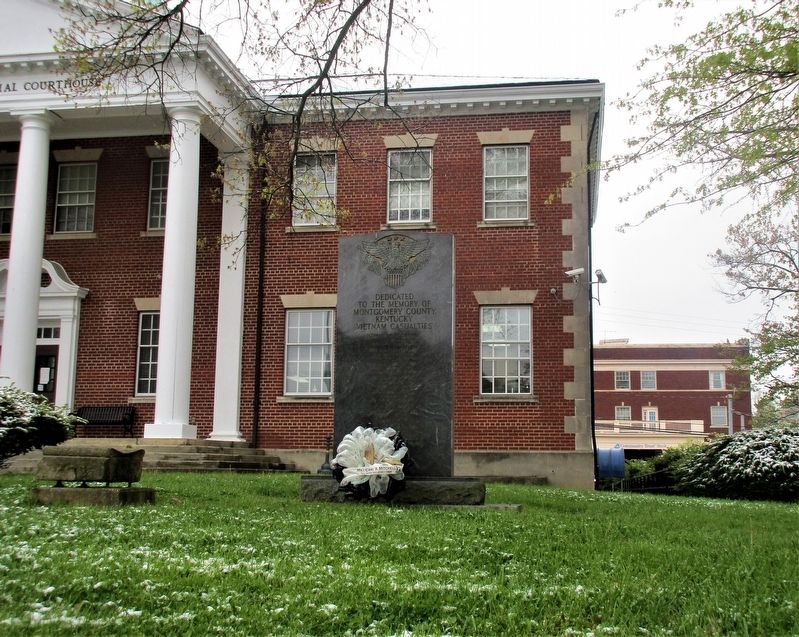
Montgomery County Kentucky Vietnam Casualties Marker
RANKED BY RELEVANCE
| On Courthouse Square (County Route 1066) at North Maysville Street (U.S. 460), on the right when traveling west on Courthouse Square. |
| On Courthouse Square (County Route 1066) at North Maysville Street (U.S. 460), on the right when traveling west on Courthouse Square. |
| Near Gourd Creek Cemetery Road 0.1 miles north of Farm to Market Road 1375. |
| Near Rep. John Lewis Way South. |
| On Guthrie Highway (U.S. 79) 0.1 miles south of Oakland Road, on the right when traveling south. |
| On West Vandalia Street (Illinois Route 157) at St. Louis Street, on the right when traveling west on West Vandalia Street. |
| Near Old Mulkey Park Road 0.2 miles west of Old Mulkey Road. |
| On Kentucky Route 191 0.8 miles east of Route 203, on the left when traveling east. |
| On North Bell Street at Waverly Street, on the left when traveling north on North Bell Street. |
| On Ranch to Market Road 187 1 mile north of Waresville Cemetery Road, on the left when traveling north. |
| Near Resaca Lafayette Road Northwest (Georgia Route 136). |
| On Farris Drive at Drane Street, on the left when traveling west on Farris Drive. |
| Near Darnestown Road (Maryland Route 28) just east of Seneca Road ( Route 112), on the left when traveling east. |
| On Brooke Road 0.1 miles west of Chandlee Mill Road, on the right when traveling west. |
| On Research Boulevard/County Line Road (Ohio Route 835) 0.1 miles north of Shakertown Road, on the left when traveling north. |
| On Old Beaver Road (Route 1274) at Big Woods Road, on the right when traveling west on Old Beaver Road. |
| Near Saint Charles Road at County Route 156. |
| Near South 2nd Street (Tennessee Route 76) south of Franklin Street, on the left when traveling south. |
| On McEachin Street (U.S. 221). |
| Near Zion Road south of Sundown Road, on the right when traveling north. |
| On Old Georgetown Road (Maryland Route 187) 0.1 miles south of Tilden Lane, on the right when traveling south. |
| On Brooke Road 0.1 miles west of Chandlee Mill Road, on the right when traveling west. |
| Near Norwood Road (Maryland Route 182) 0.1 miles north of Ednor Road, on the right when traveling north. |
| Near Colesville Road (U.S. 29) south of Hillwood Drive, on the left when traveling north. |
| On South Broadway Street at Morris Avenue, on the right when traveling north on South Broadway Street. |
Thin black lines indicate changes in relevance. Between each pair of lines entries are ordered geographically but all have the same relevance.* Inflectional forms of words are their plurals, singulars, and possessives as well as gramatical tenses and similar variations.
Nov. 12, 2026
