By J. J. Prats, July 1, 2007
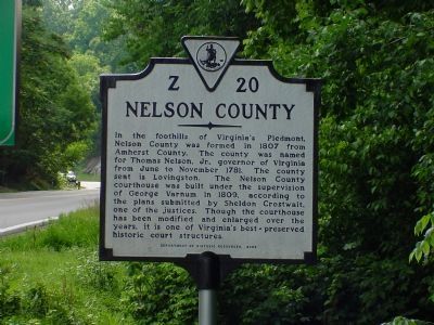
Nelson County Face of Marker
RANKED BY RELEVANCE
| On Rockfish Gap Turnpike (U.S. 250) east of Afton Mountain Road (Virginia Route 6), on the right when traveling west. |
| Near Three Notched Mountain Highway (U.S. 250) 0.9 miles north of Interstate 64, on the left when traveling north. |
| On Blue Ridge Tunnel Trail just west of Afton Depot Lane, on the left when traveling west. |
| On Thomas Nelson Highway (U.S. 29) east of State Route 6, on the right when traveling west. |
| On Patrick Henry Highway (Route 151) north of Warrick Barn Road, on the right when traveling south. |
| On James River Road (State Highway 56), on the right when traveling north. |
| On Court Street (Virginia Route 1001) at Main Street, on the right when traveling north on Court Street. |
| Near Patrick Henry Highway (Virginia Route 151) 0.4 miles south of Firehouse Road ( Route 675), on the left when traveling south. |
| On Blue Ridge Tunnel Trail 0.1 miles west of Afton Depot Lane, on the right when traveling west. |
| On Louisville/Bardstown Road (U.S. 31E/150) 0 miles north of Wheeler Wright Lane, on the right when traveling north. |
| On Beechland Road (Kentucky Route 438) at Lincoln Park Road ( Route 528), on the left when traveling east on Beechland Road. |
| On Blue Ridge Tunnel Trail 0.4 miles west of Afton Depot Lane, on the right when traveling west. |
| On Thomas Nelson Highway (U.S. 29). |
| On Thomas Nelson Hwy (Virginia Route 29) at Cooperative Way, on the right when traveling south on Thomas Nelson Hwy. |
| On Crabtree Falls Highway (State Highway 56) at Dickie Road (State Route 666) on Crabtree Falls Highway. |
| On Rose Hill Drive at Henry Avenue, on the left when traveling north on Rose Hill Drive. |
| Near George Collin Parkway (County Route 305), on the right when traveling south. |
| On Richmond Highway (U.S. 60) west of Pidemont Road, on the left when traveling east. |
| On Crabtree Falls Highway (State Highway 56) just south of Dickie Road (State Route 666). |
| Near Three Notched Mountain Highway (U.S. 250) 0.8 miles north of Interstate 64, on the left when traveling north. |
| On Rockfish Gap Turnpike (U.S. 250) at Skyline Drive and Blue Ridge Parkway, on the right when traveling east on Rockfish Gap Turnpike. |
| Near Kenneth Jones Drive just west of Montgomery Avenue, on the left when traveling west. |
Thin black lines indicate changes in relevance. Between each pair of lines entries are ordered geographically but all have the same relevance.* Inflectional forms of words are their plurals, singulars, and possessives as well as gramatical tenses and similar variations.
Nov. 12, 2026
