By William Fischer, Jr., March 12, 2010
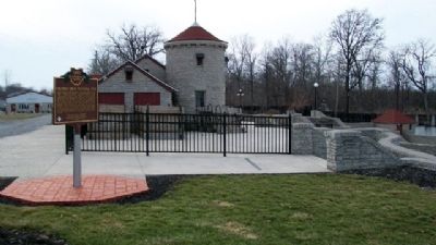
Columbus Grove Municipal Pool and Marker
RANKED BY RELEVANCE
| On Local Road 8P 0.2 miles south of State Route 12, on the right when traveling south. |
| On Broad Street (Ohio Route 115) at Napoleon Street ( Route 115), on the left when traveling north on Broad Street. |
| On 4th Street at Main Street, on the right when traveling north on 4th Street. |
| On East Main Street at Broad Street, on the left when traveling east on East Main Street. |
| On West Main Street (U.S. 224) just west of South Walnut Street, on the left when traveling west. |
| On E. Main Street east of W. Canal Street, on the left when traveling east. |
| On Ohio Route 114 near Route 634, on the right. |
| On Ohio Route 114 at Route 694, on the right when traveling north on Ohio Route 114. |
| On Broad Street just north of East Main Street, on the right when traveling north. |
| On County Route 5, on the left when traveling north on County Route 5. Reported permanently removed. |
| Near Winfield Road (West Virginia Route 817) north of Ventroux Road, on the right when traveling north. Reported unreadable. |
| On South Vine Street at East Washington Street (U.S. 231), on the right when traveling south on South Vine Street. |
| On Kanawha Valley Road (U.S. 35) 0.9 miles north of Anderson Hollow Road (County Road 17/1), on the right when traveling south. |
| On Cross Lanes Drive (West Virginia Route 62) just north of Melton Avenue, on the right when traveling south. |
| On Winfield Road (West Virginia Route 817) 0.4 miles north of Tompkins Crossing Road, on the right when traveling north. |
| Near West Jefferson Street west of North Main Street (Indiana Route 9), on the right when traveling west. |
| On Stoneleigh Road (County Route 35) at Drewville Road (County Route 36), on the right when traveling south on Stoneleigh Road. |
| On Main Street, on the right when traveling west. |
| On N. Locust Street, on the right when traveling north. |
| Near Main Street north of Rices Landing Road (County Route 1010), on the left when traveling north. |
| On Courthouse Drive at Emergency Lane / Sabre Street, on the right when traveling south on Courthouse Drive. |
| On Lafayette Street (West Virginia Route 62) at High Street, on the right when traveling north on Lafayette Street. |
| On West Virginia Route 34 east of Sycamore Road (County Route 50), on the right when traveling east. |
| On Charleston Road (U.S. 119) south of River Road (Local Route 34), on the left when traveling north. |
Thin black lines indicate changes in relevance. Between each pair of lines entries are ordered geographically but all have the same relevance.* Inflectional forms of words are their plurals, singulars, and possessives as well as gramatical tenses and similar variations.
Nov. 13, 2026
