
29 entries match your criteria.
Entries Containing All of the Phrases «washington county» AND «arkansas»
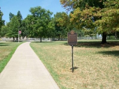
By William Fischer, Jr., August 11, 2012
The State and Land-Grant University of Arkansas Marker
RANKED BY RELEVANCE
1 ► Arkansas, Washington County, Fayetteville — The State and Land-Grant University of Arkansas —  |
| On Dickson Street at Arkansas Avenue, on the right when traveling west on Dickson Street. | |||
| 2 ► Arkansas, Pulaski County, Little Rock, Downtown — Arkansas Medal of Honor Monument — |
| Near Woodlane Street. | |||
| 3 ► Arkansas, Washington County, Fayetteville — Arkansas College — |
| On North College Avenue (Business U.S. 71) north of East Spring Street, on the right when traveling north. | |||
| 4 ► Arkansas, Washington County, Fayetteville — 58 — David Walker — |
| Near East Rock Street west of Walker Road, on the right when traveling west. | |||
| 5 ► Arkansas, Washington County, Winslow — Winslow Tunnel Date Stone — 1882-1969 — |
| On North Winslow Boulevard at Main Street, on the left when traveling north on North Winslow Boulevard. | |||
| 6 ► Arkansas, Washington County, Fayetteville — Wilson Park History — |
| On Wilson Park Trail north of North Park Avenue, on the left when traveling north. | |||
| 7 ► Arkansas, Washington County, Fayetteville — Lynching in America / Racial Terrorism in Washington County — Community Remembrance Project — |
| On Dunn Avenue south of West 11th Street, on the right when traveling south. | |||
| 8 ► Arkansas, Washington County, Fayetteville, University of Arkansas — Wilson Matthews — Arkansas Difference Makers — |
| Near Road 300, on the right. | |||
| 9 ► Arkansas, Washington County, Fayetteville — Evolution of Fayetteville — |
| On Center Street at East Avenue, on the left when traveling west on Center Street. | |||
| 10 ► Arkansas, Washington County, Prairie Grove — Historic Wall — |
| On East Douglas Street (U.S. 62), on the right when traveling west. | |||
| 11 ► Arkansas, Garland County, Hot Springs — The Miss Arkansas Pageant — Hot Springs Central Avenue Historic District — |
| On Central Avenue (State Highway 7) just south of Spring Street, on the right when traveling north. | |||
| 12 ► Arkansas, Boone County, Harrison — Mountain Meadows Massacre – The Journey — |
| On North Main Street (Business U.S. 65) at West Rush Avenue, on the right when traveling south on North Main Street. | |||
| 13 ► Arkansas, Benton County, Siloam Springs — Gulf War Memorial — Battery B 2nd Battalion 142nd Field Artillery — |
| On East Main Street at South Lincoln Street, on the right when traveling west on East Main Street. | |||
| 14 ► Arkansas, Washington County, Fayetteville — First Confederate Company Organized in Washington County — |
| On Center Street at East Avenue, on the left when traveling west on Center Street. | |||
| 15 ► Texas, Austin County, San Felipe — Founding the Town — Lot 47 — |
| Near 2nd Street at Farm to Market Road 1458. | |||
| 16 ► Texas, Nacogdoches County, Nacogdoches — 9246 — Stephen Fuller Austin — (November 3, 1793 - December 27, 1836) — |
| Near North Street (Business U.S. 59) north of Griffith Boulevard, on the right when traveling north. | |||
| 17 ► Arkansas, Washington County, Canehill — Confederates Fall Back Before Union Assault — Shelby Withdraws to Cane Hill |
| On College Road near McClellan Road, on the left when traveling north. Reported permanently removed. | |||
| 18 ► Arkansas, Benton County, Lowell — 107 — Mudtown — |
| On Jackson Place north of McClure Avenue (County Road 923), on the left when traveling north. | |||
| 19 ► Arkansas, Washington County, Fayetteville — Significant Dates in Fayetteville History — |
| On Center Street at East Avenue, on the left when traveling west on Center Street. | |||
| 20 ► Arkansas, Washington County, Fayetteville — Underwood Building 1966 — |
| On West Dickson Street east of North University Avenue, on the right when traveling east. | |||
| 21 ► Arkansas, Washington County, Canehill — Bethlehem Cemetery — |
| Near East Munyon Road (County Road 442) 0.3 miles south of State Route 45, on the left when traveling south. | |||
| 22 ► Arkansas, Washington County, Canehill — Bethlehem Methodist-Episcopal Church South — |
| Near East Munyon Road (County Road 442) 0.3 miles south of State Route 45, on the left when traveling south. | |||
| 23 ► Arkansas, Washington County, Fayetteville — Reiff House — 1834 - 1951 — |
| On College Street west of Church Avenue, on the right when traveling west. | |||
| 24 ► Arkansas, Clark County, Arkadelphia — Flanagin Law Office — |
| On Clay Street at South 4th Street, on the right when traveling west on Clay Street. | |||
| 25 ► Arkansas, Washington County, Fayetteville — 70 — Mount Comfort in the Civil War — |
| Near West Mount Comfort Road west of Rupple Road, on the right when traveling west. | |||
| 26 ► Arkansas, Washington County, Fayetteville — Revolutionary War Soldier Memorial — (1775-1783) — |
| On Cemetery Circle, on the right when traveling east. | |||
| 27 ► Arkansas, Washington County, Lincoln — R. L. Leach Grocery Store — |
| Near Dutch Mills Road North (County Road 419) north of Dutch Mills Road (County Road 418), on the left when traveling north. | |||
| 28 ► Missouri, Jefferson County, Herculaneum — Daniel Dunklin — Fifth Governor of Missouri — |
| Near Dunklin Drive. | |||
| 29 ► Arkansas, Washington County, Fayetteville — Fayetteville Confederate Cemetery — |
| Near East Rock Street west of Walker Road, on the right when traveling west. | |||
Thin black lines indicate changes in relevance. Between each pair of lines entries are ordered geographically but all have the same relevance.
* Inflectional forms of words are their plurals, singulars, and possessives as well as gramatical tenses and similar variations.
Nov. 19, 2026