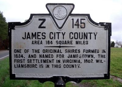
By Bernard Fisher, March 29, 2010
James City County Marker (reverse)
RANKED BY RELEVANCE
| On Old Stage Road (Virginia Route 30) 0.1 miles south of Richardson Road ( Route 705), on the right when traveling east. |
| On East Williamsburg Road (U.S. 60) 0.1 miles east of White Oak Road, on the right when traveling east. Reported missing. |
| On Eltham Road (Virginia Route 33) 0.1 miles south of Virginia Avenue, on the right when traveling south. |
| Near New Kent Highway at Courthouse Circle. Reported permanently removed. |
| On East Williamsburg Road (U.S. 60) 0.1 miles east of White Oak Road, on the right when traveling east. Reported missing. |
| On Courthouse Circle 0.1 miles east of New Kent Highway ( Route 249), on the right when traveling east. |
| On Outpost Road 0.6 miles south of Rockahock Road, on the right when traveling south. |
| Near Lot Cary Road (Virginia Route 602) at Samaria Lane, on the left when traveling south. |
| On Eltham Road (Virginia Route 33) 0.1 miles south of Virginia Avenue, on the right when traveling south. |
| On Mastin Lane east of West Broad Street, on the left when traveling north. |
| Near Wilcox Neck Road (Virginia Route 623) 0.5 miles north of The Glebe Lane ( Route 615). |
| On New Kent Highway (Virginia Route 249) 0.1 miles west of Courthouse Circle. |
| On North Courthouse Road (Virginia Route 155) at Poindexter Road (County Route 604), on the left when traveling north on North Courthouse Road. |
| On Old Union Road (Virginia Route 603) 0.1 miles east of Roxbury Road ( Route 106), on the right when traveling east. |
| On Adkins Road (Virginia Route 618) at Church Lane, on the right when traveling south on Adkins Road. |
| On Maidens Road (U.S. 522) at Maidens Loop, on the right when traveling south on Maidens Road. |
| Near Courtland Farm Road (Virginia Route 820) 0.2 miles east of Hanover Courthouse Road (U.S. 301), on the right when traveling east. |
| On Main Street south of 5th Street, on the left when traveling south. |
| On Cumberland Road 0.2 miles north of New Kent Highway ( Route 249), on the right when traveling north. |
| On New Kent Highway (Virginia Route 249) 0.1 miles east of Courthouse Circle, on the right when traveling east. |
| On Hanover Courthouse Road (U.S. 301) 0.2 miles north of Depot Road, on the right when traveling north. Reported permanently removed. |
| Near Cumberland Road 0.8 miles north of New Kent Highway ( Route 249), on the right when traveling north. |
| Near Emmaus Church Road (Virginia Route 106) at Interstate 64, on the left when traveling north. |
| On Cople Highway (Virginia Route 202) at Sandy Point Road ( Route 604), on the right when traveling east on Cople Highway. |
| Near National Avenue north of Smith Boulevard, on the left when traveling north. |
| Near New Kent Highway at Courthouse Circle. |
| Near Berkley Street at North Center Street, on the right when traveling west. |
Thin black lines indicate changes in relevance. Between each pair of lines entries are ordered geographically but all have the same relevance.* Inflectional forms of words are their plurals, singulars, and possessives as well as gramatical tenses and similar variations.
Nov. 12, 2026
