38 entries match your criteria.
Entries Containing All of the Phrases «union county» AND «south carolina»
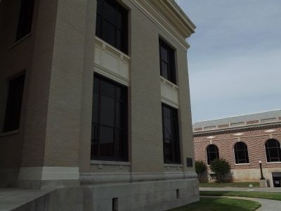
By Anna Inbody, May 19, 2012
Union County Revolutionary War Marker
RANKED BY RELEVANCE
1 ► South Carolina, Union County, Union — Union County Revolutionary War —  |
| On West Main Street at N Herndon, on the right when traveling west on West Main Street. | |||
| 2 ► South Carolina, Union County, Jonesville — Jonesville Confederate Monument — |
| On Depot Street. | |||
| 3 ► South Carolina, Union County, Union — 44-20 — Union County Lynchings of 1871 — |
| On West Main Street (State Highway 49) just east of South Enterprise Street, on the right when traveling west. | |||
| 4 ► South Carolina, Union County, Cross Anchor — 44-7 — Battle of Blackstock’s — |
| On Cross Keys Highway (State Highway 49) at Blackstock Road, on the left when traveling east on Cross Keys Highway. | |||
| 5 ► Mississippi, Union County, New Albany — Union County, Mississippi — |
| On East Bankhead Street (State Highway 178) at Court Avenue, on the right when traveling east on East Bankhead Street. | |||
| 6 ► South Carolina, Union County, Union — Furman L Fendley Highway — |
| On U.S. 176, on the right when traveling west. | |||
| 7 ► South Carolina, Union County, Union — Union County Confederate Monument — |
| On West Main Street. | |||
| 8 ► Tennessee, Union County, Maynardville — 1D 21 — Racoon Valley — |
| On Main Street (Tennessee Route 33) at Ailor Gap Road, on the right when traveling east on Main Street. | |||
| 9 ► South Carolina, Abbeville County, Honea Path — John Callaham - Zachariah Carwile Memorial — |
| Near Keowee Road near Murdock Road. | |||
| 10 ► South Carolina, Laurens County, Clinton — Battle of Musgrove Mill — |
| On State Highway 56 0.5 miles north of State Park Road, on the left when traveling north. | |||
| 11 ► South Carolina, Laurens County, Clinton — Ford Country — |
| On SC Highway 56. | |||
| 12 ► South Carolina, Union County, Union — 44-13 — Presbyterian Cemetery — |
| On North Pinckney Street, on the right when traveling north. | |||
| 13 ► South Carolina, Union County, Cross Keys — 44-3 — Cross Keys House — |
| On Old Buncombe Road at Jones Ford Road, on the left when traveling east on Old Buncombe Road. | |||
| 14 ► Georgia, Cherokee County, Canton — 028-3 — Joseph Emerson Brown — |
| On East Marietta Street 0 miles north of Elizabeth Street, on the right when traveling north. | |||
| 15 ► South Carolina, Union County, Union — 44-6 — Fairforest Church — |
| On Jonesville Highway, on the right when traveling south. | |||
| 16 ► South Carolina, Union County, Union — 44-4 — Fairforest Meeting — |
| On Cross Keys Highway (State Highway 49) at Police Club Road, on the left when traveling east on Cross Keys Highway. | |||
| 17 ► South Carolina, Union County, Union — 44-5 — Union County Jail — |
| On Main Street (Route 49) at Enterprise Street on Main Street. | |||
| 18 ► Georgia, Union County, Suches — 144-6 — Homesite of Joseph Emerson Brown — |
| On Georgia Route 60 0.1 miles north of Hello Road. | |||
| 19 ► South Carolina, Cherokee County, Gaffney — 11-10 — Steen Family Cemetery — |
| On El Bethel Church Road (State Highway 11-15) when traveling east. | |||
| 20 ► South Carolina, Spartanburg County, Spartanburg — Church of the Advent — |
| Near Advent Street 0.1 miles south of East Main Street. | |||
| 21 ► South Carolina, Union County, Cross Anchor — Battle of Blackstock — |
| On Monument Road 1.4 miles north of Blackstock Road. | |||
| 22 ► South Carolina, Union County, Union — 44-15 — Fair Forest Plantation / Emslie Nicholson House — |
| On Cross Keys Highway (State Highway 49) 0.5 miles west of Riley Road, on the right when traveling west. | |||
| 23 ► South Carolina, York County, McConnells — The Homestead |
| On Brattonsville Road 0.1 miles north of Percival Road, on the right when traveling south. Reported missing. | |||
| 24 ► Florida, Union County, Providence — Village Of Providence — (Unincorporated) Union County — |
| On County Road 238, on the left when traveling west. | |||
| 25 ► Oklahoma, Cleveland County, Norman — Adams Hall — |
| On West Brooks Street 0.1 miles west of Jenkins Avenue, on the right when traveling west. | |||
| 26 ► South Carolina, Greenville County, Greenville — 23-5 — General Store — Alexander McBeth & Co. — |
| On White Horse Road (U.S. 25) at Banner Drive, on the right when traveling north on White Horse Road. | |||
| 27 ► South Carolina, Union County, Union — Lynching in America / Lynching in Union County after 1877 — Community Remembrance Project — |
| On West Main Street (South Carolina Route 49) west of South Herndon Street, on the left when traveling west. | |||
| 28 ► North Carolina, Mecklenburg County, Charlotte, Grier Heights — Sam Billings — Est. 1886 — |
| On Sam Drenan Road at Skyland Avenue, on the right when traveling east on Sam Drenan Road. | |||
| 29 ► South Carolina, Union County, Union — Gist Cemetery — |
| On Galilee Church Road, on the left when traveling east. | |||
| 30 ► Georgia, Walker County, Suttles Mill — William Little House — General John Bell Hood, CSA — |
| On Manning Mill Road at West Armuchee Road, on the left when traveling east on Manning Mill Road. | |||
| 31 ► North Carolina, Mecklenburg County, Charlotte — 15 — Homegrown Innovations In Retail — Charlotte Trail of History — |
| Near Metropolitan Avenue south of Charlottetown Avenue, on the right when traveling south. | |||
| 32 ► South Carolina, Greenville County, Greenville — Andrew Pickens — "The Wizard Owl" — 1739 - 1817 |
| On South Main Street (State Highway 124) at East Broad Street, on the left on South Main Street. Reported permanently removed. | |||
| 33 ► South Carolina, Union County, Union — 44-12 — Culp-Beaty Hall — |
| On North Mountain Street at Hames Street, in the median on North Mountain Street. | |||
| 34 ► South Carolina, Cherokee County, Pacolet — 11-9 — Mulberry Chapel Methodist Church — |
| On Asbury Road (State Highway 211), on the right when traveling west. | |||
| 35 ► South Carolina, Cherokee County, Pacolet — 11-8 — Nuckolls-Jefferies House — |
| On Asbury Road 0.1 miles east of Arrowhead Trail, on the right when traveling east. | |||
| 36 ► New Jersey, Hunterdon County, Clinton — Hunterdon County's Forgotten / The Forgotten History Trail 1780 — Bonnell's Tavern & the Minutemen/Militia / — |
| Near Leigh Street near Riverside Drive, on the left when traveling north. | |||
| 37 ► South Carolina, Laurens County, Waterloo — 30-2 — Rosemont — |
| On Greenwood Highway (US 221), on the right when traveling south. | |||
| 38 ► South Carolina, Spartanburg County, Converse — The Pacolet River Flood of 1903 — |
| On U.S. 29 at Brooklyn Road, on the right when traveling west on U.S. 29. | |||
Thin black lines indicate changes in relevance. Between each pair of lines entries are ordered geographically but all have the same relevance.
* Inflectional forms of words are their plurals, singulars, and possessives as well as gramatical tenses and similar variations.
Nov. 13, 2026