THE HISTORICAL
MARKER DATABASE
“Bite-Size Bits of Local, National, and Global History”


25 entries match your criteria.  


Yreka Trail Historical Markers

The Yreka Trail opened up far Northern California and Southern Oregon to gold mining, ranching, farming and lumbering. The emigrants used the Yreka trail for eight to ten years.
 
By Douglass Halvorsen, April 4, 2015
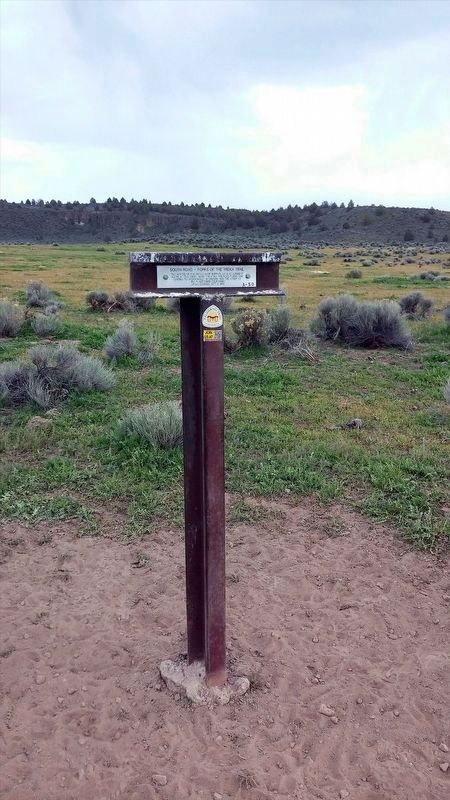
South Road - Forks Of The Yreka Trail / Yreka Trail - The Trail Forks Marker
1 ► California, Siskiyou County, Dorris — A-50, Y-1 — South Road - Forks Of The Yreka Trail / Yreka Trail - The Trail Forks — California Trail —
On Dorris Brownell Road, on the left when traveling west.
2 ► California, Siskiyou County, Dorris — Y-2 — Yreka Trail - Willow Springs —
Near Willow Creek and Red Rock Road, on the right.
3 ► California, Siskiyou County, Grenada — Y-16 — Yreka Trail - Down Shasta Valley —
On Harry Cash Road at Aubrey Lane when traveling north on Harry Cash Road.
4 ► California, Siskiyou County, Macdoel — Y-4 — Yreka Trail - No Water —
On Red Rock Road, on the right when traveling west.
5 ► California, Siskiyou County, Macdoel — Y-5 — Yreka Trail - One Very Steep Stony Hill —
Near no nearby street.
6 ► California, Siskiyou County, Macdoel — Y-3 — Yreka Trail - Over Rocky Roads —
On Willow Creek Red Rock Road at Red Rock Road, on the right on Willow Creek Red Rock Road.
7 ► California, Siskiyou County, Macdoel — Y-6 — Yreka Trail - Quite a Stream —
On Old State Hwy, on the left when traveling north.
8 ► California, Siskiyou County, Macdoel — Y-6A — Yreka Trail - Quite Stony Today —
On no nearby street.
9 ► California, Siskiyou County, Montague — Y-18 — Yreka Trail - Shasta River —
On Montague Grenada Road, on the right when traveling south.
10 ► California, Siskiyou County, Montague — Y-17 — Yreka Trail - Splendid Roads —
On Big Springs Road, on the right when traveling north.
11 ► California, Siskiyou County, Montague — Y-15 — Yreka Trail - The Snelling Ranch —
On Harry Cash Road, on the left when traveling north.
12 ► California, Siskiyou County, Mount Hebron — Yreka Historic Trail — (1852 - Present) —
On Tenant Road 2 miles south of U.S. 97, on the left when traveling south.
13 ► California, Siskiyou County, Tennant — Y-11 — Yreka Trail - A Big Meadow —
On Volcanic Legacy Scenic Byway (California Route 97) 3.3 miles north of Grass Lake Fire Road, on the left when traveling north.
14 ► California, Siskiyou County, Tennant — Y-9 — Yreka Trail - Are Yet On Butte Creek —
On Tennant Road 0.8 miles north of Forest Road 44N25, on the left when traveling north.
15 ► California, Siskiyou County, Tennant — Y-8 — Yreka Trail - Near a Little Lake —
Near no nearby street.
Paid Advertisement
16 ► California, Siskiyou County, Tennant — Y-6B — Yreka Trail - Out of Danger —
On Forest Rd 44N06X, on the right when traveling west.
17 ► California, Siskiyou County, Tennant — Y-7 — Yreka Trail - Up Butte Creek —
On no nearby street, on the right when traveling north.
18 ► California, Siskiyou County, Tennant — Y-10 — Yreka Trail-Splendid Pine Timber / Yreka Trail-To a Swamp —
On Forest Road 44N18Y 0.8 miles east of Forest Road 44N23, on the right when traveling east.
19 ► California, Siskiyou County, Weed — 517 — Emigrant Trail —
On U.S. 97 at Military Pass Road, on the right when traveling north on U.S. 97.
20 ► California, Siskiyou County, Weed — Y-12 — Yreka Trail – A Splendid Cite —
On California Route 97, on the left when traveling north.
21 ► California, Siskiyou County, Weed — Y-12 — Yreka Trail - Down hill to Sheep Rock —
Near Volcanic Legacy Scenic Byway (at milepost 19) near U.S. 97.
22 ► California, Siskiyou County, Weed — Y-13 — Yreka Trail - Sheep Rock —
Near U.S. 97 0.2 miles north of Military Pass Road when traveling north.
23 ► California, Siskiyou County, Weed — Y-14 — Yreka Trail - Sheep Rock Springs —
On Pilar Road, on the left when traveling south.
24 ► California, Siskiyou County, Yreka — Y-20 — Yreka Trail – A Mighty Town —
On Yama Street at Discovery Street, on the right when traveling west on Yama Street.
25 ► California, Siskiyou County, Yreka — Y-19 — Yreka Trail - Our Journeys End —
On Campbell Avenue, on the left when traveling east.
 
 
CeraNet Cloud Computing sponsors the Historical Marker Database.
This website earns income from purchases you make after using our links to Amazon.com. We appreciate your support.
Paid Advertisement
Nov. 13, 2026