35 entries match your criteria.
Illinois & Michigan Canal Historical Markers
The opening of the Illinois & Michigan Canal in 1848 made Chicago and northern Illinois the key hub of mid-America. Chicago grew into a major metropolis, agricultural and industrial innovations abounded, and Illinois soon became the most populous inland American state, all attributable to the 96-mile canal that linked the Great Lakes to the Illinois and Mississippi rivers. By connecting those waterways, the canal made possible a vast all-water route that linked a growing nation. Its significance was recognized in 1984 when President Reagan, native son of Illinois, signed a bill that established the region as the first National Heritage Area.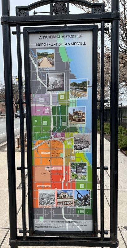
By Sean Flynn, April 1, 2024
Pictorial History of Bridgeport & Canaryville
1 ► Illinois, Cook County, Chicago, Bridgeport — Bridgeport and the Development of Chicago's Infrastructure — The Story of a Neighborhood —  |
| On South Halsted Street north of West 34th Street when traveling north. | |||
| 2 ► Illinois, Cook County, Chicago, Bridgeport — Canal Origins Park |
| Near Ashland Avenue 0.3 miles north of Archer Avenue, on the right when traveling north. Reported damaged. | |||
| 3 ► Illinois, Cook County, Chicago, Canaryville — People of Canaryville |
| On South Halsted Street north of West 41st Street, on the right when traveling north. Reported damaged. | |||
| 4 ► Illinois, Cook County, Chicago, Streeterville — Illinois & Michigan Canal — National Heritage Corridor — |
| On North Streeter Drive at East Illinois Street, on the left when traveling south on North Streeter Drive. | |||
| 5 ► Illinois, Cook County, Chicago, The Loop District — Chicago — |
| On Chicago Riverwalk at Jean Baptiste Point du Sable Lake Shore Drive (U.S. 41), on the left when traveling east on Chicago Riverwalk. | |||
| 6 ► Illinois, Cook County, Chicago, The Loop District — Illinois and Michigan Canal — |
| On Chicago Riverwalk at Jean Baptiste Point du Sable Lake Shore Drive (U.S. 41), on the right when traveling west on Chicago Riverwalk. | |||
| 7 ► Illinois, Cook County, Forest View — The Chicago Portage Site at the Forest Preserves of Cook County — |
| Near South Harlem Avenue (Illinois Route 43) at Portage Trail, on the right when traveling south. | |||
| 8 ► Illinois, Cook County, Hodgkins — Betz & Swink — |
| On Leon Cook Road 0.4 miles south of Santa Fe Drive, on the right when traveling south. | |||
| 9 ► Illinois, Cook County, Hodgkins — Santa Fe Prairie — An Illinois Nature Preserve — |
| On Leon Cook Drive 0.3 miles east of Santa Fe Drive, on the right. | |||
| 10 ► Illinois, Cook County, Hodgkins — Santa Fe Prairie — An Illinois Nature Preserve — |
| Near Leon Cook Drive 0.4 miles south of Santa Fe Drive, on the right. | |||
| 11 ► Illinois, Cook County, Hodgkins — The Burlington Northern and Santa Fe Railway Co. — |
| On Leon Cook Road 0.4 miles south of Santa Fe Drive. | |||
| 12 ► Illinois, Cook County, Hodgkins — Welcome to Santa Fe Prairie — |
| Near Leon Cook Road 0.4 miles south of Santa Fe Drive, on the right. | |||
| 13 ► Illinois, Cook County, Lemont — Old Stone Church — I&M Canal Passage — Waterways That Built Chicago — |
| On Lemont Street north of Illinois Street, on the right when traveling south. | |||
| 14 ► Illinois, Cook County, Oak Park — Continental Divide — |
| On Oak Park Avenue at Ontario Street, on the right when traveling south on Oak Park Avenue. | |||
| 15 ► Illinois, Cook County, Oak Park — Continental Divide — |
| On Lake Street east of Forest Avenue, on the right when traveling east. | |||
| 16 ► Illinois, Cook County, Oak Park — Continental Divide — |
| On Berkshire Street at Elmwood Avenue, on the right when traveling east on Berkshire Street. | |||
| 17 ► Illinois, Cook County, Oak Park — Continental Divide — |
| On Chicago Avenue 0.1 miles west of East Avenue, on the right when traveling west. | |||
| 18 ► Illinois, Cook County, Oak Park — Continental Divide — |
| On North Avenue (Illinois Route 64) at Narragansett Avenue, on the right when traveling east on North Avenue. | |||
| 19 ► Illinois, Cook County, Willow Springs — Old Towpath — |
| Near Willow Boulevard near Archer Avenue ( Route 171), on the left when traveling north. | |||
| 20 ► Illinois, Cook County, Willow Springs — Original Illinois & Michigan Canal — Forest Preserve — |
| On Willow Boulevard 0.3 miles north of Archer Avenue ( Route 171), on the right when traveling north. | |||
| 21 ► Illinois, Cook County, Willow Springs — Willow Springs Civilian Conservation Corps Camp #612 — |
| On Archer Avenue (Illinois Route 171) west of Willow Springs Road. | |||
| 22 ► Illinois, DuPage County, Oak Brook — The Indian Boundary Line — |
| Near 31st Street (County Route 34) 0.3 miles west of Route 83, on the left when traveling west. | |||
| 23 ► Illinois, Lake County, Gurnee — Underground Railroad in Illinois — |
| Near Kilbourne Road near Old Grand Avenue, on the right when traveling north. | |||
| 24 ► Illinois, LaSalle County, Ottawa — Jim Gray's Escape to Freedom — |
| On West Madison Street at La Salle Street ( Route 23), on the right when traveling east on West Madison Street. | |||
| 25 ► Illinois, LaSalle County, Ottawa — Lincoln the Litigator — Looking for Lincoln — |
| On West Madison Street at La Salle Street ( Route 23), on the right when traveling east on West Madison Street. | |||
| 26 ► Illinois, Morgan County, Jacksonville — Lincoln & Governor Duncan — Looking for Lincoln — |
| On Duncan Park. | |||
| 27 ► Illinois, Will County, Joliet — George Kiser, Iron Works laborer — I&M Canal Passage — |
| On Columbia Street at Route 53, on the left when traveling east on Columbia Street. | |||
| 28 ► Illinois, Will County, Joliet — James McKee's Mill and Dam — |
| Near North Bluff Street south of U.S. 30. | |||
| 29 ► Illinois, Will County, Joliet — Joliet Limestone: Our Canals and Quarries — |
| On Washington Street at Des Plaines Street on Washington Street. | |||
| 30 ► Illinois, Will County, Joliet — The Marx Brothers — Joliet Bicycle Route — I&M Canal Passage — |
| On North Chicago Street at Clinton Street, on the right when traveling south on North Chicago Street. | |||
| 31 ► Illinois, Will County, Lockport — Illinois & Michigan Canal Office — |
| On State Street (Illinois Route 171) at 8th Street, on the right when traveling south on State Street. | |||
| 32 ► Illinois, Will County, Lockport — Lock 1 — |
| On Division Street near Canal Street, on the left when traveling east. | |||
| 33 ► Illinois, Will County, Lockport — The Hydraulic Basin — |
| Near Canal Street. | |||
| 34 ► Illinois, Will County, Lockport — The Norton Building — |
| On West 10th Street near South State Steet. | |||
| 35 ► Illinois, Will County, Romeoville — Romeoville, Illinois — Welcome to Route 66 Illinois — |
| Near South Independence Boulevard (Illinois Route 53) 0.3 miles south of University Parkway. | |||