18 entries match your criteria.
UNESCO Slave Route Project Historical Markers The UNESCO Slave Route Project initiative was launched in 1994 in Ouidah, Benin, which aims to promote intercultural dialogue about the Atlantic slave trade, and the history of slavery in general.
By John Bloomfield, December 22, 2019
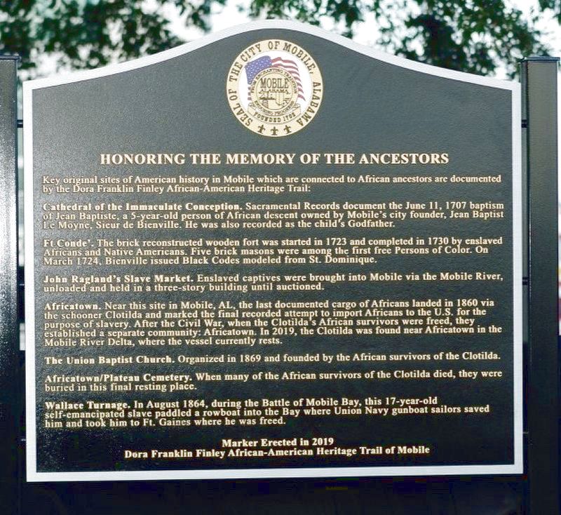
Honoring The Memory Of The Ancestors Marker
GEOGRAPHIC SORT Title Sort Marker Number Sort Marker Number Sort for Trails Publication Order Sort Publication Order Sort A Erected Year Sort Most Viewed Sort Most Recent-Interest Sort Most Recently Changed Sort SEE FAQ #33 FOR DESCRIPTIONS
Near Water Street south of Government Street (Alabama Route 16), on the right when traveling north.
On Harbor Drive 0.3 miles north of Union Street, on the right when traveling north.
On San Fernando Street south of White Street, on the right when traveling south.
Near Beach View Drive at South Riverview Drive.
Near Beach View Drive 0.1 miles north of South Riverview Drive.
Near Beach View Drive 0.1 miles north of South Riverview Drive.
Near Beach View Drive 0.1 miles north of South Riverview Drive.
Near Beach View Drive 0.1 miles north of South Riverview Drive.
Near Beach View Drive 0.1 miles north of South Riverview Drive.
Near Beach View Drive 0.1 miles north of South Riverview Drive.
Near Beach View Drive 0.1 miles north of South Riverview Drive.
Near Beach View Drive 0.1 miles north of South Riverview Drive.
Near Beach View Drive 0.1 miles north of South Riverview Drive.
Near Beach View Drive 0.1 miles north of South Riverview Drive.
Near Beach View Drive 0.1 miles north of South Riverview Drive.
Paid Advertisement
Near Londontown Road west of Londontown Court, on the right when traveling west.
On Front Street at Orange Street, on the right when traveling east on Front Street.
On Thames Street at Franklin Street, on the right when traveling south on Thames Street.
︽
Nov. 13, 2026