Marker Logo HMdb.org THE HISTORICAL
MARKER DATABASE
“Bite-Size Bits of Local, National, and Global History”


32 entries match your criteria.  


Historical Markers and War Memorials with «estanislao» in Erected By

 
Irwin City Monument image, Touch for more information
By James King, January 20, 2013
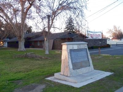
Irwin City Monument
1 California, Merced County, Hilmar — Irwin City
On Lander Avenue (California Route 165) 0.3 miles south of Falke Street, on the right when traveling south.
2 California, Merced County, Snelling — Merced Falls
On Merced Falls Road, on the right when traveling west.
3 California, Merced County, Winton — The Montpelier-Oakdale Railroad1890 to 1942
On Oakdale Road south of Turlock Road, on the right when traveling south.
4 California, Stanislaus County, Ceres — The Daniel Whitmore House
On 5th Street north of Lawrence Street, on the right when traveling north.
5 California, Stanislaus County, Empire — 418 — Empire City
On Sante Fe Avenue near Yosemite Boulevard (California Route 132), on the left when traveling south.
6 California, Stanislaus County, Empire — 418 — Empire City
Near First Street near Yosemite Boulevard (California Highway 132).
7 California, Stanislaus County, Knights Ferry — Buena Vista
On Kennedy Road east of Sonora Road, on the left when traveling east.
8 California, Stanislaus County, Knights Ferry — Knights Ferry - The Store
On Main Street-Sonora Road at Dean Street, on the right when traveling west on Main Street-Sonora Road.
9 California, Stanislaus County, Knights Ferry — Miller's Saloon
On Main Street at Dean Street, on the right when traveling west on Main Street.
10 California, Stanislaus County, Knights Ferry — Rancheria del Rio Estanislao
On Sonora Road at Schell Road on Sonora Road.
11 California, Stanislaus County, Knights Ferry — The Ancient and Honorable Order of E Clampus Vitus
On Sonora Road, 0.2 miles north of Kennedy Road, on the right when traveling north.
12 California, Stanislaus County, La Grange — La Grange
On Yosemite Boulevard (State Highway 132), on the left when traveling east.
13 California, Stanislaus County, La Grange — La Grange Gold Dredge Co. Camp
On Lake Road south of Yosemite Boulevard (California Highway 132), on the left when traveling south.
14 California, Stanislaus County, La Grange — La Grange Saloon
On Yosemite Boulevard (State Highway 132), on the right when traveling east.
15 California, Stanislaus County, La Grange — LaFayette Historical Lodge #65
On Yosemite Boulevard (California Route 132), on the right when traveling east.
Paid Advertisement
16 California, Stanislaus County, La Grange — The Old Jail
On Yosemite Boulevard (State Highway 132), on the left when traveling east.
17 California, Stanislaus County, La Grange — The Old La Grange Schoolhouse
On Flota Road west of Yosemite Boulevard (California Highway 132), on the left when traveling west.
18 California, Stanislaus County, La Grange — Tuolumne Gold Dredge
On County Route J59, 2 miles south of California Highway 132, on the right when traveling south.
19 California, Stanislaus County, Modesto — AdamsvilleThe First County Seat
On West Service Road at Jennings Road, on the right when traveling west on West Service Road.
20 California, Stanislaus County, Modesto — Coffee Field
On Neece Drive at Tuolumne Boulevard, on the left when traveling north on Neece Drive.
21 California, Stanislaus County, Modesto — Grand Army of the Republic
Near Scenic Drive.
22 California, Stanislaus County, Modesto — Laird Park
Near West Grayson Road west of Shiloh Road.
23 California, Stanislaus County, Modesto — Modesto – Stanislaus County Seat
On "I" Street, on the right when traveling east.
24 California, Stanislaus County, Modesto — Silent City
On Scenic Drive, on the right when traveling west.
25 California, Stanislaus County, Newman — Orestimba
Near Interstate 5.
26 California, Stanislaus County, Oakdale — Oakdale Saddle Club
On E F Street (Route 120), on the right when traveling west.
27 California, Stanislaus County, Patterson — Patterson & Western Railroad
Near Del Puerto Canyon Road, 12 miles east of Interstate 5.
28 California, Stanislaus County, Patterson — Rancho del Puerto
On West Las Palmas Avenue at Plaza Circle on West Las Palmas Avenue.
29 California, Stanislaus County, Riverbank — Burneyville
30 California, Stanislaus County, Riverbank — Riverbank Historical Museum
On Sante Fe Street, on the left when traveling east.
31 California, Stanislaus County, Roberts Ferry — Roberts Ferry
On Yosemite Boulevard (State Highway 132) at Roberts Ferry Road, on the right when traveling east on Yosemite Boulevard.
Paid Advertisement
32 California, Stanislaus County, Turlock — Joe Velasquez Post 5059 Turlock
Near East Linwood Avenue.
 
 
CeraNet Cloud Computing sponsors the Historical Marker Database.
This website earns income from purchases you make after using our links to Amazon.com. We appreciate your support.
Paid Advertisement
May. 20, 2024