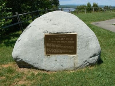
This scenic overlook named in memory of Maine Highway Pioneer A. J. “Allie” Cole. In 1917 Allie began horse drawn mail, freight and passenger service between Enfield and Burlington, Maine. By the 1920’s he hauled freight in motor trucks north to . . . — — Map (db m2087) HM
Donated to the State of Maine by Percival Proctor Baxter Governor 1921 – 1925and accepted by the State forever to be held in trust in its natural wild state for the benefit of the people of Maine for public park, public forest and public . . . — — Map (db m136198) HM
Thirsting to experience nature’s splendor and vast wilderness, famous conservationists, politicians and artists were drawn to this area. In August 1879, young Theodore Roosevelt – who saw himself as a combination of naturalist, old-time . . . — — Map (db m136219) HM
Baxter Peak – elevation- 5267 ft. Northern terminus of the Appalachian Trail A mountain footpath extending over 2000 miles to Springer Mtn. Georgia ← Thoreau Spring 1.0 m. ← Katahdin Stream Campground 5.2 . . . — — Map (db m67678) HM
This tablet is placed here by the Forest Commissioner of Maine under order of the governor and Executive Council dated March 16, 1932 to record the gift and conveyance to the state on March 3, 1931 and October 7, 1931 by Percival Proctor Baxter, . . . — — Map (db m67677) HM
Welcome to the Golden Road, a 96-mile private road built by the Great Northern Paper Company that stretches from the Canadian border crossing to Millinocket, Maine. The road, which parallels the West Branch of the Penobscot River, was built . . . — — Map (db m136220) HM
I can smell and hear you long before you see me. To get a glimpse of me, look for my tracks and droppings; then approach quietly, with the wind in your face.
I am crepuscular. During the day, I can be hard to find in the thick, cool forest, . . . — — Map (db m136221)
Though it has all but vanished, this is the scene that would have appeared directly in front of you had you visited this spot in the 1880’s.
The stone furnace still standing today was once enclosed within a group of buildings that housed each . . . — — Map (db m102285) HM
Beginning at 4:00am July 24 Thoreau, Edward Hoar and Indian guide Joe Polis launched their canoe. Their first stop was at Moose Island for breakfast.
Keeping close to shore they saw the dam at east outlet and continued to Sand Bar Island. . . . — — Map (db m102400) HM
In memory of those who lost their lives in the B-52 crash of 24 Jan 1963.
Lt.Col. Joe S. Simpson Jr. Maj. William W. Gabriel Maj. Herbert L. Hansen Maj.Robert J. Hill Maj. Robert J. Morrison Capt. Charles G. Leuchter T-Sgt. Michael F. O'Keefe . . . — — Map (db m95834) HM
Low's Bridge sits adjacent to land once owned by Robert Low, one of Guilford's early settlers. The towns of Guilford and Sangerville built the original structure in 1830 to make travel between the two areas of commerce easier. A flood destroyed the . . . — — Map (db m147970) HM
This tablet marks the place where Colonel Benedict Arnold with his soldiers left the Kennebec River October 1775 and marched from the west shore in a north-westerly direction to Dead River on their way to Quebec.
— — Map (db m102371) HM
Maine Historic Civil Engineering Landmark
American Society of Civil Engineers
Founded 1852
Wire Bridge
Completed 1866
Designated in 1990 by the Maine Section ASCE — — Map (db m155755) HM