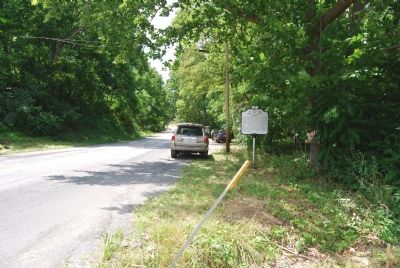
Colonists first settled Mossy Creek in the 1740s. Mossy Creek Iron Works was founded by 1775, when partners Henry Miller and Mark Bird began operating an iron furnace, forge, and mills here. The ironworks became an important industrial enterprise . . . — — Map (db m1841) HM
Here on June 5, 1864, was fought the Battle of Piedmont for the possession of Staunton.
Union Forces under Gen. David Hunter 12,015 men and suffered a loss of 130 killed and 650 wounded. Confederate forces numbering 5,600 men under Gen. . . . — — Map (db m193109) HM
The Battle of Piedmont, fought on June 5, 1864 between Union Gen. David Hunter and Confederate Gen. William E. "Grumble" Jones, ended here. It began more than a mile northeast when the 12,000-man strong Federal army, whose mission was to scour the . . . — — Map (db m155471) HM
A state residential school created by an act of the General Assembly of the Commonwealth of Virginia on March 31, 1838 for the purpose of educating the deaf and the blind children of the state. — — Map (db m11797) HM
Soon after the Civil War ended in 1865, Confederate veteran Charles S. Roller began teaching at the Old Stone Church nearby at Ft. Defiance. By 1874 he had founded Augusta Male Academy and incorporated military discipline into its classical . . . — — Map (db m11900) HM
The oldest college for women related to the Presbyterian Church, U. S. Founded 1842 by Rufus W. Bailey as Augusta Female Seminary; renamed in 1895 to honor Mary Julia Baldwin, pioneer woman educator and Principal, 1863–1897. — — Map (db m12366) HM
Chartered on 13 January 1744 as the Virginia Female Institute, Stuart Hall is Virginia’s oldest college preparatory school for girls. The Rev. Dr. Richard H. Phillips headed the school from 1848 until 1880. Flora Cooke Stuart, “Mrs. . . . — — Map (db m12372) HM
In 1862, West View was a village of about 15 buildings including a flour mill, post office, store, wagon shop and saw mills. About 3,000 soldiers camped in the surrounding fields from April 20 to May 6. Confederates under Gen. Edward . . . — — Map (db m15788) HM
Confederate troops, the remnant of the Army of the Northwest commanded by Brig. Gen. Edward “Allegheny” Johnson, constructed this fortification about 1 Apr. 1862 to protect the Shenandoah Valley, the “Breadbasket of the . . . — — Map (db m15791) HM
Born near Churchville on 25 Feb. 1843, Hanger joined the Churchville Cavalry at Phillipi, W.Va., on 2 June 1861, where the next morning he was wounded. The resulting amputation of his leg was probably the first of the Civil War. He convalesced at . . . — — Map (db m255040) HM
Near this site on April 17, 1861, approximately one hundred local citizens, many of whom had just enlisted in The Staunton Artillery, met to board trains for Harper's Ferry. They were led by prominent local citizen John D. Imboden, who would . . . — — Map (db m155474) HM
This was first the Southern Branch of the “Triple Forks of Shenandoah” Congregation, which called John Craig as pastor in 1741. A church was completed here about 1748; two other buildings have succeeded it. Beginning with 1777, James Waddel, the . . . — — Map (db m122178) HM
Five miles east, formerly known as Woods’ Gap. Michael Woods, his three sons and three Wallace sons-in-law (Andrew, Peter, William), coming from Pennsylvania via Shenandoah Valley, crossed through this pass into Albemarle County in 1734 – . . . — — Map (db m16644) HM
Relocated from its original site approximately fifty miles to the south on Little Patterson’s Creek in Botetourt County, Virginia, the Barger home, immediately in front of you, is an operational pre-Civil War farmstead from the Valley of Virginia. . . . — — Map (db m16653) HM
The Battle of McDowell began three miles to the southeast (near the intersection of Routes 629 and 716) when Confederates were fired upon by Union cavalry on May 7, 1862. After skirmishing, Federals rushed to the base camp here, sounding the . . . — — Map (db m62920) HM
You are standing in the middle of what was once Fort Edward Johnson. Confederate soldiers built this fort in 1862 under the command of Brigadier general Edward Johnson, a career officer from Virginia.
Look to your right, and then left across . . . — — Map (db m272339) HM
My name is Shepherd Green Pryor, but my friends and family call me “Shep.” I was elected First Lieutenant of the Muckalee Guards, Company A, 12th Regiment, Georgia Volunteer Infantry. We’ve just survived a cold Virginia winter on the top of . . . — — Map (db m16773) HM
On April 19, 1862, General Johnson, with General Lee’s approval, moved our regiment from Allegheny Mountain to Shenandoah Mountain. To protect ourselves from Yankee bullets, we dug about a mile of trench in this rocky ground. We then opened our . . . — — Map (db m16775) HM
February 23, 1862
My Dear Penelope,
I write a few lines this morning to let you know that I am well & doing as well as I have since Iv been in the service. Well, Dear, wee had an alarm Friday knight about two oclock, and the way . . . — — Map (db m16776) HM
Camp Shenandoah April 9th, 1862 My Dear Penelope, I take the opportunity this morning to write you a few lines to let you know that I am yet in the land of the living and enjoying good health. I thought last week that it was done . . . — — Map (db m16777) HM
My Dear Penelope
Wee are now tolerable well fortified; got 12 pieces of cannon and places all fixed for the men to shoot from; that is, fortifications for cannon with openings to shoot through so the men can man the cannon and not . . . — — Map (db m86203) HM
Camp Shenandoah April 18th, 1862 My Dear Penelope, I take the opportunity this evening to write you a few lines to let you know that I am yet in the land of the living &, thank God, enjoying good health. Wee are now looking out for a fight here; . . . — — Map (db m16781) HM
On April 20, 1862, the Confederate garrison left Fort Johnson to protect Staunton, and to avoid being cut off from the rear by another advancing Union Army. Lt. Pryor describes the retreat from the mountain.
Union forces now occupied Fort Johnson and were moving to capture Staunton. “Stonewall” Jackson, moving with speed and secrecy, had arrived at the foot of Shenandoah Mountain and moved west to defeat Union Generals John C. Fremont and R.H. Milroy . . . — — Map (db m255356) HM
After surviving the Battle of McDowell, in which he lost many comrades, Lt. “Shep” Pryor was later wounded in battle near Culpepper, Virginia. He survived the war, returned to his beloved Penelope, and became Sheriff of Sumter County, Georgia. . . . — — Map (db m16785) HM
West Panel:
Honor to the Brave
870 Lie Here
Recorded by Name, Company & Regiment:
From
Virginia 385, N. Carolina 176, S. Carolina 59,
Georgia 208, Alabama 49, Florida 8,
Mississippi 11, Louisiana 19, Tennessee 12,
Arkansas 20, . . . — — Map (db m53666) WM
This Bronze
Commemorates, To Generations
Which Knew Then Not,
The Virginia Volunteers
From Augusta In The Army
Of The Confederate States.
Twenty-Two Companies From
Here Followed By Jackson And
Stuart, With Many In Other Commands.
No . . . — — Map (db m155476) HM
On the ridge west of Waynesboro occurred the last engagement of Confederate forces commanded by Lt. Gen. Jubal A. Early. Portions of Maj. Gen. Philip H. Sheridan's army, including cavalry led by Maj. Gen. George A. Custer, attacked and routed . . . — — Map (db m207734) HM
William H. Harman
Colonel, C.S.A.
Born Feb. 17, 1828
Killed in action at
Waynesboro Mar 2, 1865.
He was a lieutenant of a com-
pany from Augusta County
in the Mexican War; after-
wards Brig. General in the
Virginia Militia; . . . — — Map (db m106824) HM
The Plumb House was built between 1802 and 1806 on what was then the western edge of Waynesboro. While fighting did not occur here until late in the war, the community felt its impact early on. Henry Plumb, who lived here, was mortally wounded at . . . — — Map (db m170606) HM
Settlers began to arrive to present day Augusta County in the 1730s and by the Revolutionary War a small hamlet existed here. By 1797, it was known as Waynesborough, for Revolutionary War hero Brig. Gen. Anthony Wayne. It became a town in 1801 and . . . — — Map (db m4032) HM