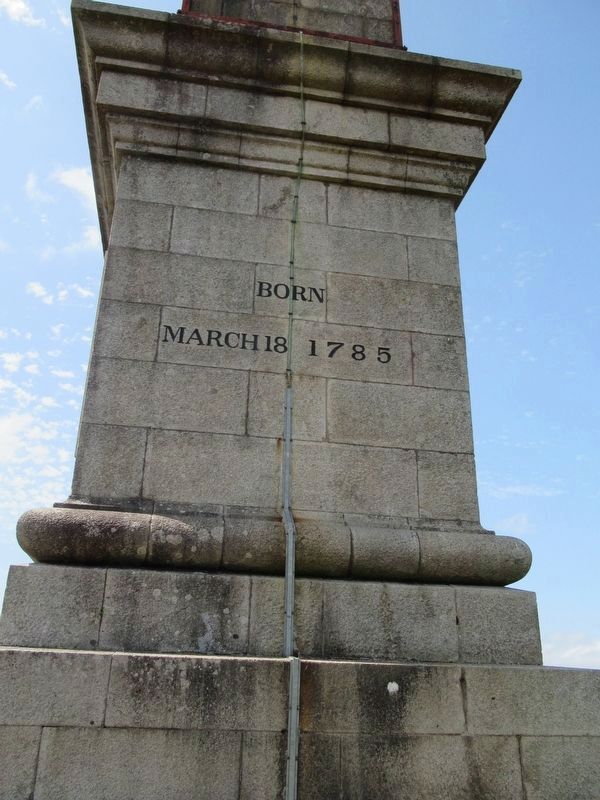
By Michael Herrick, August 6, 2018
Bodmin Beacon Monument
| On Barn Lane at Robartes Road, on the right when traveling east on Barn Lane. |
| On St Nicholas Street (England Route B3268) close to Castle Canyke Road, on the right when traveling north. |
| Near St Nicholas Street (England Route B3268) close to Fore Street, on the right when traveling north. |
| On St Nicholas Street (England Route B3268) at Castle Canyke Road, on the right when traveling north on St Nicholas Street. |
| On St Nicholas Street (England Route B3268) at Castle Canyke Road, on the right when traveling north on St Nicholas Street. |
| On Turf Street at Honey Street, on the left when traveling north on Turf Street. |
| On Fore Street close to Turf Street, on the left when traveling north. |
| On St Nicholas Street (England Route B3268) at Castle Canyke Road, on the right when traveling north on St Nicholas Street. |
| Near Avenue Road at Campbeltown Way, on the right when traveling north. |
| On Pendennis Rise, 0.2 kilometers south of Castle Drive, on the right when traveling south. |
| Near Avenue Road at Campbeltown Way, on the right when traveling north. |
| On Avenue Road at Campbeltown Way, on the right when traveling north on Avenue Road. |
| Near Avenue Road at Campbeltown Way, on the right when traveling north. |
| Near Castle Drive, 0.8 kilometers south of Cliff Road, on the left when traveling south. |
| Near Avenue Road close to Campbeltown Way, on the right when traveling north. |
| Near Avenue Road at Campbeltown Way, on the right when traveling north. |
| On Castle Drive, 0.8 kilometers south of Cliff Road, on the right when traveling south. |
| Near Western Road close to Dockey, on the left when traveling north. |
| Near Western Road at Dockey, on the left when traveling north. |
| Near Western Road at Dockey, on the left when traveling north. |
| On Broad Street at High Street, on the left when traveling north on Broad Street. |
| Near Western Road at Dockey, on the left when traveling north. |
| Near Western Road at Dockey, on the left when traveling north. |
| Near Western Road at Dockey, on the left when traveling north. |
| Near Western Road at Dockey, on the left when traveling north. |
| Near Western Road at Dockey, on the left when traveling north. |
| Near Western Road at Dockey, on the left when traveling north. |
| Near Western Road at Dockey, on the left when traveling north. |
| On Western Road at Dockey, on the left when traveling north on Western Road. |
| On Western Road at Dockey, on the left when traveling north on Western Road. |
| Near Western Road at Dockey, on the left when traveling north. |
| Near Western Road close to Dockey, on the left when traveling north. |
| On Broad Street at Westgate Street, on the left when traveling west on Broad Street. |
| On Unnamed Road, 0.1 kilometers north of St Breward Village Hall, on the left when traveling north. |
| On Unnamed Road, 0.2 kilometers north of St Breward Village Hall, on the left when traveling north. |
| Near Castle Road, 0.6 kilometers west of Atlantic Road, on the right when traveling west. |
| Near Castle Road, 0.6 kilometers west of Atlantic Road, on the right when traveling west. |
| Near Castle Road, 0.6 kilometers west of Atlantic Road, on the right when traveling west. |
| Near Castle Road, 0.6 kilometers west of Atlantic Road, on the right when traveling west. |
| Near Castle Road, 0.6 kilometers west of Atlantic Road, on the right when traveling west. |
| Near Castle Road, 0.6 kilometers west of Atlantic Road, on the right when traveling west. |
| Near Castle Road, 0.6 kilometers west of Atlantic Road, on the right when traveling west. |
| Near Castle Road, 0.6 kilometers west of Atlantic Road, on the right when traveling west. |
| Near Castle Road, 0.6 kilometers west of Atlantic Road, on the right when traveling west. |
| Near Castle Road, 0.6 kilometers west of Atlantic Road, on the right when traveling west. |
| Near Castle Road, 0.6 kilometers west of Atlantic Road, on the right when traveling west. |
| Near Castle Road, 0.6 kilometers west of Atlantic Road, on the right when traveling west. |
| Near Castle Road, 0.6 kilometers west of Atlantic Road, on the right when traveling west. |
| Near Castle Road, 0.6 kilometers west of Atlantic Road, on the right when traveling west. |
| Near Castle Road, 0.6 kilometers west of Atlantic Road, on the right when traveling west. |
| Near Castle Road, 0.6 kilometers west of Atlantic Road, on the right when traveling west. |
| On Boscawen Street at Prince’s Street, on the right when traveling east on Boscawen Street. |
| On Boscawen Street at Prince’s Street, on the right when traveling east on Boscawen Street. |
| Near England Route B3276, 817.6 kilometers north of Henver Road, Newquay, on the left when traveling north. |
| On un-named road, on the right when traveling south. |
