W.A. Irwin came from Santa Monica, California, where as a developer, he owned thousands of acres and established colony tracts. He laid out Irwin City, which was surveyed by George Manuel, and had it recorded on May 8, 1907. The colony was less than . . . — — Map (db m62790) HM
First known as California Ranche Crossing, then as Belt’s Ferry. The site of a large Indian Rancheria. The Post Office at Merced Falls opened Sept. 4. 1856. The flour and woolen mills were built in 1854 and 1867. The town was destroyed by fire in . . . — — Map (db m46956) HM
This important Southern Pacific Route was called by many names, also including, "The Stockton-Tulare Railroad", "The Oakdale Line", "The Oakdale-Montpelier Railroad", and "The Eastside Route". There were North and South bound trains daily. . . . — — Map (db m91847) HM
This home was built by town founder, Daniel Whitmore, in 1870 and is the oldest house in Ceres. Daniel and his wife Lucy Jane Whitmore, sons Clinton and Leonard, came by wagon train from Michigan in 1854 landing near Stockton where son Eugene was . . . — — Map (db m223705) HM
1 mile south of this spot is the site of Empire City. Founded 1850 by John G. Marvin . Head of navigation on the Tuolumne River, military supply depot and 2nd county seat of Stanislaus County. Destroyed by flood in 1861 – 62.
Dedicated Oct. . . . — — Map (db m19453) HM
Two miles south of this spot was the site of “Empire City,” located on the south bank of the river. Founded in 1850 by John C. Marvin. The town was head of navigation on the Tuolumne River. It was a military supply depot for Forts Miller . . . — — Map (db m20210) HM
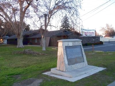
On October 3, 1806 a military and missionary expedition, led by Gabriel Moraga, encountered a native tribe a mile or two upstream from what is now Knights Ferry.
This settlement, which became Buena Vista, was probably started by J.S. Grayson in . . . — — Map (db m42176) HM
Founded in 1852. This grocery store has been in continuous operation sever since. Making it the oldest store of its kind in the state of California. It has survived several disastrous floods that struck this community. The old pot bellied stove at . . . — — Map (db m12932) HM
Built 1860's by Fred Miller; the finest bar, pool hall, card room, and dance hall in the area. Sold to R. V. Shaw in 1903 who operated a hotel here for years; later known as John Greenhalgh Hall. Napier family sold to the Knights Ferry History and . . . — — Map (db m42153) HM
Mexican land grant. 11 Sq. leagues, - 48,887 acres - made to Francisco Rico and A. Castro on Dec. 29, 1843 by Gov. Micheltorena. Patent signed by Pres. A. Lincoln on Jan. 21, 1863. Abraham Schell bought 3½ leagues in 1863 and with George H. . . . — — Map (db m42103) HM
The establishment of Estanislao Chapter 58 occurred on June 21, 1958. The inaugural meeting took place at the historic Tulloch Flour Mill in Knights Ferry under the direction of Noble Grand Humbug W.S. 'Walt' Hargrove. There were forty-eight . . . — — Map (db m178005) HM
This area has seen four phases of mining – placer, tunneling, hydraulic, and dredging. This bucket, one of a chain of 100, holds 12 c.f. and is from one of the worlds largest dredges. The Tuolumne Gold Dredging Co. started operation of the . . . — — Map (db m94799) HM
In this stand of eucalyptus trees lie the remains of the La Grange Gold Dredge Co. Camp. Here unmarried miners lived in a small community while they operated huge dredging machines near and on the Tuolumne River. The camp was abandoned in 1951 when . . . — — Map (db m46325) HM
The original saloon on this site burned on January 13, 1897 as a result of a fire in the adjacent Coulter Hotel. The saloon owner Louis Levaggi, erected the present building the same year for 13,000. It was known as the “Metropolitan”. . . . — — Map (db m42575) HM
This is one of the oldest continuously occupied buildings in LaGrange. In 1857, Lodge #65 of the Independent Order of Odd Fellows of California was formed.
The Odd Fellows purchased the two story jail from the County in 1862 and it was used for . . . — — Map (db m94798) HM
Formerly at the foot of Main Street. Replaced one built in 1858, which burned in June, 1900. A few Clampers may have slept here, but Clampers helped restore this building in 1976. — — Map (db m42596) HM
This building, circa 1875, replaced the Branch District School that was built of rough lumber in 1855. Typical of the era, it is one room with handmade furnishings, porch and bell tower. A native of Iowa, C. C. Wright came here and began teaching in . . . — — Map (db m42562) HM
Behind this monument rests the historic Tuolumne Gold Dredge which started operation at Patricksville, just east of this location, on June 15, 1938. A Walter Johnson No. 52 Model, it floated on a self-created pond of water. It was larger than a . . . — — Map (db m7323) HM
The Town of Adamsville was located approximately ½ mile west of this location. Founded in 1849 and named after Dr. David Adams, Adamsville became the county seat of the newly formed Stanislaus County on June 10, 1854. County government remained here . . . — — Map (db m213851) HM
In 1918 the Modesto Aviation Field was established on land donated by T. Lellane, making it the first municipally owned airport in the country.
In 1926 the name was changed to Bud Coffee Aviation Field in honor of Harold Coffee, a local test . . . — — Map (db m243824) HM
Grant Post #9
Modesto, California
1879 – 1938
GAR
This plot was dedicated to the GAR members of Grant Post #9 who fought for the Union during the Civil War of 1861-1865. The post was chartered in 1879 with ten members and grew to several . . . — — Map (db m219498) HM
Named in honor of John W. Laird, pioneer of 1846. A Mexican War Veteran, miner, ferryman, and civic leader. He established the first private school in this area, and served as commissioner in the organization of Stanislaus County in 1854. Born 1806 . . . — — Map (db m213853) HM WM
Originally called “Ralston” after the
founder who was too modest to permit
the use of his name, hence “Modesto”
Adamsville – 1854, Named after Doctor Adams, the only physician in the area.
Empire City – . . . — — Map (db m19506) HM
The first recorded burial here was in 1860, but oral history says there were burials as early as 1850. Veterans of wars and conflicts since the Civil War are also buried here. In 1890 a wooden sidewalk was built from downtown so that the ladies’ . . . — — Map (db m19458) HM
A local Indian word for "meeting place". Nearby are the famous Indian rocks and sycamore grove where mission padres met with the local Indian tribes. Visited by Lt. Moraga and Fr. Viader on October 25, 1810. Became a favorite watering place for . . . — — Map (db m61582) HM
The Oakdale Saddle Club was started by a group of
local "horsemen” and incorporated in July of 1945.
They began by putting on some local horse activities
after completing the basic work on the grounds they had purchased.
Rodeos emerged in . . . — — Map (db m134034) HM
The narrow gauge railroad winding some 25 miles from Patterson through Del Puerto Canyon operated from Sept. 20, 1916 to August 14, 1920. During World War I, the railroad brought the much needed minerals of magnesite, manganese chrome and . . . — — Map (db m17968) HM
A 3 Sq. League - 13,340 acres - Rancho granted to Mariano and Pedro Hernandez on Jan. 20, 1844 by Gov. M. Micheltorina. Confirmed by the Land Commissioners on May 22, 1855 and by the U.S. District Court on Mar. 22, 1857. Patent issued by Pres. A. . . . — — Map (db m27312) HM
Below this bluff is the site of Burneyville. Founded 1867 by Maj. James Burney, miner, Indian fighter, and public servant. As school superintendent and Justice of the Peace, Burney lived a full life. Died 1901 at the age of 87 years.
Dedicated . . . — — Map (db m243828) HM
This building was constructed in 1921 by the Andrew Carnegie Foundation and served as a public library. In 1996 it was placed into the National Registry of Historic Places. The history of our community is preserved in this museum by the Riverbank . . . — — Map (db m19460) HM
Originally located 3/8 mile downstream, this ferry was first established by Dr. B. D. Horr about 1850. Later owned by Dickenson and by Osborn, it was purchased by John W. Roberts in 1862 and moved to this location in 1865. The ferry was the . . . — — Map (db m42598) HM
Established December 27, 1945 for combat veterans and their families. This monument is dedicated to all the men and women who have served and are serving in the armed forces of the United States of America, in time of peace and conflict. The . . . — — Map (db m241731) HM WM