21 entries match your criteria.
Entries Containing All of the Phrases «oklahoma county» AND «oklahoma»
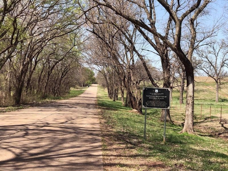
By Duane and Tracy Marsteller, April 10, 2025
Arcadia Route 66 Roadbed Marker
RANKED BY RELEVANCE
1 ► Oklahoma, Oklahoma County, Arcadia — Arcadia Route 66 Roadbed — Oklahoma County — Oklahoma U.S. 66 1926-1952 —  |
| On East Old Highway 66 west of U.S. 66, on the right when traveling west. | |||
| 2 ► Oklahoma, Oklahoma County, Edmond — Citizens Bank — 102 South Broadway — |
| On South Broadway at East 1st Street, on the right when traveling north on South Broadway. | |||
| 3 ► Oklahoma, Oklahoma County, Edmond — Edmond Public School 1889 — First Public Schoolhouse In Oklahoma Territory — |
| On East 2nd Street (U.S. 77) west of South Boulevard, on the right when traveling east. | |||
| 4 ► Oklahoma, Oklahoma County, Oklahoma City, Central Oklahoma City — Lion's Head from Terminal Building and Arcade — |
| On Kiamichi Place at Stagecoach on Kiamichi Place. | |||
| 5 ► Oklahoma, Oklahoma County, Oklahoma City, Arts District — 420 W. Main Street — |
| On West Main Street east of North Walker Avenue, on the right when traveling east. | |||
| 6 ► Oklahoma, Oklahoma County, Oklahoma City, Arts District — The Harbour-Longmire Building — |
| On West Main Street east of North Walker Avenue, on the right when traveling east. | |||
| 7 ► Oklahoma, Oklahoma County, Oklahoma City, Business District — Cotton Exchange Building — c. 1923 — |
| On Robert S Kerr Avenue at North Harvey Avenue, on the right when traveling east on Robert S Kerr Avenue. | |||
| 8 ► Oklahoma, Oklahoma County, Oklahoma City, Central Oklahoma City — Oklahoma City No. 1 — |
| On Itio Boulevard at Southeast 57th Street, on the left when traveling south on Itio Boulevard. | |||
| 9 ► Oklahoma, Oklahoma County, Oklahoma City, Central Oklahoma City — Chickasaw Economic Renaissance — |
| On Centennial Drive south of E Reno Ave. | |||
| 10 ► Oklahoma, Oklahoma County, Oklahoma City, Central Oklahoma City — Council Grove — |
| On North MacArthur Boulevard 0.1 miles NW 5th St, on the right when traveling north. | |||
| 11 ► Oklahoma, Kingfisher County, Kingfisher — Pioneer Telephone Cooperative, Inc. — Established 1953 — |
| On East Robberts Avenue at N Main Street (U.S. 81), on the left when traveling east on East Robberts Avenue. | |||
| 12 ► Oklahoma, Oklahoma County, Oklahoma City, Central Oklahoma City — 10 — City Hall by Forfeiture — The ‘89er Trail — |
| On West Sheridan Avenue at North Broadway Avenue, on the right when traveling east on West Sheridan Avenue. | |||
| 13 ► Oklahoma, Oklahoma County, Oklahoma City, Central Oklahoma City — 7 — The Election of May 1, 1889 — The ‘89er Trail — |
| On West Main Street, on the right when traveling east. | |||
| 14 ► Oklahoma, Oklahoma County, Oklahoma City, Central Oklahoma City — 4 — The Land Run — Oklahoma City April 22, 1889 — The ‘89er Trail — |
| On South E.K. Gaylord Boulevard north of Reno Avenue, on the right when traveling north. | |||
| 15 ► Oklahoma, Johnston County, Tishomingo — Johnston County Courthouse — |
| On West Main Street (State Highway 377) at North Capital Avenue, on the right when traveling west on West Main Street. | |||
| 16 ► Oklahoma, Cleveland County, Norman — The Beginning of Cleveland County — |
| On East Comanche Street at South Peters Avanue, on the right when traveling east on East Comanche Street. | |||
| 17 ► Oklahoma, Oklahoma County, Oklahoma City, Central Oklahoma City — 16 — Beale Defeats Overholser For Mayor — Oklahoma City November 27, 1889 — The ‘89er Trail — |
| On Latting Circle south of Park Avenue, on the left when traveling north. | |||
| 18 ► Oklahoma, Oklahoma County, Oklahoma City, Deep Deuce — Dr. William Lewis Haywood — 1883 - May 1971 — |
| On Northeast 2nd Street at North Central Avenue, on the right when traveling east on Northeast 2nd Street. | |||
| 19 ► Oklahoma, Oklahoma County, Oklahoma City, Central Oklahoma City — 23 — C.G. "Gristmill" Jones — Oklahoma City 1889-1903 — The '89er Trail — |
| On S Robinson Ave west of SW 7th St. | |||
| 20 ► Oklahoma, Oklahoma County, Edmond — Gower Memorial Cemetery / Gower Cemetery — |
| On East Covell Road 0.6 miles east of North Douglas Boulevard, on the right when traveling east. | |||
| 21 ► Oklahoma, Osage County, Pawhuska — Pawhuska — A Picture Window of our Heritage, The Cowboy, The Indian, The Rich Oil History!! — |
| On East Main Street (U.S. 60) at Lynn Avenue, on the left when traveling west on East Main Street. | |||
Thin black lines indicate changes in relevance. Between each pair of lines entries are ordered geographically but all have the same relevance.
* Inflectional forms of words are their plurals, singulars, and possessives as well as gramatical tenses and similar variations.
Nov. 12, 2026