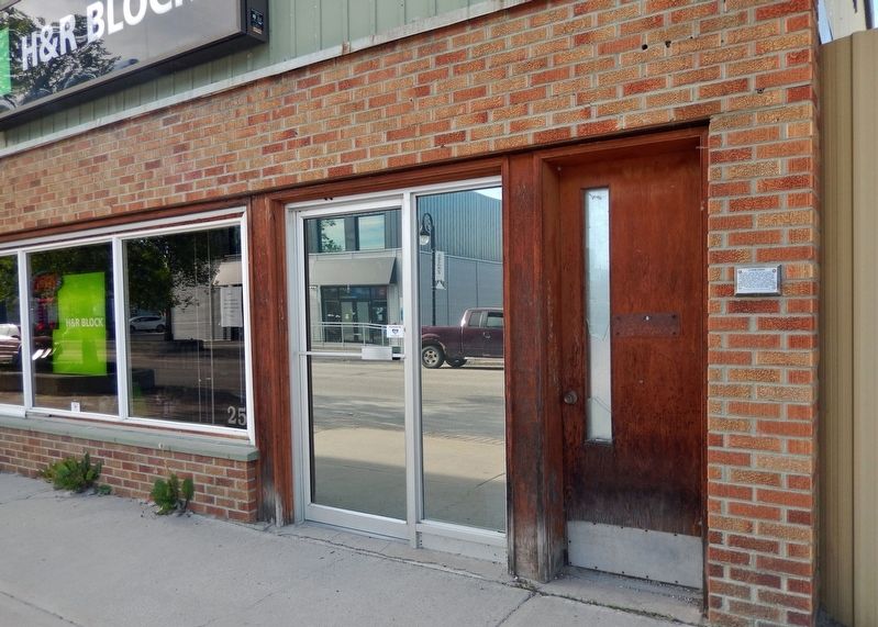
On King Street just east of Earl Avenue, on the left when traveling east.
In 1923, a garage was built here and an automobile sales and service was operated by "Dryden District Motors", "Dryden Motors", and "Dryden Service" respectively. Vernon Pronger rebuilt the building in 1938, and operated "Vernon's Grocery" here for . . . — — Map (db m243107) HM
On West River Road (Duke Street) (Provincial Highway 594) at Earl Avenue, on the right when traveling east on West River Road (Duke Street).
According to legend, the Honourable John Dryden, Ontario Minister of Agriculture, got off the train at Barclay Tank to stretch his legs on a trip to the west in 1893. He was impressed with the clover growing along the embankment, and as a result . . . — — Map (db m242999) HM
On Earl Avenue at West River Road (Duke Street) (Provincial Highway 594), on the right when traveling south on Earl Avenue.
Alan Durance left behind a legacy of accomplishments the likes of which most people only dream. It all began in 1919 at age 17 when he arrived from England with his parents and siblings and settled on a homestead farm two miles north of Dryden. . . . — — Map (db m243095) HM
On Whyte Avenue just south of King Street, on the right when traveling south.
Alex Wilson was a visionary and a man of many talents and accomplishments. He came to Canada with his Scottish parents at age eight. With a grade nine formal education, he began a life-long period of learning in the real world of the world's worst . . . — — Map (db m243269) HM
On West River Road (Duke Street) (Provincial Highway 594) at Earl Avenue, on the right when traveling east on West River Road (Duke Street).
The west shore of the river is about where nature made it. There was a waterfall where the dam and Duke Street Bridge are now, and an island at the east end of the present bridge. A second channel, also with a waterfall about where you are . . . — — Map (db m242997) HM
On West River Road (Duke Street) (Provincial Highway 594) at Earl Avenue, on the right when traveling east on West River Road (Duke Street).
Before World War II, most of the wood supply for the mill as well as the several saw mills which operated in Dryden was delivered by water. The wood was cut generally in the winter around the hundreds of miles of shore line of Lake Wabigoon and its . . . — — Map (db m242994) HM
Near Provincial Highway 17 at Florence Street, on the right when traveling south.
Dryden has been a center of the forest industry for over a century due to the availability of timber, its location on the Canadian Pacific Railroad and, before the existence of the power grid, the potential for power generation by the Wabigoon . . . — — Map (db m243085) HM
On King Street just east of Earl Avenue, on the right when traveling east.
In 1940, at the age of 21 years, Russell left Dryden to escape the great depression, and to join the Royal Canadian Regiment at London, Ontario. In 1943 he left the peaceful hills of England to land in Sicily as part of the British Army. When . . . — — Map (db m243258) HM
On West River Road (Duke Street) (Provincial Highway 594) just west of Earl Avenue, on the right when traveling west.
Farmer, bush camp foreman, tugboat operator, retail lumberman, husband and father, fisherman, hunter, town councillor, mayor. George Rowat was part of a generation who started life in an era of great potential and who worked hard to build their . . . — — Map (db m243094) HM
On West River Road (Duke Street) (Provincial Highway 594) at Earl Avenue, on the right when traveling east on West River Road (Duke Street).
About 1885 gold was discovered at Goldrock on the northern tip of Upper Manitou Lake about 30 miles southeast of here. A townsite was laid out in 1898 which grew to a town of 500 by its peak in 1908. At that time there were 5 gold mines operating . . . — — Map (db m243000) HM
On King Street just west of Whyte Avenue, on the left when traveling west.
Born in Reston, Manitoba Sept. 20, 1920 and brought up in Treherne, Manitoba, Grant had a happy, busy childhood. When WWII started, Grant volunteered with the Air Force, serving in North Africa and England. He was on his way to the Pacific when the . . . — — Map (db m243231) HM
On Van Horne Avenue just north of King Street, on the right when traveling north.
Built in 1897 by J. S. McFadyenMr. McFadyen built several of the town’s early buildings including the first jail & council chamber in 1904. — — Map (db m243242) HM
On King Street just west of Whyte Avenue, on the right when traveling west.
In 1949 Norman McAuley opened Dryden's first law office. Choosing Dryden was a geographical compromise as Norman grew up on a farm outside of Orangeville, Ontario and Valerie had spent her childhood in Saskatchewan. Norman continued to practice law . . . — — Map (db m243292) HM
On King Street at Provincial Highway 17, on the right when traveling south on King Street.
In 1894, The Honourable John Dryden, Minister of Agriculture, travelled to Northwestern Ontario to explore the commercial possibilities of the region. He found clover growing in abundance and, at that time, there was a demand for clover on the . . . — — Map (db m243054) HM
Near Provincial Highway 17 at Florence Street, on the right when traveling south.
The title "Pieces of Dryden" was chosen for the artwork because all the pieces were collected from the residents of Dryden and the surrounding area… dishes, pottery, mirrors and tiles. Artist's Design Statement The natural beauty of . . . — — Map (db m243233) HM
On West River Road (Duke Street) (Provincial Highway 594) at Earl Avenue, on the right when traveling east on West River Road (Duke Street).
For 20 years Dryden turned its back on its waterfront, and the river no longer played a central role in the lives of the town. The wood disappeared from the river, and the paper mill retreated from the waters edge. The dilapidated boathouses . . . — — Map (db m242996) HM
On West River Road (Duke Street) (Provincial Highway 594) at Earl Avenue, on the right when traveling east on West River Road (Duke Street).
In the early 1900’s the best and strongest wrapping paper was made from Jack Pine using the Kraft process. The process used then required quantities of soap stone, and there are a number of soap stone mines in the Dryden area. The principal forest . . . — — Map (db m242993) HM
On West River Road (Duke Street) (Provincial Highway 594) at Earl Avenue, on the right when traveling east on West River Road (Duke Street).
Construction of the Canadian Pacific Railway was completed through the Dryden area in 1882. The railroad was constructed through virgin wilderness in this area, mostly mature forest which was readily ignited by sparks from the wood burning . . . — — Map (db m242998) HM
On West River Road (Duke Street) (Provincial Highway 594) at Earl Avenue, on the right when traveling east on West River Road (Duke Street).
The area just north of this point was originally an island and the east branch of the river. When the earth dam forming the base of Duke Street was built, the east branch of the river became a bay which was used for swimming. Later a small Hall . . . — — Map (db m242995) HM
Near Government Street (Provincial Highway 17) at King Street, on the right when traveling east.
[left side] Opened in the Fall of 2009, the naming of this bridge after Mr. Roy Wilson recognizes his many contributions to City Revitalization. This 34 meter suspension bridge was built with generous support from the Province of Ontario . . . — — Map (db m243089) HM
On King Street just east of Earl Avenue, on the left when traveling east.
This building was built in 1911 by postmistress, Mrs. Ida Smith. With Ida's death in 1921, her daughter Aldra became owner and postmistress. In 1926, Mr. John Harris became owner and postmaster. The post office was moved in 1939. Mr. & Mrs. . . . — — Map (db m243297) HM
On King Street at Earl Avenue, on the left when traveling west on King Street.
Dedicated in memory of William Jennings (Bill) Silver A papermaker of forty-eight years and husband of Edna Lillian Silver (nee Neely), Bill was a gentle and upright man who loved and supported his family and his community. The Silver family was . . . — — Map (db m243293) HM