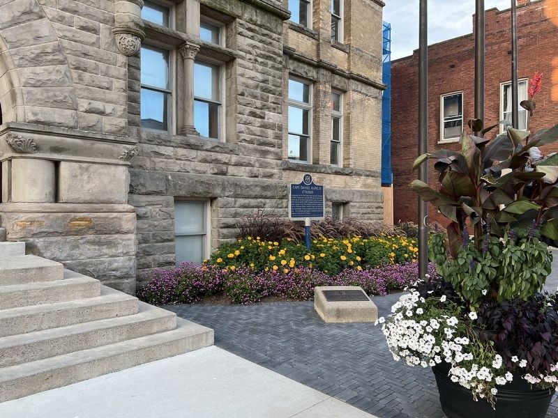
On Talbot Street at Mondamin Street on Talbot Street.
Emigrating from New York State to the Long Point Settlement in 1802, Rapelje later received 200 acres of land on the south side of the Talbot Road at Kettle Creek. He settled here with his family in 1810. A veteran of Lundy's Lane and other battles . . . — — Map (db m255828) HM
On Wellington Street at Queen Street, on the right when traveling east on Wellington Street.
Founder of the Talbot Settlement, he was born at Castle Malahide, Ireland, a member of the Anglo-Irish nobility. In 1803, after serving in the British Army, and on Simcoe's staff, he was granted 5,000 acres in this region and settled in Dunwich . . . — — Map (db m255637) HM
On Pleasant Street at Talbot Street, on the right when traveling south on Pleasant Street.
This house was built in 1848 by Dr. Elijah Duncombe brother of Dr. Charles Duncombe. The latter, born in Connecticut, came to Upper Canada in 1819 and settled on this property shortly thereafter.
In 1824, with Dr. John Rolph, he opened at St. . . . — — Map (db m255573) HM
On Wellington Street at Metcalfe Street on Wellington Street.
The Elgin Registry Office was built in 1874 during a formative period (1870 to 1886) of constructing separate buildings for the registry offices. A standard design was developed by the Ontario Department of Public Works for registry office . . . — — Map (db m255730) HM
On Stanley Street at Wellington Street, on the left when traveling south on Stanley Street.
The former Governor's residence was a two-storey, yellow-brick, Queen Anne-style house. It sat at the south-west corner of the Elgin County Courthouse, facing west towards Stanley Street and the Kettle Creek river valley. The house was . . . — — Map (db m255655) HM
On Stanley Street at Wellington Street, on the left when traveling south on Stanley Street.
The Provisional Elgin County Council accepted a site for the courthouse and jail from a local landowner, Benjamin Drake. The site was conveyed to Queen Victoria for county and district buildings in October of 1848. During the planning of . . . — — Map (db m255656) HM
On Metcalfe Street at Queen Street, on the right when traveling east on Metcalfe Street.
The Elgin County Courthouse was built in 1852-53 and is one of the earliest pre-Confederation county courthouses in Ontario. Along with the courthouses of Brant and Norfolk Counties, the
Elgin County Courthouse is one of the three . . . — — Map (db m255667) HM
After a fire in 1898, St. Thomas architect Neil R. Darrach was commissioned to repair and enlarge the courthouse to meet its growing needs. Darrach's plans closely followed the designs done by the original architect John Turner when he . . . — — Map (db m255665) HM
On Wellington Street at Queen Street on Wellington Street.
The Elgin County Courthouse has stood as a St. Thomas cultural landmark for more than 150 years. Its restoration and renovation will preserve its historical stature and allow it to continue serving the local and the extended community for . . . — — Map (db m255657) HM
On White Street at Talbot Street, on the left when traveling south on White Street.
On Sunday, June 25 1916, a crowd of 20,000 gathered at the Michigan Central Station to see off the 940 men of the Elgin Regiment's 91st Battalion.
Travelling by train from St. Thomas to Halifax, they crossed the Atlantic aboard the Olympic and . . . — — Map (db m255841) HM
On Talbot Street at Mary Street, on the right when traveling east on Talbot Street.
Ontario's eleventh prime minister was born in nearby Yarmouth Township and educated at St. Thomas Collegiate. After serving in World War I, he was elected to the federal parliament in 1926 as member for Elgin West. In 1930 he was named leader of the . . . — — Map (db m255738) HM
On Fingal Line 1.6 kilometers west of Sunset Drive, on the right when traveling east.
This property once belonged to John Rolph, a prominent
physician, lawyer and legislator. Born in England, he
emigrated to Upper Canada in 1812. In 1824, with Dr.
Charles Duncombe, he established at St. Thomas the
province's first medical school, . . . — — Map (db m255560) HM
On Talbot Street close to King Street, on the right when traveling west.
On September 15, 1885, the giant African elephant, star of the Barnum and Bailey Circus, met a untimely death when struck in St. Thomas by a Grand Trunk locomotive. To commemorate the one hundredth anniversary of this tragic event, the citizens of . . . — — Map (db m78342) HM
On Walnut Street at Church Street, on the right when traveling east on Walnut Street.
In a fall of 1814 American general Duncan McArthur lead an expedition of 600 mounted riflemen, mostly Kentucky and Ohio volunteers, into Upper Canada from Detroit. He intended to attack Burlington Heights, the closest British encampment, in concert . . . — — Map (db m255604) HM
On Sparta Line 1.2 kilometers west of Quaker Road, on the right when traveling west.
Jonathan Doan (1765-1847), a member of the Society of Friends, came to Upper Canada from Pennsylvania about 1789. He settled first in the Niagara peninsula, and then purchased 200 acres of wilderness here in south Yarmouth Township in . . . — — Map (db m252787) HM
On Sunset Drive (County Road 4) 0.4 kilometers north of John Wise Line, on the right when traveling north.
RCAF Technical Training School
The only facility of its kind in Ontario during the Second World War, No. 1 Technical Training School, St. Thomas, was established by the Royal Canadian Air Force in 1939 to produce skilled ground crews for . . . — — Map (db m255293) HM
Near Talbot Street east of Horton Street, on the right when traveling east.
[English] The St. Thomas Canada Southern (CASO) Station, financed by American railway promoters, was constructed between 1871 and 1873 to serve as both the passenger station for St. Thomas and CASO's corporate headquarters. During the 1920s, . . . — — Map (db m198268) HM
On Walnut Street at Church Street, on the right when traveling east on Walnut Street.
This church was completed in 1824 on land given by Capt.
Daniel Rapelje, the founder of the city of St. Thomas.
It is one of the province's finest remaining examples
of Early English Gothic Revival architecture. In 1825
a tower, steeple and . . . — — Map (db m255608) HM
On Mondamin Street at Talbot Street, on the left when traveling north on Mondamin Street.
The St. Thomas Street railway opened in 1879. Although it was originally a horse drawn trolley line, the ten mile line was modernized with electrical power in 1898. By 1908, St. Thomas was home to seven different railways. It was then that St. . . . — — Map (db m255838) HM