April 8, 1865 Union cavalry arrived early in the evening and captured three of Lee’s four supply trains. Advancing toward Appomattox Court House, they encountered the surplus Confederate wagons and artillery train. After a brief conflict, . . . — — Map (db m6075) HM
On Main Street (Virginia Route 131) at Church Street, on the right when traveling east on Main Street.
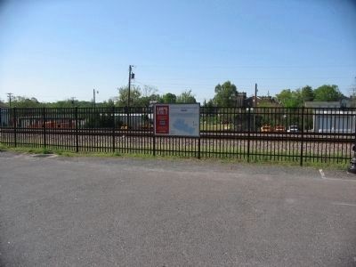
Near this building stood the station of the South Side Railroad where, on April 8, 1865, three trains unloading supplies for the Army of Northern Virginia were captured by units of Sheridan’s Union cavalry under Gen. Geo. Custer. Significant for its . . . — — Map (db m203259) HM
On Court Street (Virginia Route 131) at Morton Lane, on the right when traveling south on Court Street.
This building, erected in 1892 when the county seat was moved to this location, should not be mistaken for the original, built in 1846 and destroyed by fire in 1892. Three miles northeast is old Appomattox Court House and the McLean House where Lee . . . — — Map (db m15514) HM
On Old Courthouse Road (Virginia Route 24), on the left when traveling west.
The four-year effort to vanquish the Confederate Army of Northern Virginia came to its climax in the fields before you. “Legs will win the battle men …. They can’t escape, if you will keep up to it.” Maj. Gen. E.O.C.Ord, . . . — — Map (db m15516) HM
On Old Courthouse Road (Virginia Route 24), on the left when traveling west.
The 30-foot obelisk marks the Raine family cemetery. Erected in 1912 by C. Hunter Raine, the monument honors past family members, including C. Hunter’s father, Charles James Raine, who served as a captain in the Lee Battery of Virginia Artillery. . . . — — Map (db m36257) HM
On Old Courthouse Road (Virginia Route 24), on the left when traveling west.
(Front):Erected by C. Hunter Raine in loving memory of his father Chas. J. Raine captain of Lee Battery, Co. A, Virginia Artillery, C. S. A. Killed in the Battle of Mine Run Va., November 30th, 1863 and the members of the family buried . . . — — Map (db m15520) HM
On Old Courthouse Road (Virginia Route 24), on the right when traveling west.
Here are buried eighteen Confederate soldiers who died April 8 and 9, 1865 in the closing days of the War Between the States. The remains of one unknown Union soldier found some years after the war are interred beside the Confederate dead. About 500 . . . — — Map (db m156470) HM
On Old Courthouse Road (Virginia Route 24), on the right when traveling west.
As Lee’s Confederate Army retreated west, Federal forces blocked their way. Near this spot, Union artillery pieces commanded by Lieutenant James H. Lord and a cavalry brigade led by Brevet Brigadier General Charles Smith proved a strategic delay to . . . — — Map (db m169121) HM
On Old Courthouse Road (Virginia Route 24), on the right when traveling west.
The last Federal battery taken by the Confederates was captured by the North Carolina cavalry brigade of Brig. Gen. W.P. Roberts at this place. — — Map (db m5972) HM
On Old Courthouse Road (Virginia Route 24), on the right when traveling west.
Buried here are nineteen men (out of perhaps 100) killed during the last two days of war in Virginia. These men were at first buried where they died – at hospitals or in farm fields and woodlots around Appomattox Court House. But in 1866, the . . . — — Map (db m5990) HM
Near Old Courthouse Road (Virginia Route 24), on the right when traveling west.
The road trace in front of you is the remnant of the Richmond-Lynchburg Stage Road – on April 9, 1865, the most important road in Virginia to Robert E. Lee. Along this road he planned to escape west, hoping eventually to turn south and join Joe . . . — — Map (db m5984) HM
On National Park Drive (State Highway 24), on the right when traveling north.
Here, amidst the once-quiet streets and lanes of Appomattox Court House, Lee, Grant, and their tired armies enacted one of the great dramas in American history. “General, this is deeply humiliating; but I console myself with the thought . . . — — Map (db m15530) HM
Near National Park Drive (State Highway 24), on the right when traveling west.
Built in 1819, this was the first building in what would become the village of Appomattox Court House. The Clover Hill Tavern served travelers along the Richmond-Lynchburg Stage Road. For several decades, it offered the village’s only restaurant, . . . — — Map (db m5989) HM
Near State Highway 24, on the right when traveling west. Reported missing.
Here in the parlor of Wilmer Mclean's home on April 9 — Palm Sunday — 1865 Lee surrendered the Army of Northern Virginia to Grant. This act brought the Civil War to an end. — — Map (db m36254) HM
On Richmond-Lynchburg Stage Road, on the left when traveling east.
On this spot Lieutenant General Ulysses S. Grant, U.S.A. and General Robert E. Lee, C.S.A. met on the morning of April 10th, 1865. — — Map (db m15535) HM
On Richmond-Lynchburg Stage Road, on the left when traveling east.
On the knoll before you, Lee and Grant held the second of their two meetings at Appomattox Court House. They met here on the morning of April 10. Grant hoped to enlist Lee’s support in urging the surrender of other Confederate armies, and Lee was . . . — — Map (db m5966) HM
On Old Courthouse Road (Virginia Route 24), on the right when traveling west.
The depression before you is the trace of the old Richmond-Lynchburg Stage Road. Gen. Robert E. Lee rode this route both to and from his meeting with Grant on April 9, 1865. His return to the army – as he passed towards his headquarters atop . . . — — Map (db m6004) HM
Near Old Courthouse Road (Virginia Route 24), on the right when traveling west.
Near this site General Lee crossed the Appomattox River and proceeded up the hill to the McLean House where he met General Grant to draft the terms of surrender. April 9, 1865. — — Map (db m6006) HM
Near Old Courthouse Road (Virginia Route 24), on the left when traveling west.
On this spot were established the headquarters of the Army of Northern Virginia, General Robert E. Lee, C.S.A, commanding, from April 8th to April 11th, 1865. — — Map (db m15533) HM
On Old Courthouse Road (Virginia Route 24), on the left when traveling west.
For most of the war, Lee and his army had tormented their Northern enemies – at Gaines’ Mill, Manassas, Fredericksburg, Chancellorsville. But here, on April 9, 1865, the once-mighty Army of Northern Virginia found itself trapped. Lee faced . . . — — Map (db m15526) HM
On Howe Flood Highway (State Highway 24), on the left when traveling south.
You are standing where Gen. James Longstreet’s corps entrenched early in the morning of April 9, 1865, to protect the rear of the Army of Northern Virginia. Gen. Robert E. Lee and most of the army bivouacked about four miles south, just short of . . . — — Map (db m6051) HM
On Howe Flood Highway (State Highway 24), on the left when traveling south.
April 8, 1865. General Longstreet built breastworks here to protect the rear of Lee's army at Appomattox Court House. On the morning of April 9, General Lee arrived hoping to meet General Grant. After learning that he was approaching from . . . — — Map (db m6073) HM