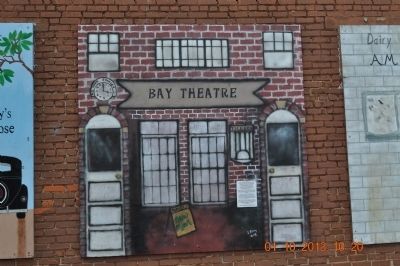
T. A. Wilson built the theater in 1927. Since Red Bay had no electricity at that time, he used a Delco System. Shortly after, electricity became available and he had to switch from Delco to Alabama Power. When he first started in the business, he . . . — — Map (db m83742) HM
Jesse James Gang
Canal Payroll Robbery
March 1881
In, 1881, approximately three miles south of here, the U.S. Corps of Engineers was constructing the Muscle Shoals Canal along the north side of the Tennessee River. On March 11, 1881, . . . — — Map (db m99897) HM
Lock Six, headquarters of Muscle Shoals Canal, was located 1.3 miles south of here. An 1836 attempt to build a bypass canal around the shoals proved unsuccessful. On November 10, 1890 the canal from Rogersville to Florence was successfully . . . — — Map (db m28452) HM
General Leroy Pope Walker was born 7 Feb 1817 in Madison County, Al., son of John W. Walker (1784~1823). John was House Speaker of the AL Territory, the first constitutional convention president, the first US AL senator, and namesake of Walker . . . — — Map (db m69669) HM
On land expropriated from San Miguel Mission, at the site of an adobe frequented by Frank and Jesse James, the first saloon in San Luis Obispo County opened its doors here on December 5, 1853. In its heyday, the Elkhorn Saloon often earned over . . . — — Map (db m59926) HM
The Jackson Hotel was built in 1878 by Henry A. Jackson who left his home in Kentucky looking for a place where his family could escape the turmoil of post-Civil War reconstruction. A former Memphis steamboat captain, Jackson found himself high and . . . — — Map (db m117048) HM
Nunnally Johnson was a native of Columbus who left his job as a reporter for "The Columbus Enquirer - Sun" to eventually become one of Hollywood's most successful screenwriter/producers. By the age of thirty-five, Johnson had written two musicals . . . — — Map (db m101322) HM
Built circa 1870, the café was formerly the Crowell Bank, which Jesse James robbed in 1876. It is currently a restaurant and bed and breakfast. — — Map (db m37551) HM
The first bank in Baxter Springs was the Bank of Baxter also called the Crowell Bank. It was established in 1870 and did business in this building. H. R. Crowell, the founder, was the second mayor of Baxter Springs. In May of 1876, Jesse James and . . . — — Map (db m37531) HM
Part of building erected about 1810 by Wm. Harrison, used as a residence by him and later by the Nortons. In 1857 front part built for Southern Bank of Ky. Building owned by Judge Hardy family sixty yrs. (1966). Mar. 20, 1868, it was scene of holdup . . . — — Map (db m123354) HM
In 1833 Major John Gray, Founder of Elkton, built an inn here as a relay house for his stage coach lines. Legend states that Andrew Jackson, Jenny Lind, and Jesse James were patrons. It was a Civil War Confederate hospital. Most of original inn . . . — — Map (db m92103) HM
On September 7, 1876 Nicolaus Gustafson, a recent immigrant from Sweden, was fatally shot by Cole Younger during the notorious Jesse James Gang's aborted raid on the Northfield bank. Gustafson had ridden into town that morning with Peter Youngquist . . . — — Map (db m93625) HM
Late in the day on September 6, 1876, four heavily armed men rode into Millersburg from the west and spent the night in the Cushman Hotel east of the school. They were led by a ruthless outlaw named Thomas Coleman "Cole" Younger. The four armed men . . . — — Map (db m93623) HM
Outlaw Jesse James was shot and killed in this house April 3, 1882. It was then at 1318 Lafayette on the hill above Patee House. It was moved here in 1977. — — Map (db m58835) HM
Patee Park Baptist Church is the second oldest Baptist Church in St. Joseph. It began as a Sunday School in 1881 under the leadership of H.G. Walker, an active leader in the First Baptist Church of St. Joseph.
It was organized as a church . . . — — Map (db m48080) HM
John Patee came to St. Joseph in 1845 and opened the city's first drugstore at the corner of of Main and Francis Streets. He purchased 320 acres, platted what was known as "Patee Town" and began selling building lots in 1849. He later built the . . . — — Map (db m22072) HM
Renowned city of the Pony Express, St. Joseph was first settled as a trading post for the American Fur Company by Joseph Robidoux, 1826. Later he acquired the site and laid out a town in 1843. St. Joseph became an outfitting point for settlers in . . . — — Map (db m4989) HM
Missouri Mule The mule was adopted as Missouri's state animal in 1995. Generally considered smarter, hardier, and more sure-footed than a horse, mules have been used or pulling wagons and other endurance-related task. For many years Missouri . . . — — Map (db m107853) HM
The Civil War on the Missouri-Kansas border was an extension of the raiding and looting that took place during the Bleeding Kansas era of 1854 to 1860. Early in the war, Kansas Jayhawkers and Redlegs dressed in blue Union uniforms looted and . . . — — Map (db m20318) HM
The American Civil War had a profound and long-lasting impact on the Pleasant Hill area. Its location in the border state of Missouri ensured that residents would align themselves on both sides of the conflict. Numerous skirmishes were fought . . . — — Map (db m88350) HM
Built in 1858, only ante-bellum building remaining on the square. Originally housed a branch of the Farmer's Bank. Scene of first daylight robbery in 1866, supposedly by James-Younger gang. Restored to original appearance by Jack Wymore. . . . — — Map (db m68210) HM
Early border town, prominent trading and outfitting center, and one of the farthest northwest of U. S. towns to be based on southern culture and economy. Settled about 1820, mainly by southern pioneers, the town became the seat of justice for . . . — — Map (db m81749) HM
Clay County offers a variety of interesting choices for visitors. History buffs can visit the Jesse James farm in Kearney, the Elms Hotel, once a popular mineral water destination in Excelsior Springs, the Woolen Mill at Watkins Mill State Park and . . . — — Map (db m68365) HM
In the early 1870's he and his band used the cavern on numerous occasions because it afforded a complete hideout for men and horses — — Map (db m156382) HM
As far back as anyone can recall, the cave on the right bank of Meramec River, one hundred miles upstream from its confluence with the Mississippi River, was called Saltpeter Cave. Anyone venturing into Saltpeter, or any of the other large . . . — — Map (db m173410) HM
Robbed of approximately $2,000 at noon, October 30, 1866, by the Jesse James gang. This was the second bank robbed by this gang. Though pursued by a posse, the robbers escaped. — — Map (db m199122) HM
McDonald County, 540 sq. miles of Ozark grandeur in Missouri’s extreme southwest, was called Seneca when it was formed in 1847. Fully organized in 1849, it was named for Rev. War soldier Alexander McDonald.
Pineville, the county seat, was . . . — — Map (db m99715) HM
Northwest Missouri Tinderbox
Conflict and uncertainty were widespread in northwest Missouri in the summer of 1864. Federal forces struggled in a heavy-handed manner to control areas much too large for their capabilities. Raiders from . . . — — Map (db m65997) HM
Created from the Lousiana Territory, the Territory of Missouri was established by an Act of Congress in 1812, and became the 24th State on August 10, 1821. Sixteen years later in 1837 there were about sixty people living here on the banks of the . . . — — Map (db m61468) HM
Civil War Event - August 15, 1861
During the night, a military force comprised of 250 Zouaves of the 8th Missouri Infantry Regiment and an artillery piece with its 13 men arrived from Cape Girardeau. They were under the command of Major . . . — — Map (db m143584) HM
From the mid-nineteenth century into the early years of the twentieth century, most of Portsmouth's houses of ill-fame and low-class saloons were concentrated on Water Street, (today Marcy Street). City officials and the police gave unofficial . . . — — Map (db m96183) HM
Hermit of Leydecker Road William Sheppard CA. 1840-1933. Was thought to be an outlaw of Jesse James' Gang. Roamed town as a scissors grinder. — — Map (db m111417) HM
Formerly a strong southerly bend in the Canadian River was located here. The course of the river was permanently changed after the construction of the Lake Eufaula Dam in 1964. It is thought that the bend is named for Cole Younger who served in the . . . — — Map (db m146401) HM
Imagine a fall day in 1876. A man approaches, galloping on his horse as fast as they can go. They are trying to escape a posse after robbing a bank in Northfield, Minnesota. The man has already divided ways with his brother to help evade the lawmen, . . . — — Map (db m187036) HM
After their September 7, 1876, failed attempt to rob a bank at Northfield, Minnesota, Jesse and Frank James separated from the Younger Brothers gang, rode southwest, and entered Minnehaha County, Dakota Territory.
Little direct evidence exists . . . — — Map (db m197202) HM
In this building, then a combination saloon and grocery, W.W. Earthman, magistrate and ex-constable of Davidson County, on March 25, 1881, arrested Bill Ryan, alias Tom Hill, ruthless and indiscreet member of the gang, members of which were living . . . — — Map (db m39211) HM
In August 1877, Jesse James, the notorious outlaw, moved to this site from Missouri and rented a farm from N.B. Link. Using the assumed name of J.D. Howard, he engaged in farming and horse racing. He entered one of his horses, Red Fox, in local . . . — — Map (db m52583) HM
Named for Maj. Gen. Johann de Kalb - a hero of the American Revolution - upon suggestion (1836) of David Crockett, a visitor on his way to fight in Texas War for Independence. Other Texas heroes traveling through here were James B. Fannin and Wm. . . . — — Map (db m96648) HM
Once a buffalo trail, Scyene Road was one of the earliest roads in Dallas County. It linked the community of Scyene with Dallas, one day's journey by wagon to the west, and with Jefferson and Shreveport to the east. Named for a town in ancient . . . — — Map (db m147580) HM
This prairie region split by the north Concho River is old Comanche, Kickapoo, Kiowa, Lipan, and Wichita hunting ground.
Possibly it was crossed by six or so Spanish explorations between 1540 and 1654.
In the 1860s and 70s, Anglo-Americans . . . — — Map (db m115870) HM
Famous western frontier outlaws, who had many Texas hideouts along a line from the Rio Grande to the Red River. The camps—extending into Missouri, their home state—were used for hiding stolen horses until posses could be thrown off the . . . — — Map (db m108533) HM