Marker Logo HMdb.org THE HISTORICAL
MARKER DATABASE
“Bite-Size Bits of Local, National, and Global History”


45 entries match your criteria.  


Jesse James Historical Markers

This series focuses on the outlaw Jesse James: his life, his gang, his legacy and depictions of him in film, music and other cultural media.
 
Bay Theater Marker image, Touch for more information
By Sandra Hughes, October 1, 2013
Bay Theater Marker
1 Alabama, Franklin County, Red Bay — Bay Theater
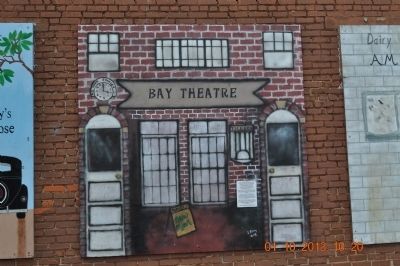
On 2nd Street Southeast at 4th Avenue South (Alabama Route 24), on the left when traveling north on 2nd Street Southeast.
2 Alabama, Lauderdale County, Elgin — Jesse James Gang Canal Payroll Robbery/Trial of Frank James
On Lee Highway (County Route 72) at Houstontown raod (Route 33), on the right when traveling east on Lee Highway.
3 Alabama, Lauderdale County, Killen — Muscle Shoals Canal1836 - 1918
On U.S. 72 at Lock 6 Road on U.S. 72.
4 Alabama, Lawrence County, Moulton — General Leroy Pope Walker
On Market Street (Alabama Route 33) at College Street, on the right when traveling south on Market Street.
5 California, San Luis Obispo County, San Miguel — Elkhorn SaloonEstablished 1853
Near Mission Street south of 13th Street, on the right when traveling south.
6 Colorado, Chaffee County, Poncha Springs — The Jackson Hotel
On U.S. 285, on the right when traveling north.
7 Georgia, Muscogee County, Columbus — Nunnally Johnson (1897-1977)
Near Front Avenue north of West 6th Street, on the right when traveling south.
8 Iowa, Adair County, Adair — First Train Robbery in the WestJesse James Robberies
On County Road G30, on the left when traveling west.
9 Iowa, Adair County, Adair — Site of the First Train Robbery in the West
On Broad Street at 5th Street, on the right when traveling east on Broad Street.
10 Kansas, Cherokee County, Baxter Springs — Café on the Route, Baxter Springs, KansasRoute 66 Roadside Attraction
On Military Avenue (U.S. 69) at 11th Street, on the right when traveling south on Military Avenue.
11 Kansas, Cherokee County, Baxter Springs — Crowell BankBaxter Springs Historic Walking Tour
On Military Avenue (U.S. 69) at 11th Street, on the right when traveling south on Military Avenue.
12 Kentucky, Logan County, Russellville — 969 — Old Bank, Robbed 1868
On South Main Street at West 6th Street, on the right when traveling south on South Main Street.
13 Kentucky, Todd County, Guthrie — 210 — Stage Coach Inn
On Graysville Road (County Route 1270) at Guthrie Road (Kentucky Route 181), on the right when traveling west on Graysville Road.
14 Minnesota, Rice County, Lonsdale — Nicolaus Gustafson
On Millersburg Blvd (County Route 1), on the right when traveling west.
15 Minnesota, Rice County, Millersburg — Millersburg & the Northfield Bank RobberySeptember 6-7, 1876
On Millersburg Blvd (County Route 1), on the right when traveling east.
Paid Advertisement
16 Missouri, Buchanan County, St. Joseph — Buchanan County CourthouseNeo-Classical — 1876 —
On 5th Street at Jules Street, on the left when traveling north on 5th Street.
17 Missouri, Buchanan County, St. Joseph — Jesse James Home
On Penn Street.
18 Missouri, Buchanan County, St. Joseph — Patee Park Baptist Church
On 10th Street (Business Interstate 29) near Seneca Street, on the right when traveling north.
19 Missouri, Buchanan County, St. Joseph — Patee Town
On Penn Street at South 10th Street, on the left when traveling east on Penn Street.
20 Missouri, Buchanan County, St. Joseph — Saint Joseph
On Penn Street, on the left when traveling east.
21 Missouri, Cape Girardeau County, Cape Girardeau — Missouri Mule / The Wild West
On Water Street.
22 Missouri, Cass County, Harrisonville — Burnt District MonumentThe Heart of the Burnt District — Missouri's Civil War —
On Missouri Route 2, 0.2 miles U.S. 71, on the left when traveling west.
23 Missouri, Cass County, Pleasant Hill — The Civil War in Pleasant Hill
On Paul Street at Broadway / Boardman St / Wyoming St, on the left when traveling west on Paul Street.
24 Missouri, Clay County, Liberty — Jesse James Bank MuseumClay County Historical Society Historical Landmark
On Water Street north of Franklin Street, on the right when traveling north.
25 Missouri, Clay County, Liberty — Liberty
On Water Street north of Kansas Street, on the left when traveling north.
26 Missouri, Clay County, Liberty — Passing Pleasures, Tourist Treasures
On Water Street north of Mill Street, on the left when traveling north.
27 Missouri, Clay County, Liberty — Site of First Daylight Bank Hold Up in United States
On Water Street at Franklin Street, on the right when traveling north on Water Street.
28 Missouri, Franklin County, Stanton — Jesse James HideoutMeramec Caverns — Stanton, Missouri
Near Highway West (State Highway W). Reported missing.
29 Missouri, Franklin County, Stanton — Saltpeter CaveMissouri's Civil War
Near Highway West (State Highway W), on the right.
30 Missouri, Lafayette County, Lexington — Alexander Mitchell & Company Bank
On Main Street (State Highway 224) at North 9th Street, on the right when traveling east on Main Street.
31 Missouri, McDonald County, Lanagan — McDonald County
On State Highway 59, 0.5 miles south of Highway EE, on the left when traveling south.
Paid Advertisement
32 Missouri, Platte County, Parkville — Attack on the Paw Paw FortMissouri's Civil War 1861 - 1865 — The Struggle for Platte County
On NW River Park Drive (Missouri Route 9) 0.1 miles east of East Street, on the right when traveling east. Reported permanently removed.
33 Missouri, St. Clair County, Osceola — The Old Commercial Hotel
On 2nd Street at Pine Street, on the right when traveling south on 2nd Street.
34 Missouri, Ste. Genevieve County, Ste. Genevieve — Merchants Bank / Ste. Genevieve Savings Bank
On South Main Street at Merchant Street, on the right when traveling south on South Main Street.
35 New Hampshire, Rockingham County, Portsmouth — Portsmouth NH Red Light District
On Marcy Street.
36 New York, Erie County, West Seneca — 27 — "Old Shep" — Legends & Lore —
On Leydecker Road just south of Seneca Street, on the right when traveling north.
37 Oklahoma, McIntosh County, Porum — Younger's Bend
On State Highway 71, 5.5 miles west of State Highway 2, on the right when traveling west.
38 South Dakota, Minnehaha County, Garretson — The Legend of Jesse JamesHit the Trail and Explore Devil's Gulch
On Devil's Gulch Park Road, 0.5 miles north of 5th Street, on the left when traveling north.
39 South Dakota, Minnehaha County, Sioux Falls — James Brothers
On West 39th Street west of South Jefferson Avenue, on the left when traveling west.
40 Tennessee, Davidson County, Nashville, Whites Creek — 3A 20 — The James Gang
On Whites Creek Pike (U.S. 431) 0.1 miles south of Old Hickory Blvd., on the right when traveling north.
41 Tennessee, Humphreys County, New Johnsonville — 3E 21 — Jesse James
On Old State Route 1 (County Highway 927) 0.2 miles south of Crockett Road, on the left when traveling south.
42 Texas, Bowie County, De Kalb — 9475 — De Kalb
On Northwest Fulton Street at Northwest Napp Street, on the right when traveling west on Northwest Fulton Street.
43 Texas, Dallas County, Dallas, Riverway Estates/Bruton Terrace — 6880 — Old Scyene Road
On Scyene Road.
44 Texas, Sterling County, Sterling City — 5113 — Sterling County
On 4th Avenue (U.S. 87) east of Elm Street, on the right when traveling east.
45 Texas, Wise County, Decatur — 3700 — Old Campsite of Jesse and Frank James(Approximately 1 mi. south)
On U.S. 380 at Renshaw-Beal Road (County Highway 2311), on the right when traveling east on U.S. 380.
 
 
CeraNet Cloud Computing sponsors the Historical Marker Database.
This website earns income from purchases you make after using our links to Amazon.com. We appreciate your support.
Paid Advertisement
May. 3, 2024