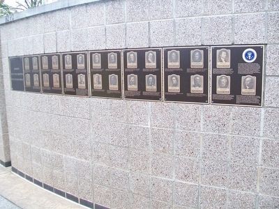
Our Constitution names the President of the United States the Commander in Chief of all the Armed Forces. Presidents who have served in our military are displayed on the following plaques. Each has served either on Active Duty, in the National . . . — — Map (db m92382) HM WM
[Written on the initial marker, provided for context]
Our Constitution names the President of the United States the Commander in Chief of all the Armed Forces. Presidents who have served in our military are displayed on the following . . . — — Map (db m92423) HM WM
On North Palm Canyon Drive, on the right when traveling north.
Prescott T. Stevens, developer of the El Mirador Hotel, donated this site and the funds to build the Frances S. Stevens School, in memory of his wife and her interest in education. The first two rooms were completed in 1927. Katherine Finchy, who . . . — — Map (db m82139) HM
On South 3rd Street at Victor Avenue on South 3rd Street.
Tomkins Hardware/Victor Museum
In 1900, the Victor museum building was the Tompkins Hardware Store, part of the Reynolds Block.
At one time the offices upstairs served as the Mining Exchange. In later years it became the Hackley . . . — — Map (db m92261) HM
On Pennsylvania Avenue Northwest at 17th Street Northwest, on the right when traveling east on Pennsylvania Avenue Northwest.
Originally State, War, and Navy Departments Constructed 1871-1888 South Wing Ground broken June 1871 Completed December 1875 East Wing Ground broken July 1872 Completed April 1879 North Wing Ground broken July 1879 Completed December 1882 West . . . — — Map (db m71253) HM
Near Tingey Street Southeast east of New Jersey Avenue Southeast, on the right when traveling west.
USS Sequoia
Presidents relax and entertain, work and negotiate on presidential yachts. The last yacht to serve, the USS Sequoia, is used by Presidents Franklin Roosevelt through Gerald Ford and was retired in 1977. . . . — — Map (db m113626) HM
Near U.S. 301, 0.2 miles south of East Dr. Martin Luther King Jr. Boulevard, on the right when traveling south.
A remnant of U.S. forces separated from South Vietnam in April 1975 in what President Gerald Ford termed a “humiliating withdrawal." U.S military involvement in southeast Asia had officially said it wasn’t over yet. In what many consider to be . . . — — Map (db m194326) HM WM
On Pinchot Road (State Road 189) at Museum Drive, on the right when traveling south on Pinchot Road.
The F-100 was the first operational aircraft capable of flying faster than the speed of sound (Mach 1) in level flight. The aircraft made its initial flight on May 25, 1953, and the first production aircraft was completed in October 1953. North . . . — — Map (db m102657) HM WM
On North Humphrey Avenue south of Chicago Avenue, on the right when traveling north.
This home was built in 1911 by Clarence James for his bride-to-be, Tannisse Gardner. The future President of the United States' mother,
Tannisse's sister, Dorothy Gardner King, brought him here as a newborn - originally named Leslie Lynch King Jr. . . . — — Map (db m245348) HM
1906 - - - - - 1992
President, Brotherhood of Railroad Trainmen
1963 - 1969
President, United Transportation Union
1969 - 1972
Contributing six decades to the Rail Labor Movement, Charles Luna began working as a Yard . . . — — Map (db m58537) HM
On N. 5th Ave at E. Main St, on the right when traveling north on N. 5th Ave.
Ray "Bubba" Sorensen painted this rock in June 2017.
The west face includes images of Sgt. Charles Floyd and the Floyd Monument in Sioux City, Iowa.
Sgt. Floyd was a United States explorer, a non-commissioned officer in the U.S. Army . . . — — Map (db m126927) WM
On Pennsylvania Avenue (U.S. 75) at Locust Street, on the right when traveling north on Pennsylvania Avenue.
[The original marker has been removed]
Dedicated Feb. 17, 1952
by
Boy Scouts of America
Rededication by
President Gerald R. Ford
in memory
Gary W. Moffatt
Coordinator
Independence Police
Reserve Unit
Assistant Coordinator . . . — — Map (db m61439) HM
Near River Road (State Highway 48) north of West Campus Drive, on the right when traveling north.
Marker 1 On October 20, 1976, the worst ferry disaster in the history of the United States occurred on the Mississippi River in St. Charles Parish. Seventy-seven lives were lost. The people of Louisiana will never forget you. . . . — — Map (db m109564) HM
Near Catoctin Furnace Road (Maryland Route 806) north of Catoctin Hollow Road.
A picturesque fieldstone chapel built as a memorial to Harriet McPherson Brien, wife of John Brien, owner of Catoctin Iron Furnace. Harriet Chapel would become a place of worship for members of the Episcopal Church in 1833. Most church services . . . — — Map (db m184185) HM
Near South Washington Avenue, on the right when traveling north.
Constructed in 1902, this castle-like building with its square tower was the Lansing station for the Grand Trunk Western Railroad until 1971. For decades passengers streamed through its doors. Here servicemen left and returned from military duty. . . . — — Map (db m104014) HM
On Lake Drive Southeast near Fitzhugh Avenue Southeast, on the right when traveling east.
Boy Scout Troop 15. In 1918, eight years after the Boy Scouts of America incorporated, Trinity Methodist Episcopal Church chartered Boy Scout Troop 15 with a membership of twenty-six boys. The troop number changed to 215 in the 1940s. Among . . . — — Map (db m176452) HM
On Union Avenue Southeast, 0.1 miles north of Thomas Street Southeast, on the left when traveling north.
Gerald R. Ford Boyhood Home
Gerald R. Ford, the thirty-eighth president of the U.S., lived here from age 8 to 17 (1921-1930). Of all his boyhood homes, Ford remembered this one most vividly. In his autobiography, Ford recalled that he and . . . — — Map (db m176451) HM
Near Pearl Street Northwest at Scribner Avenue Northwest, on the right when traveling west.
Elizabeth Anne "Betty" Bloomer was born in Chicago and raised in Grand Rapids. She became an accomplished dancer and was fashion coordinator for Herpolsheimer's Department Store. On October 15, 1948, she married Gerald R. Ford. Together they had . . . — — Map (db m176431) HM
Beyond these gates is the final resting place of our Nation's 38th President Gerald R. Ford and his wife Elizabeth R. Ford
President of the United States 1974 -1977 Vice President of the United States 1973 - 1974 United States House of . . . — — Map (db m99970) HM
President of the United States 1974 -1977 Vice President of the United States 1973 - 1974 United States House of Representatives 1949 - 1973 United States Navy 1942 - 1946I am acutely aware that you have not elected me as your president with your . . . — — Map (db m99968) HM
President Gerald R. Ford, Jr.
Distinguished Eagle Scout
38th President of the United States of America
This sculpture of President Gerald R. Ford, as a 14-year old Eagle Scout, was created by artist Charles C. Parks and proudly presented to . . . — — Map (db m198989) HM
On Huron Road, 0.2 miles east of Fort Street, on the left when traveling east.
Scout BarracksIn 1929, Park Commissioner Roger Andrews invited eight Eagle Scouts, including future President Gerald Ford, to serve as the “Governor’s Honor Guard” and tour guides at Fort Mackinac. Scouts raised and lowered the colors . . . — — Map (db m107087) HM
On Wooworth Avenue at 32nd Street, on the right when traveling west on Wooworth Avenue.
38th President
of the United States
“My fellow Americans, our long national nightmare is over. Our Constitution works. Our Great Republic is a government of laws and not of men.
Here, the People rule…”
President Ford’s Inaugural Address . . . — — Map (db m58089) HM
University Hall was completed in 1893. It is constructed of Amherst Sandstone. The bell tower rises to a height of 148 feet. The structure houses administrative offices, classrooms, and the legendary Gray Chapel. Among the celebrities who have . . . — — Map (db m12845) HM
James Cleveland Owens was born in Alabama in 1913 and moved with his family to Cleveland at age nine. An elementary school teacher recorded his name "Jesse" when he said "J.C." It became the name he used for the rest of his life. Owens' dash to . . . — — Map (db m12799) HM
Near Tumwater Drive at S. 2nd Street, on the right when traveling south.
Born in Oregon City
June 10, 1949
Killed in Action
February 23, 1971
Vice President Ford of the United States of America awarded posthumously in the name of Congress
The Medal of Honor
for conspicuous gallantry & intrepidity in . . . — — Map (db m8711) HM
Near Valley Forge Road (Pennsylvania Route 23), on the left when traveling east.
The perseverance of the soldiers at Valley Forge is a beloved American story. Long-discussed ideas for commemoration of their sacrifices were implemented after the disruption of the Civil War, when the centennials of both the Declaration of . . . — — Map (db m29110) HM
On Walnut Street (County Road 3006) east of South 9th Street when traveling west.
The Walnut Street Theatre was the site of the 1st presidential debate between
President Gerald R. Ford
and
Governor Jimmy Carter
on September 23, 1976 — — Map (db m221062) HM
On Avenida de la Constitución/Constitution Avenue (State Highway 25/26) 0.1 miles west of C.Reverendo Gerardo Dávila/Rev. Gerardo Dávila St., on the right when traveling east.
Prior to being sworn in, President Ford served as congressman, and as minority leader of the House for 25 years, and as Vice President of the United States for less than a week. A soft spoken college athlete, a reconciler, and dealmaker, . . . — — Map (db m193236) HM
On State Highway 909, on the right when traveling north.
Front The state of Pennsylvania authorized the “Thirteen Original Colonies Bicentennial Covered Wagon Train” as an official Bicentennial project. It was one of five such trains that traveled across the country to reach Valley . . . — — Map (db m55707) HM
For Lyndon Johnson, a traditional guest register was not enough. To commemorate the visits of dignitaries and friends to the Ranch, the Johnsons used “Friendship Stones.” Visitors etched their autographs and the date of their visit into . . . — — Map (db m91314) HM
On Preston Street east of Bagby Street, on the right when traveling east.
Baker Common The Baker Family history and Houston’s history are one and the same Few have contributed more to our city’s progress than the members of the James Addison Baker family. They pioneered Texas law, built the law firm Baker Botts, . . . — — Map (db m140419) HM
Near North Union Street east of Fayette Alley, on the right when traveling north. Reported missing.
13,000 years ago
The Paleoindian Period
A Native American hunter during the Paleoindian period discards a broken spear point, on a bluff overlooking a tributary to the Potomac River at the southern edge of present-day Alexandria. . . . — — Map (db m166409) HM
Near Janneys Lane (Virginia Route 420) at North Quaker Lane, on the right when traveling east.
Former U.S. President Gerald R. Ford and his family lived in Alexandria for 23 years before he became President. The Fords moved to Park Fairfax in 1951, when he was in his second term in Congress (R-Michigan). The family moved into a new house . . . — — Map (db m133935) HM
On Crown View Drive east of Cloverway Drive, on the right when traveling east.
President Gerald R. Ford, Jr.
Residence
has been designated a
National Historic Landmark
This residence possesses significance in
commemorating the history of the
United States of America
From 1955-1974, this was the home . . . — — Map (db m133934) HM
Near Washington Boulevard just north of Jefferson Avenue, on the right when traveling north.
The Sikorsky H-34 Choctaw first flew on March 8, 1954 and the Army brought it into service in 1955 as a transport vehicle. The Choctaw was one of the Army's two standard light helicopters. It was to be used to transport supplies, equipment and . . . — — Map (db m167674) HM
Near North Spokane Falls Court, 0.1 miles north of West Spokane Falls Boulevard.
The early 1970s were a time of growing environmental awareness and a worldwide desire to reduce pollution, recognize and protect endangered species and take better care of the planet. Spokane and its river became a perfect venue for this . . . — — Map (db m148696) HM
Near South Rim Drive, 0.6 miles east of Grand Loop Road.
Welcome to Uncle Tom’s Point
Uncle Tom’s Trail
For a memorable descent into the canyon, follow Uncle Tom’s Trail. From there, you can sense the power of Lower Falls as the Yellowstone River thunders over the brink, . . . — — Map (db m45272) HM