Of all the geological agents which have played a part in shaping the face of Minnesota, the most overwhelming and powerful one is glacial ice. At least four times during the last million years, continental glaciers have spread over the state . . . — — Map (db m101379) HM
Near State Highway 210, 3.9 miles east of State Highway 45, on the right when traveling east.
This point overlooks the St. Louis River Valley. The steeply inclined rocks in the river channel upstream are alternating beds of slates and graywackers of the Thompson Formation thousands of feet thick.
. . . — — Map (db m44627) HM
On Arrowhead Lane (State Highway 73) at Lakeshore Drive, on the right when traveling north on Arrowhead Lane.
Toward the end of the great ice ages about 10,000 years ago, the glacier, which had pushed its way along the trough of Lake Superior, retreated toward the northeast, and near Moose Lake crossed the divide between the Mississippi River and Lake . . . — — Map (db m205057) HM
On Veterans Evergreen Memorial Drive (State Highway 23) at Line Road, on the right when traveling south on Veterans Evergreen Memorial Drive.
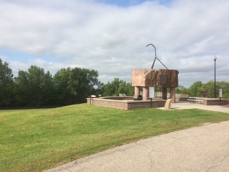
Two kilometers northwest of here, the St. Louis River flows on its way to Lake Superior. Its broad river valley, visible from this point, is in a western extension of the Lake Superior basin. Over the last two million years, the Lake Superior basin . . . — — Map (db m205010) HM
Near Viking Trail (U.S. 10) at 5th Street, on the right when traveling east.
Toward the close of the last or Wisconsin stage of glaciation about 10,000 years ago, the ice front receded from central Iowa toward the north and, in the latitude of Browns Valley, crossed the continental divide between the Mississippi River and . . . — — Map (db m233564) HM
On Main Park Drive (County Road 38) 0.9 miles south of Bearpaw Lane, on the right when traveling south.
The diversified scenery of Minnesota- of which the Itasca park area is one phase- is due to the location of the state in the approximate center of the continent, situated midway between the Atlantic and Pacific oceans, Hudson Bay and the Gulf of . . . — — Map (db m232172)
On North Shore Scenic Drive (State Highway 61) 2.3 miles east of County Road 7, on the right when traveling north.
The rocks of the North Shore of Lake Superior record the last period of volcanic activity in Minnesota. This volcanism occurred 1.1 billion years ago when the North American continent began to rupture along a great rift valley, which extended from . . . — — Map (db m203069) HM
On North Shore Scenic Drive (State Highway 61) at Wisconsin Street, on the right when traveling east on North Shore Scenic Drive.
The harbor of Grand Marais is the result of unequal weathering or erosion of two types of rock. One of these, called diabase, resulted from the cooling of molten material which was forced between two earlier lava flows. The dark, massive diabase, . . . — — Map (db m203155) HM
On State Highway 371, 0.1 miles north of Seagull Road Northwest, on the right when traveling north.
Toward the close of the Wisconsin stage of glaciation about 12,000 years ago, the waning lobe of the ice sheet in the Brainerd area retreated westward, leaving in its wake many stagnant ice blocks which had become separated from the main ice field. . . . — — Map (db m155678) HM
Hasting lies just south and East of the last glaciation. About 20,000 years ago a lobe of ice, called the Superior lobe, advanced from the Lake Superior basin and crossed the ancient bedrock valley of the Mississippi River between St. Paul and . . . — — Map (db m42199) HM
During the great ice ages the landscape of Minnesota was profoundly altered by continental glaciers in four major epochs of glaciation. In this area, as elsewhere, the closing stage of each epoch was characterized by the release of floods of . . . — — Map (db m45869) HM
On Lake Street at Water Street, on the right when traveling north on Lake Street.
Like most lakes in Minnesota, Lake Minnetonka was formed during the Ice Age of the last two million years. During several separate glacial periods, ice advanced along different routes across the state. The glaciers, along with large volumes of . . . — — Map (db m59925) HM
Near South Minnehaha Park Drive near Godfrey Road.
Near Fort Snelling, 10,000 years ago, melt water from the Wisconsin glacier was discharged through the Mississippi River and plunged over a ledge of Platteville limestone into a gorge cut chiefly in the white St. Peter sandstone. The . . . — — Map (db m40765) HM
Near 42nd Street West at West Lake Harriet Parkway.
The continental glaciers spreading over Minnesota during the great ice ages brought vast quantities of rock material from the north to be dumped indiscriminately during the recession of the ice. Old river valleys were filled and belts of . . . — — Map (db m37863) HM
Near Ella Avenue Northwest, 0.1 miles west of Business U.S. 71, on the right when traveling west.
The agricultural land of the Willmar region has a history that dates back 60 million years, when an inland sea covered the Great Plains from the Gulf of Mexico to the Arctic Ocean. As the adjacent land eroded and life in the sea flourished, . . . — — Map (db m75844) HM
Near Split Rock Lighthouse Road, 0.5 miles south of North Shore Scenic Drive (State Highway 61).
Earth's Crust Ruptures
The geology of the shoreline between Split Rock and Little Marais is the direct result of cataclysmic events that occurred many kilometers* below the earth's surface. About 1.1 billion years ago, this continent began . . . — — Map (db m204164) HM
The classic steel arch bridge that spans this gorge is impressive for its simple beauty and elegance. Equally remarkable, but not as obvious to the onlooker, is the massive underground foundation that keeps this bridge sound and secure. To construct . . . — — Map (db m204424) HM
Near State Highway 61, 3 miles north of Blueberry Hill Road.
The scenery of the region between Split Rock and Beaver Bay is the direct result of important events of early geologic time.
Lava flows, which had accumulated in this region to a thickness of about 30,000 feet, were lifted and arched by a huge . . . — — Map (db m76280) HM
Near State Highway 61, 0.3 miles north of Superior Shores Drive, on the right when traveling east.
As you walk the pebbled beaches of the North Shore, watch for translucent, color-banded, and reddish-brown stones called Lake Superior agate—Minnesota's state gemstone. The story of the Lake Superior agate begins 1.1 billion years ago, when basaltic . . . — — Map (db m204248) HM
On Lakeshore Drive at U.S. 75, on the right when traveling south on Lakeshore Drive.
The second highest point in southwestern Minnesota is about one kilometer north of here on the Bemis moraine, locally known as Buffalo Ridge. This ridge marks a drainage divide separating the watersheds of the Mississippi and Missouri Rivers. Lake . . . — — Map (db m228133) HM
On Lookout Drive, 1.1 miles west of U.S. 169, on the left when traveling west.
This marker is located near the big bend of the Minnesota River directly opposite the mouth of the Blue Earth River. The abandoned channel east of it is the former course of the LeSueur before it joined the Blue Earth. Most of the broad . . . — — Map (db m66715) HM
On East Silver Lake Drive, 1.8 miles north of 12th Street Southeast (U.S. 14), on the right when traveling south.
The diversified scenery of Minnesota - of which the Rochester area is one phase - is due to the location of the state in the approximate center of the continent. Situated midway between the Atlantic and Pacific Oceans, Hudson Bay and the Gulf of . . . — — Map (db m178698) HM
Near Interstate 35 at milepost 249, on the left when traveling north.
Lake Superior is situated over the Midcontinent Rift, which is a rupture in the North American continent that formed a great rift valley from the Lake Superior region southwest to Kansas about 1.1 billion years ago. For about 20 million years as the . . . — — Map (db m5113) HM
The Laurentian Divide separates the watershed of streams that flow north to the Arctic Ocean from the watershed of streams that flow south through the Great lakes to the Atlantic Ocean. Where you are standing the divide is formed by a prominent . . . — — Map (db m183138) HM
Near U.S. 10, 0.4 miles west of U.S. 169, on the left when traveling west.
Minnesota was largely covered by glaciers many times during the last million years. The ice flowed across the state from both the northeast and the northwest. As it advanced along separate paths, it scraped up, crushed, and carried with it . . . — — Map (db m69965) HM
On Great River Road (U.S. 61) 1.5 miles north of 9th Avenue, on the right when traveling north.
Lake Pepin occupies the Mississippi Valley above this point for a distance of 22 miles. The lake is formed by the delta of the Chippewa River which enters the Mississippi directly east of this site.
The Chippewa, a relatively small river, has a . . . — — Map (db m45700) HM
Near Saint Croix Trail North (State Highway 95) 1 mile north of Dellwood Road (State Highway 96), on the right when traveling north.
The site of this tablet marks the northern limit of Lake St. Croix, impounded by the natural dam of sand and gravel, made by the Mississippi where it is joined by the St. Croix River, twenty miles below Stillwater. The valley, with its steep . . . — — Map (db m233569) HM
On Leeward Road north of County Road 3, on the right when traveling south.
From Winona to La Crosse, the Mississippi River valley displays its greatest depth as it extends vertically through more than 240 meters of a sedimentary-rock plateau. Here, Highway 61 follows the narrow strip between the river and the steep bluffs . . . — — Map (db m213346) HM
Near State Highway 74, 1.9 miles north of Quincy Drive, on the right when traveling north.
The bold and picturesque bluffs of the Whitewater Valley, from the Jordan sandstone below to the massive Oneota dolomite at the top, represent deposition during a hundred million years. Much of the erosion of these marine sedimentary rocks occurred . . . — — Map (db m213348) HM
Near U.S. 61, 0.3 miles north of Bass Camp Lane, on the right when traveling north.
In its traverse of 2400 miles from Lake Itasca to the Gulf of Mexico, the Mississippi River falls 1475 feet, nearly two-thirds of which is within or along the eastern side of Minnesota. For 300 miles from Minneapolis, its course lies between rocky . . . — — Map (db m166631) HM