By Bernard Fisher, July 25, 2003
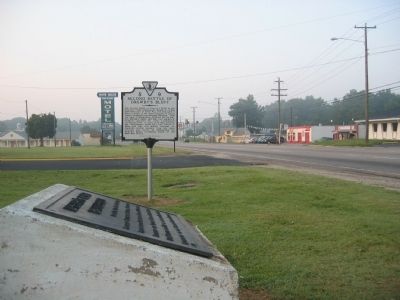
Drewry’s Bluff Battlefield Marker
GEOGRAPHIC SORT Title Sort Marker Number Sort Marker Number Sort N Marker Number Sort T Publication Order Sort Publication Order Sort A Erected Year Sort Most Viewed Sort Most Recent-Interest Sort Most Recently Changed Sort SEE FAQ #33 FOR DESCRIPTIONS
On Jefferson Davis Highway (Virginia Route 301) 0.2 miles south of Willis Road, on the left when traveling south.
On Perrymont Road, 0.1 miles north of Norcliff Avenue, on the left when traveling north.
On Jefferson Davis Highway (Virginia Route 301) at Wonderview Drive, on the left when traveling south on Jefferson Davis Highway.
On Studley Road, 0.7 miles west of Shelton Pointe Drive, on the right when traveling west.
Near Studley Road, 0.8 miles east of Avondale Drive, on the right when traveling east.
On Cold Harbor Road (Route 156), on the right when traveling west.
On Cold Harbor Road (Route 156), on the right when traveling west.
On Cold Harbor Road (Route 156), on the right when traveling west.
On Walnut Grove Road, 0.1 miles east of Colts Neck Road, on the right when traveling east.
On Mechanicsville Turnpike (U.S. 360) 0.1 miles east of Creighton Parkway, on the right when traveling east.
On Old Cold Harbor Road trace, 0.1 miles south of Cold Harbor Road, on the left when traveling south.
On Mechanicsville Turnpike (U.S. 360) 0.1 miles Westhaven Drive, on the right when traveling east.
On Mechanicsville Turnpike (U.S. 360) 0.3 miles east of Pebblepath Parkway, on the right when traveling east.
On Old Cold Harbor Road, 0.1 miles west of Harbor Hill Drive, on the right when traveling west.
Paid Advertisement
On Cold Harbor Road, 0.1 miles east of Old Millstone Drive, on the left when traveling east.
On Mechanicsville Bypass, 0.1 miles west of Atlee Road, on the left when traveling east.
On Cold Harbor Road at Watt House Road, on the right when traveling east on Cold Harbor Road.
On Watt House Road, 0.6 miles south of Cold Harbor Road.
On Cold Harbor Road, 0.1 miles west of Lee-Davis Road, on the left when traveling east.
On Studley Road at Buckeye Road, on the left when traveling east on Studley Road.
On River Road, 0.9 miles east of Summer Hill Road, on the left when traveling east.
On Mechanicsville Turnpike (U.S. 360) at Studley Road, on the left when traveling east on Mechanicsville Turnpike.
On Studley Road, 0.3 miles south of Locust Green Lane, on the right when traveling east.
On Willis Church Road (State Road 156) 0.2 miles north of Carter Mills Road, on the right when traveling south.
On Darbytown Road, 0.5 miles east of Strath Road, on the right when traveling east.
On Willis Church Road (Virginia Route 156), on the right when traveling south.
On New Market Road (Virginia Route 5) at Battlefield Park Road, on the right when traveling east on New Market Road.
On Varina Road, 1 mile south of Mill Road, on the right when traveling south.
On Charles City Road, 0.3 miles north of Darbytown Road, on the left when traveling west.
Paid Advertisement
On Darbytown Road at Longbridge Road, on the right when traveling east on Darbytown Road.
On Longbridge Road, 0.4 miles south of Darbytown Road, on the left when traveling south.
Near Willis Church Road (Virginia Route 156), on the right when traveling south.
On Mechanicsville Turnpike (U.S. 360) 0.2 miles north of East Laburnum Avenue, on the left when traveling east. Reported missing.
On Brook Road (U.S. 1) 0.4 miles Interstate 95, on the right when traveling north.
On Williamsburg Road (U.S. 60) at Eanes Lane, on the left when traveling east on Williamsburg Road.
On Mill Road at Battlefield Park Road, on the right when traveling east on Mill Road.
On Darbytown Road, 0.2 miles east of South Laburnum Avenue, on the right when traveling east.
On Darbytown Road, 0.1 miles east of Shirleydale Avenue, on the right when traveling east.
On Charles City Road at Darbytown Road, on the right when traveling west on Charles City Road.
Near Nine Mile Road, 0.1 miles west of Dabbs House Road.
On Willis Church Road (Virginia Route 156) 0.8 miles south of Charles City Road Road, on the right when traveling south.
On West Williamsburg Road (U.S. 60), on the right when traveling east.
On East Williamsburg Road (U.S. 60), on the left when traveling east.
On East Williamsburg Road (U.S. 60) east of Naglee Avenue, on the right when traveling east.
On Casey Street near Rodes Avenue, on the right when traveling west.
Paid Advertisement
Reported permanently removed.
On Charles City Road, 0.3 miles east of South Airport Drive, on the left when traveling east.
On North Airport Drive (Virginia Route 156) 0.7 miles east of Interstate 295, on the left when traveling east.
On West Williamsburg Road (Route 60) 0.1 miles west of Sandburne Parkway, on the right.
On Meadow Road, 0.1 miles east of Grapevine Road, on the right when traveling east.
On Old Hanover Road, 0.1 miles west of Grapevine Road, on the left when traveling west.
On Elko Road (County Route 156), on the right when traveling south.
On Westbrook Avenue at Hermitage Road (Virginia Route 161), on the right when traveling west on Westbrook Avenue.
On River Road (Virginia Route 147) at Three Chopt Road, on the right when traveling west on River Road.
On Brook Road at Walton Avenue, on the left when traveling north on Brook Road.
On Holly Springs Avenue, 0.1 miles north of North Hopkins Road, on the right when traveling north.